Tag:highway=service
| Description |
|---|
| Provides access to a building, service station, beach, campsite, industrial estate, business park, etc. |
| Rendering in OSM Carto |

|
| Group: highways |
| Used on these elements |
| Useful combination |
| Status: de facto |
| Tools for this tag |
|
The highway=service tag denotes ways used for vehicle access to a building, parking lot, service station, business estate, beach, campsite, etc. Service ways are usually not part of the public street network and may sometimes be inaccessible to the general public, which can be specified explicitly by adding access=*.
Service ways have local traffic function. Some of them may be restricted to local access only in the sense of motor_vehicle=destination (often signposted as "local traffic only"), but this is not implied by default. As such, this is not a tag for frontage road, sometimes called a service road, which should be tagged depending on what function the frontage road serves.
How to map
To map service ways create a way ![]() and add the tag highway=service. To define a service way in more detail, see service=*.
and add the tag highway=service. To define a service way in more detail, see service=*.
Linear ways and areas
The tag highway=service predominantly describes a linear feature of a routable way. When mapped as a closed polygon without any further tagging, it describes a linear, circular way and not an area.
When the service road has an occasional widening, e.g. the paved area in an industrial estate, that can be mapped as a filled area by drawing a closed polygon, and adding area=yes. This area tag, however, should not be used to generally describe the shape or general width of a linear way, a few mappers use area:highway=service in addition to the linear way for this purpose.
Tags used in combination
- name=* – optional
- service=*- to define a service way in more detail
- oneway=yes
- covered=yes
- tunnel=building_passage
- surface=*
- lit=yes
- maxspeed=*
- living_street=yes
- access=*
Examples
| Description | Tags | Image |
|---|---|---|
| Service way for access to a fuel station | amenity=fuel name=Classic also an area with building=yes and a way with highway=service |
|
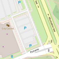
| Subordinated service ways on a parking lot | In an area with amenity=parking often multiple ways with highway=service service=parking_aisle. The main ways on the parking lot, connecting multiple parking_aisle should be mapped with highway=service, only. |
 
|
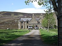
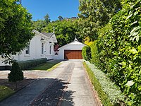
| A driveway is a service road leading to a residence, property or place of business | highway=service service=driveway Even if there are a few parking spots on the property, it remains a driveway. |
 
|
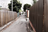
| An alley: A narrow road, alley or path between properties | highway=service service=alley |

|
| A service road for emergency access | highway=service service=emergency_access Consider adding access permissions to the highway, such as access=no and emergency=yes. |
 
|
Deprecated: highway=service for busways
Historically, highway=service has also been used to tag busways. This is deprecated because busways do not meet the definition of service roads given above. Generally, this tagging of busways should be replaced by one of the following, depending on the nature of the way:
This does not apply to those roads which do meet the definition of service roads above, even if only used by buses e.g. for access to a building, bus station, or parking and not for through-traffic as part of a busway. See highway=busway for more information and examples.
|
Be aware that not all OSM software supports highway=busway yet. Please coordinate the transition to the new tagging scheme with your local community. Under no circumstances should you (semi-)automatically change “deprecated” tags to something else in the database without conforming to the Automated Edits code of conduct. Any such change will be reverted. |
See also
- service=parking_aisle
- highway=busway
- highway=services—not to be mixed up with! Use highway=services on a node or area to create a POI.
| ||||||||||||||||||||||||||||||


