Tag:highway=bus_stop
| Description |
|---|
| A bus stop is a place where public buses stop for passengers. |
| Rendering in OSM Carto |
| Group: highways |
| Used on these elements |
| Useful combination |
| Status: de facto |
| Tools for this tag |
|
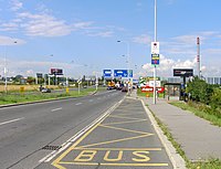
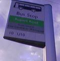
A bus stop is a place where passengers can board or alight from a bus. Its position may be marked by a shelter, pole, bus lay-by, or road markings.
The highway=bus_stop tag is widely used on a node off to one side of the highway way to identify the position where passengers wait for a bus beside the carriageway.
How to map
A bus stop should be defined for each discrete location where a pole or shelter is placed or where a person should wait for a vehicle. The widely used approach is to place bus stop nodes off to one side of the highway way, and not with the node being part of the highway=* way (being the place where the vehicle stops - see below). If there are places for passengers to wait on both sides of the road then two bus stops should be defined.
Use of the tags route_ref=*, location=* and towards=* is not required in conjunction with highway=bus_stop. This information can also be associated with the corresponding route=* relation.
| Tag | Importance | Description | Examples |
|---|---|---|---|
| highway=bus_stop | ! Required | Describes this feature as a bus stop. This tag is a widely used on a node positioned to the side of the road (where passengers wait). | highway=bus_stop |
| public_transport=platform | ‽ Important | For describing that this feature is a public transit platform, serving public transport routes. This is an approved tag to use for bus stops, introduced in the Public Transport proposal, even though it is not used in the same way as in common English. | public_transport=platform |
| name=* | ‽ Recommended | Name of the bus stop, if bus stop has it, especially when there exists no public_transport=stop_area. | name=Martin Luther King Junior Boulevard at Stateside Drive |
| ref=* | ‽ Recommended | Network-wide or operator-wide reference code of the bus stop, if bus stop has it - usually a series of 4-6 digits or letters. Often used to find the stop on digitized systems. | ref=3154 |
| local_ref=* | ‽ Recommended | The local reference of a bus stop, if bus stop has it - usually 1 or 2 digits or letters, for example "A" or "D1". If a bus station has a large number of buses arriving, many smaller bus stops, each with their own local_ref=*, will be present.
|
local_ref=C |
| network=* | ? Optional | The network of the bus stop. This can either be an abbreviation or full name, depending on the network. Check other bus routes or bus stops near the one being mapped to find out how the network should be tagged in the area. The network (relevant e.g. for fares) is really dependent upon the bus company that is making a particular stop (i.e. see "network" on the route relation), so it may be better to omit this on the bus stop itself. | network=CHT, network=London Buses, network=NYC Buses, network=TNSW |
| operator=* | ? Optional | Name of the company operating the bus stop. Note that different parts may be owned by different operators; e.g. in Germany, it is not uncommon for the pavement to be installed by the city, the signpost by the network's NGO or one of the bus companies, and the shelter (if any) be managed by an advertising agency. | operator=Arriva |
| shelter=* | ‽ Recommended | 'yes' if the stop is protected from the rain by a shelter. 'no' if it is not. The shelter may also be mapped separately using amenity=shelter and shelter_type=public_transport. | shelter=no |
| covered=* | ? Optional | 'yes' if the stop is protected from the rain by cover that is not a dedicated shelter. 'no' if it is not. | covered=no |
| departures_board=* | ? Optional | This tag indicates the type of departures board present at the bus stop. This could be a paper timetable, a live information display, neither, or something else. departures_board=no indicates none. | departures_board=timetable |
| passenger_information_display=* | ? Optional | If there is a real time electronic passenger information display. | passenger_information_display=yes |
| bench=* | ? Optional | 'yes' if a bench for riders to sit on is present at the stop. 'no' if not. The bench may also be mapped separately. | bench=yes |
| bin=* | ? Optional | 'yes' if there is a trash can at the bus stop. 'no' if not. The bin may also be mapped separately. | bin=no |
| lit=* | ? Optional | 'yes' if the bus stop is lit up at night. 'no' if not. | lit=yes |
| kerb=* | ? Optional | The type of kerb at a bus stop, most likely kerb=raised | kerb=raised |
| tactile_paving=* | ? Optional | 'yes' if tactile paving (small bumps at the edge of the platform to alert visually impaired riders when they are walking into the road) are present. 'no' if not. | tactile_paving=no |
| wheelchair=* | ? Optional | 'yes' if it is wheelchair accessible. 'no' if not. | wheelchair=yes |
| surface=* | ? Optional | The surface of the ground where the bus stop is located. | surface=concrete |
| pole=* | ? Optional | If there is a pole marking the bus stop. | pole=yes |
| flag=* | ? Optional | If there is a flag or sign detailing the name, reference, etc. of the bus stop. | flag=yes |
| traffic_sign=* | ? Optional | The presence and nature of any traffic sign on the pole or shelter. See Key:traffic sign#Lists of IDs per country for values. | traffic_sign=yes |
| advertising=* | ? Optional | The type of advertising present at the bus stop (usually on shelters). | advertising=yes |
| layer=* | ! Required in multi-level bus stations. | For where the associated road is not at ground level. Essential with complex multi-level situations where there would otherwise be doubt as to which road (or stop_position) it was associated. | layer=-1 |
This table is a wiki template with a default description in English. Editable here.
Photos
Tagging examples
| Picture | Tags | Link |
|---|---|---|

|
469782070 | |

|
|
9944581518 |

|
|
1701710285 |
See also
- amenity=bus_station - A bus station would usually be a terminus where many routes stop / start, and where you can change between routes, etc
- highway=platform - A platform at a bus stop or station
- public_transport=platform - The place where passengers are waiting for the public transport vehicles
- public_transport=stop_position - The position on the street or rails where a public transport vehicle stops
- bus_bay=* - A bus bay outside the main carriageway for boarding/alighting
- Buses - A form of public transport
- Routes - Used to describe routes of various kinds
- Public transport - Railways, buses, trams, etc.
- Approved public transport schema
- NaPTAN/Import (a database of 360,000 bus stops in Great Britain)
| ||||||||||||||||||||||||||||||||||||||||||||||||||


