JA:Tag:aeroway=runway
Jump to navigation
Jump to search
| 説明 |
|---|
| 滑走路。飛行機が着陸したり離陸したりするために、脇にある平らな土地。 |
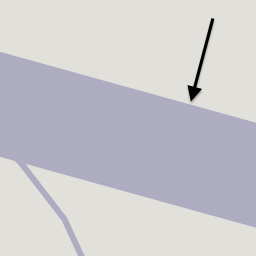
| OSM Cartoでのレンダリング |

|
| グループ: 空路 |
| 適用できる要素 |
| よく併用されるタグ |
| 関連項目 |
| 状態:事実上の標準 |
| ツール |
この記事は翻訳記事ですが、翻訳が不完全であり、抜けや誤り、未翻訳の部分があります。
英語版の記事の内容が分かる方は、翻訳の完成にご協力ください。このウィキの翻訳方法についての説明をお読みください。
現時点では、誰もこの記事の翻訳に取り組んでいないようですので、あなたが取り組めます。
英語版の記事の内容が分かる方は、翻訳の完成にご協力ください。このウィキの翻訳方法についての説明をお読みください。
現時点では、誰もこの記事の翻訳に取り組んでいないようですので、あなたが取り組めます。
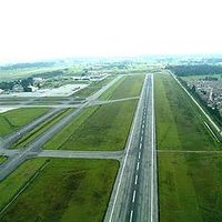
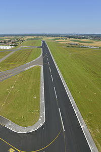
![]() 滑走路は空港にある細長い土地で、飛行機が離陸した離着陸したりする場所です。滑走路は人工の表面(ふつうはアスファルト、コンクリート、または両方の混合)であったり自然の表面(草、土、砂利)であったりします。
滑走路は空港にある細長い土地で、飛行機が離陸した離着陸したりする場所です。滑走路は人工の表面(ふつうはアスファルト、コンクリート、または両方の混合)であったり自然の表面(草、土、砂利)であったりします。
マッピング方法
滑走路のコースに沿ってウェイを描き、 aeroway=runway を追加してください。
エリアとしてのマッピング
| aeroway=runway をエリアとしてマッピングするかどうかは議論中です。 こちらとこちらの議論に参加してください。 |
ときどき、追加で滑走路の輪郭が aeroway=runway + area=yes でタグ付けしたエリア ![]() としてマッピングされていることがあります。
としてマッピングされていることがあります。
タグ付け
追加情報は以下のキーで指定することができます。
| タグ | 説明 |
|---|---|
| Date | source:date=* - If imported/updated from the FAA 56-day NASR database, this tag will contain the date the database became valid. |
| Elevation | The ele=* tag should be used for the average altitude of the runway. Individual nodes (endpoints, displaced thresholds) may have more specific values. |
| Heading | Use heading=* for the actual geographic headings (forward;reverse) of the runway. Rounded to nearest degree, left-0-padded to three digits if from import. Example: "083;263". |
| Incline | Use the incline=[+|-]d.d% tag for the % incline of the runway. The direction of the way is from approach to departure. The incline is the elevation at the departure threshold minus the elevation at the approach threshold, divided by the distance between them. |
| Incline spec | incline:spec=[+|-]d.d%: the % incline of the runway, as specified in the FAA airport diagram. According to the legend diagram, this is measured to the midpoint of the runway (instead of the far threshold) if the runway is >= 8000ft, and is only specified if the absolute value is >= 0.3%. Note that this tag is used only if the incline is in the same direction as the runway. Otherwise, the reverse_incline tag is used (see reverse_incline:spec=* below). |
| Landing Facility Site Number | The FAA's Landing Facility Site Number for the airport with which the runway associated should be tagged with FAA:LFSN=*. There is generally no reason to edit this value - it is used to refer back to the associated aeroway=aerodrome node or way and the FAA database for synchronization of imports. Example: "01818.*A" is the LFSN for LAX. |
| Length | The length=* tag can be used to hold the physical length of the runway surface, including blast-pad, displaced threshold, etc. This is generally more than the length actually available for takeoff and landing. Use meters, or specify units. ('100' for a hundred meters, or '200 ft' for 200 feet. |
| Reference | Use the ref=* tag for the name of the runway (for example "02/20" or "09L/27R"). See [1]. |
| Reverse incline | reverse_incline:spec=[+|-]d.d%: the % incline of the runway as specified in the FAA airport diagram, in the reverse direction of the OSM way. See incline:spec=* above. |
| Source | source=* - Source(s) of information present in tags, semi-colon-delimited if necessary. "FAA" indicates at least some information from one or more FAA databases or imports. Often combined with an imagery tag to indicate the imagery with which the boundary was drawn. |
| Source_ref | source_ref=* - Key to source documents. Example: when source=FAA, you may see source_ref=nnnnnAD, which indicates the document number of the FAA Airport Diagram, which are at http://aeronav.faa.gov/d-tpp/vvvv/''nnnnn''AD.PDF where vvvv is the version number (incremented every 56 days). |
| Surface | The surface=* tag can be used to identify the physical makeup of the surface of the runway. Example: "paved" or "grass". |
| Width | Use the width=* tag to identify the physical width of the runway surface. |
ライフサイクル
- 主な記事:JA:ライフサイクルの接頭辞
| 段階 | タグ付け | メモ |
|---|---|---|
| proposed | aeroway=proposed proposed=runway(taginfo で7件) |
計画中の誘導路で、建設間近のものです。このタグは純粋な願望に対して使うべきではありません。他に proposed:aeroway=runway の用法もあります(taginfo で1件)。 |
| construction | aeroway=construction construction=runway(taginfo で26件) |
建設中の誘導路です。他に construction:aeroway=runway の用法もあります。(taginfo で1件) |
| In operation | aeroway=runway | 運用中の滑走路です。 |
| disused | disused:aeroway=runway(taginfo で219件) | 使われなくなった滑走路ですが、運用に戻すことができるものです。 |
| abandoned | abandoned:aeroway=runway(taginfo で304件) | 使えなくなった、またはほかの目的で再利用されている場合です。例えば highway=cycleway を追加します。 |
廃止された・放棄された滑走路には、レンダリングされるように natural=meadow のような追加タグをつけることが提案されています。
例
| 写真/説明 | タグ | Mapnik |
|---|---|---|

|
aeroway=runway ref=06/24 |
参考としてミュンヘン国際空港(Munich International Airport)を参照してください。
| ||||||||||||||||||||||||||||||||||||||||||||||||||

