Template:Pt:Map Features:natural
Jump to navigation
Jump to search
Natural
Etiquetas usadas para descreverem características naturais e físicas. Inclui também características que tenham sido alteradas por humanos. Ver também Natural(en).
| Chave | Valor | Elemento | Descrição | Renderização | Imagem |
|---|---|---|---|---|---|
Vegetação ou relativos à superfície | |||||
| natural | fell | Terrenos em zonas altas, alpinas e sub-polares com vegetação rasteira não cultivada como pequenos arbustos, musgo e herbáceas. Ocorrem principalmente na Fino-Escandinávia, Ilha de Man, Norte de Inglaterra e Escócia. | No, see #545. | ||
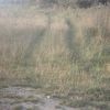
| natural | grassland | Uma A maior parte das áreas de pradaria (savanas, grandes planícies e pampas) encontram-se fora da Europa. Contudo, esta etiqueta é usada na Europa para mapear terras abandonadas que já foram cultivadas e que estão hoje cobertas de ervas e vegetação rasteira, sem árvores e grandes arbustos lenhosos. |
|||
| natural | heath | Uma |
|||
| natural | moor | Terreno em zonas de alta altitude, caracterizada por vegetação rasteira em solos ácidos e inférteis. | currently not rendered by OSM Carto | ||
| natural | scrub | Um O que o diferencia de uma floresta ou bosque é a possibilidade de, em geral, toda a vegetação poder receber luz solar, sem ter de ficar sob uma copa de árvores impenetrável pela luz. |
|||
| natural | shrubbery | An area of shrubbery that is actively maintained or pruned by humans. A slightly wilder look is also possible | currently not rendered by OSM Carto | ||
| natural | tree | Árvore: uma única árvore. Esta etiqueta foi originalmente criada apenas para árvores de valor histórico ou cultural, mas atualmente é aplicada em qualquer tipo de árvore, pelo menos em zonas urbanas, servido para inventário e análise, sinalização de obstáculos para cegos, etc. | |||
| natural | tree_row | Linha ou fila de árvores: série de árvores dispostas em linha, comuns em avenidas, cemitérios, etc. | |||
| natural | tree_stump | A tree stump, the remains of a cut down or broken tree. | |||
| natural | tundra | Habitat above tree line in alpine and subpolar regions, principally covered with uncultivated grass, low growing shrubs and mosses and sometimes grazed. | |||
| natural | wood | Floresta, bosque, brenha ou mata natural com árvores autóctones. Em áreas com árvores para produção de madeira, usar antes a etiqueta landuse=forest. | |||
Relativo à água | |||||
| natural | bay | ||||
| natural | beach | ||||
| natural | blowhole | An opening to a sea cave which has grown landwards resulting in blasts of water from the opening due to the wave action | |||
| natural | cape | A piece of elevated land sticking out into the sea or large lake. Includes capes, heads, headlands and (water) promontories. | |||
| natural | coastline | ||||
| natural | crevasse | A large crack in a glacier | |||
| natural | geyser | ||||
| natural | glacier | ||||
| natural | hot_spring | ||||
| natural | isthmus | A narrow strip of land, bordered by water on both sides and connecting two larger land masses. | |||
| natural | mud | ||||
| natural | peninsula | A piece of land projecting into water from a larger land mass, nearly surrounded by water | |||
| natural | reef | A feature (rock, sandbar, coral, etc) lying beneath the surface of the water | |||
| natural | shingle | Seixal, cascalhada ou cascalheira: zona de acumulação de pedras que sofreram a erosão da água, normalmente com cascalho e seixos. Normalmente encontram-se nas margens de rios ou praias. | |||
| natural | shoal | An area of the sea floor near the sea surface (literally, becomes shallow) and exposed at low tide. See natural=sand as well. | |||
| natural | spring | ||||
| natural | strait | A narrow area of water surrounded by land on two sides and by water on two other sides. | |||
| natural | water | Água:áreas de água. O tipo de corpo de água pode ser especificado com water=*, como por exemplo lagos water=lake, reservatórios artificiais como albufeiras com water=reservoir, lagoas com water=lagoon, etc. | |||
| natural | wetland | ||||
Relativo à forma das superfícies | |||||
| natural | arch | A rock arch naturally formed by erosion, with an opening underneath. | currently not rendered by OSM Carto | ||
| natural | arete | Aresta viva na cumeada da montanha, formada por rochas. | |||
| natural | bare_rock | Zona rochosa: área com nenhuma ou escassa vegetação, preenchida principalmente com rochas (embasamento rochoso). | |||
| natural | blockfield | A surface covered with boulders or block-sized rocks, usually the result of volcanic activity or associated with alpine and subpolar climates and ice ages. | Currently not rendered by OSM Carto | ||
| natural | cave_entrance | Entrada de caverna: cavidade de entrada numa caverna suficientemente larga para uma pessoa entrar. | |||
| natural | cliff | ||||
| natural | dune | A hill of sand formed by wind, covered with no or very little vegetation. See also natural=sand and natural=beach | currently not rendered by OSM Carto | ||
| natural | earth_bank | Large erosion gully or steep earth bank | |||
| natural | fumarole | A fumarole is an opening in a planet's crust, which emits steam and gases | |||
| natural | gully | Small scale cut in relief created by water erosion | |||
| natural | hill | A hill. | currently not rendered by OSM Carto | ||
| natural | peak | ||||
| natural | ridge | ||||
| natural | rock | Rochedo: pedra ou rocha de grandes dimensões dando continuidade ao chão rochoso (pedra não solta). | currently not rendered by OSM Carto | ||
| natural | saddle | Selada: depressão na lombada de um monte, ou seja, o ponto mais baixo ao longo de uma cordilheira ou entre os cumes de duas montanhas. | |||
| natural | sand | ||||
| natural | scree | Escarpa de rochas soltas: acumulação de pedras angulares não consolidadas formado por aluimentos ladeiras rochosas adjacentes. | |||
| natural | sinkhole | currently not rendered by OSM Carto | |||
| natural | stone | Pedra ou pedregulho: pedra de grandes dimensões e solta do chão, rochoso ou não. Em locais com muitas pedras soltas deve-se usar antes a etiqueta natural=scree | currently not rendered by OSM Carto | ||
| natural | valley | currently not rendered by OSM Carto | |||
| natural | volcano | ||||
| natural | user defined | Todos os valores comuns segundo o Taginfo | |||
This table is a wiki template with a default description in English. Editable here.


