Template:Id:Map Features:natural
Jump to navigation
Jump to search
[Create]  Template documentation
Alam
Digunakan untuk menggambarkan kenampakan fisik alam, termasuk kenampakan fisik alam yang telah dimodifikasi oleh manusia. Lihat Natural untuk informasi lebih lanjut.
| Key | Value | Element | Deskripsi | Carto rendering |
Foto |
|---|---|---|---|---|---|
Vegetation | |||||
| natural | fell | Lahan kosong di dataran tinggi yang ditutupi oleh rerumputan. | No, see #545. | ||
| natural | grassland | Suatu lahan yang didominasi oleh rerumputan (Poaceae) dan tanaman herba lainnya (non-kayu), kecuali rumput hias (lihat landuse=grass) dan grazing (lihat landuse=meadow) | |||
| natural | heath | Dataran rendah yang gundul dan tidak digarap yang tertutup oleh semak belukar, hanya ada sedikit tutupan pohon atau bahkan tidak ada sama sekali. | |||
| natural | moor | Don't use, see wikipage. Upland areas, characterised by low-growing vegetation on acidic soils. | currently not rendered by OSM Carto | ||
| natural | scrub | Tanah yang tidak digarap yang ditutupi oleh semak belukar atau pohon-pohon kerdil. | |||
| natural | shrubbery | An area of shrubbery that is actively maintained or pruned by humans. A slightly wilder look is also possible | currently not rendered by OSM Carto | ||
| natural | tree | Pohon yang berdiri sendiri. | |||
| natural | tree_row | Barisan pepohonan. | |||
| natural | tree_stump | A tree stump, the remains of a cut down or broken tree. | |||
| natural | tundra | Habitat above tree line in alpine and subpolar regions, principally covered with uncultivated grass, low growing shrubs and mosses and sometimes grazed. | |||
| natural | wood | Tree-covered area (a 'forest' or 'wood'). Also see landuse=forest. For more detail, one can use leaf_type=* and leaf_cycle=*. | |||
|
| |||||
| natural | bay | Sebuah teluk, badan air yang luas / perairan yang menjorok ke daratan. (Bahasa lainnya) | |||
| natural | beach | Pantai, adalah sebuah bentuk geografis yang terdiri dari pasir, dan terdapat di daerah pesisir laut. (Bahasa lainnya) | |||
| natural | blowhole | An opening to a sea cave which has grown landwards resulting in blasts of water from the opening due to the wave action | |||
| natural | cape | A piece of elevated land sticking out into the sea or large lake. Includes capes, heads, headlands and (water) promontories. | |||
| natural | coastline | Garis pantai adalah batas pertemuan antara bagian laut dan daratan pada saat terjadi air laut pasang tertinggi. | |||
| natural | crevasse | A large crack in a glacier | |||
| natural | geyser | A spring characterized by intermittent discharge of water ejected turbulently and accompanied by steam. | |||
| natural | glacier | Area (puncak gunung) yang tertutupi oleh es sepanjang tahun. | |||
| natural | hot_spring | A spring of geothermally heated groundwater | |||
| natural | isthmus | A narrow strip of land, bordered by water on both sides and connecting two larger land masses. | |||
| natural | mud | (Bahasa lainnya) | |||
| natural | peninsula | A piece of land projecting into water from a larger land mass, nearly surrounded by water | |||
| natural | reef | A feature (rock, sandbar, coral, etc) lying beneath the surface of the water | |||
| natural | shingle | An accumulation of rounded rock fragments on a beach or riverbed | |||
| natural | shoal | An area of the sea floor near the sea surface (literally, becomes shallow) and exposed at low tide. See natural=sand as well. | |||
| natural | spring | Sebuah tempat di mana air tanah mengalir secara alami dari tanah ((hydrology, land) (3596) Bahasa lainnya) | |||
| natural | strait | A narrow area of water surrounded by land on two sides and by water on two other sides. | |||
| natural | water | Danau, dll. | |||
| natural | wetland | Daerah tergenang (contoh di Wikipedia) | |||
|
| |||||
| natural | arch | A rock arch naturally formed by erosion, with an opening underneath. | currently not rendered by OSM Carto | ||
| natural | arete | Arête, tipis, hampir seperti pisau, punggungan bukit berbatu yang biasanya terbentuk ketika dua gletser mengikis paralel lembah berbentuk U. | |||
| natural | bare_rock | An area with sparse/no soil or vegetation, so that the bedrock becomes visible. | |||
| natural | blockfield | A surface covered with boulders or block-sized rocks, usually the result of volcanic activity or associated with alpine and subpolar climates and ice ages. | Currently not rendered by OSM Carto | ||
| natural | cave_entrance | Pintu masuk Goa. | |||
| natural | cliff | Tebing adalah formasi bebatuan yang menjulang secara vertikal atau hampir vertikal. Tebing terbentuk akibat dari erosi ataupun patahan. | |||
| natural | dune | A hill of sand formed by wind, covered with no or very little vegetation. See also natural=sand and natural=beach | currently not rendered by OSM Carto | ||
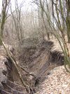
| natural | earth_bank | Large erosion gully or steep earth bank | |||
| natural | fumarole | A fumarole is an opening in a planet's crust, which emits steam and gases | |||
| natural | gully | Small scale cut in relief created by water erosion | |||
| natural | hill | A hill. | currently not rendered by OSM Carto | ||
| natural | peak | Bagian tertinggi dari gunung (Puncak gunung). | |||
| natural | ridge | Ridge / Punggungan adalah bentukan geologis yang merupakan bagian dari pegunungan atau perbukitan yang memiliki posisi tanah lebih tinggi dibandingkan posisi tanah di keduan sisinya. | |||
| natural | rock | A notable rock or group of rocks attached to the underlying bedrock. | currently not rendered by OSM Carto | ||
| natural | saddle | Pelana antar bukit | |||
| natural | sand | Area yang tertutupi oleh bahan granular alami terdiri dari batuan halus dan partikel mineral (pasir). Hanya ada sedikit vegetasi atau bahkan tidak ada sama sekali. | |||
| natural | scree | Reruntuhan batuan | |||
| natural | sinkhole | Cekungan atau lubang alami yang ada di atas permukaan bumi | currently not rendered by OSM Carto | ||
| natural | stone | Batu yang berdiri sendiri, contohnya glacial erratic | currently not rendered by OSM Carto | ||
| natural | valley | A natural depression flanked by ridges or ranges of mountains or hills | currently not rendered by OSM Carto | ||
| natural | volcano | Sebuah gunung berapi, baik yang tidak aktif, sudah punah ataupun masih aktif | |||
| natural | user defined | Semua "value" yang umum digunakan sesuai dengan Taginfo | |||
This table is a wiki template with a default description in English. Editable here. Tabel ini adalah sebuah template wiki, dengan deskripsi dalam Bahasa Indonesia. Editable here.

