Template:Zh-hant:Map Features:natural
Jump to navigation
Jump to search
自然物 (natural)
用來描述自然的物理特徵,詳見Natural。
| 關鍵字(key) | 值 (value) | 元素 (element) | 敘述 (desc) | 圖例 (render) | 照片 (photo) |
|---|---|---|---|---|---|
陸域 | |||||
| natural | fell | 高山/極地荒原。 | No, see #545. | ||
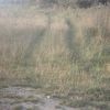
| natural | grassland | 天然草本植被。人工草皮改用landuse=grass,牧場改用landuse=meadow。 | |||
| natural | heath | 矮灌木林,以矮林、草本植物為主。 | |||
| natural | moor | currently not rendered by OSM Carto | |||
| natural | scrub | 灌木荒地。 | |||
| natural | shrubbery | An area of shrubbery that is actively maintained or pruned by humans. A slightly wilder look is also possible | currently not rendered by OSM Carto | ||
| natural | tree | 單一顯著的樹。 | |||
| natural | tree_row | 單排顯著的樹。 | |||
| natural | tree_stump | A tree stump, the remains of a cut down or broken tree. | |||
| natural | tundra | Habitat above tree line in alpine and subpolar regions, principally covered with uncultivated grass, low growing shrubs and mosses and sometimes grazed. | |||
| natural | wood | 非林業管理的天然林。人造林請改用landuse=forest。 | |||
水域 | |||||
| natural | bay | 河灣、海灣 | |||
| natural | beach | 海灘。海水浴場請參見leisure=beach_resort。 | |||
| natural | blowhole | An opening to a sea cave which has grown landwards resulting in blasts of water from the opening due to the wave action | |||
| natural | cape | 海岬、陸岬、海角 | |||
| natural | coastline | 海岸線 | |||
| natural | crevasse | A large crack in a glacier | |||
| natural | geyser | 間歇泉 | |||
| natural | glacier | 冰河 | |||
| natural | hot_spring | 溫泉 | |||
| natural | isthmus | A narrow strip of land, bordered by water on both sides and connecting two larger land masses. | |||
| natural | mud | 泥地。 | |||
| natural | peninsula | 半島 | |||
| natural | reef | 礁岩 | |||
| natural | shingle | 礫石灘。 | |||
| natural | shoal | An area of the sea floor near the sea surface (literally, becomes shallow) and exposed at low tide. See natural=sand as well. | |||
| natural | spring | 湧泉 | |||
| natural | strait | 海峽是兩側陸地包圍的狹長水體 | |||
| natural | water | 湖/池塘 | |||
| natural | wetland | 濕地 | |||
地貌 | |||||
| natural | arch | A rock arch naturally formed by erosion, with an opening underneath. | currently not rendered by OSM Carto | ||
| natural | arete | 刃脊、瘦稜 | |||
| natural | bare_rock | 裸岩。植物稀疏或沒有植被,使裸露的岩床清晰可見。 | |||
| natural | blockfield | A surface covered with boulders or block-sized rocks, usually the result of volcanic activity or associated with alpine and subpolar climates and ice ages. | Currently not rendered by OSM Carto | ||
| natural | cave_entrance | 天然洞穴口。 | |||
| natural | cliff | 懸崖 | |||
| natural | dune | A hill of sand formed by wind, covered with no or very little vegetation. See also natural=sand and natural=beach | currently not rendered by OSM Carto | ||
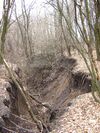
| natural | earth_bank | Large erosion gully or steep earth bank | |||
| natural | fumarole | A fumarole is an opening in a planet's crust, which emits steam and gases | |||
| natural | gully | Small scale cut in relief created by water erosion | |||
| natural | hill | A hill. | currently not rendered by OSM Carto | ||
| natural | peak | 山峰 | |||
| natural | ridge | 山脊、山稜 | |||
| natural | rock | 岩地 | currently not rendered by OSM Carto | ||
| natural | saddle | 鞍部、啞口 | |||
| natural | sand | 沙地。 | |||
| natural | scree | 碎石坡/崩坍地。 | |||
| natural | sinkhole | 沉洞、天坑、滲穴 | currently not rendered by OSM Carto | ||
| natural | stone | 顯眼的單顆巨石 | currently not rendered by OSM Carto | ||
| natural | valley | 谷地 | currently not rendered by OSM Carto | ||
| natural | volcano | 火山。 | |||
| natural | user defined | 到Taginfo查詢常用標籤值 | |||
This table is a wiki template with a default description in English. Editable here.
此表格由模版自動生成,協助改善中譯版本請按此。


