Template:NL:Map Features:natural
This template defines Dutch values for Template:Map_Features:natural.
Natuur
| Key | Waarde | Element | Omschrijving | Resultaat | Foto |
|---|---|---|---|---|---|
Vegetation | |||||
| natural | fell | Hoog Grasland
Grasland in hooglanden in een bergachtige gebieden. Is alleen geschikt om extensief te laten begrazen. |
No, see #545. | ||
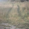
| natural | grassland | Grassen en kruidachtige planten
Natuurlijke gebieden waar de vegetatie wordt overheerst door grassen en kruidachtige (niet-houtige) planten. |
|||
| natural | heath | Heide | |||
| natural | moor | Don't use, see wikipage. Upland areas, characterised by low-growing vegetation on acidic soils. | currently not rendered by OSM Carto | ||
| natural | scrub | Ruig land
Natuurlijke gebieden waar lagere hout-achtige planten (struiken of onvolgroeide bomen) de vegetatie overheersen. |
|||
| natural | shrubbery | An area of shrubbery that is actively maintained or pruned by humans. A slightly wilder look is also possible | currently not rendered by OSM Carto | ||
| natural | tree | Alleenstaande of belangrijke bomen | |||
| natural | tree_row | Bomenrij | |||
| natural | tree_stump | A tree stump, the remains of a cut down or broken tree. | |||
| natural | tundra | Habitat above tree line in alpine and subpolar regions, principally covered with uncultivated grass, low growing shrubs and mosses and sometimes grazed. | |||
| natural | wood | Oerbos
Voor gewone bossen in bewoonde gebieden gebruik dan landuse=forest. |
|||
|
| |||||
| natural | bay | Baai of golf | |||
| natural | beach | Strand | |||
| natural | blowhole | An opening to a sea cave which has grown landwards resulting in blasts of water from the opening due to the wave action | |||
| natural | cape | A piece of elevated land sticking out into the sea or large lake. Includes capes, heads, headlands and (water) promontories. | |||
| natural | coastline | Kustlijn | |||
| natural | crevasse | A large crack in a glacier | |||
| natural | geyser | A spring characterized by intermittent discharge of water ejected turbulently and accompanied by steam. | |||
| natural | glacier | IJsgletsjer | |||
| natural | hot_spring | A spring of geothermally heated groundwater | |||
| natural | isthmus | A narrow strip of land, bordered by water on both sides and connecting two larger land masses. | |||
| natural | mud | Slikgronden
Gebied wat altijd nat of vaak overstroomd is, en waar de grond bestaat uit slik ofwel modder. Voor zoutwater moddergronden onder invloed van het getij, is het meestal aan te raden om natural=wetland met wetland=tidalflat te gebruiken. |
|||
| natural | peninsula | Schiereiland - Zie ook place=peninsula | |||
| natural | reef | A feature (rock, sandbar, coral, etc) lying beneath the surface of the water | |||
| natural | shingle | An accumulation of rounded rock fragments on a beach or riverbed | |||
| natural | shoal | An area of the sea floor near the sea surface (literally, becomes shallow) and exposed at low tide. See natural=sand as well. | |||
| natural | spring | Bron van een beek of rivier | |||
| natural | strait | A narrow area of water surrounded by land on two sides and by water on two other sides. | |||
| natural | water | Water - Meren, vijvers enz. | |||
| natural | wetland | Moerassen en waterrijke gebieden
Ook bekend als drasland, gebieden die (regelmatig) door water overstroomd worden. Specificeer het gebied verder met wetland=*, zoals wetland=reedbed voor rietgebieden, wetland=marsh voor moeras (lage, niet-houtachtige beplanting) en wetland=swamp voor broekbos (dichtbegroeide hoge hout-achtige beplanting) . |
|||
|
| |||||
| natural | arch | A rock arch naturally formed by erosion, with an opening underneath. | currently not rendered by OSM Carto | ||
| natural | arete | An arête, a thin, almost knife-like, ridge of rock which is typically formed when two glaciers erode parallel U-shaped valleys. | |||
| natural | bare_rock | An area with sparse/no soil or vegetation, so that the bedrock becomes visible. | |||
| natural | blockfield | A surface covered with boulders or block-sized rocks, usually the result of volcanic activity or associated with alpine and subpolar climates and ice ages. | Currently not rendered by OSM Carto | ||
| natural | cave_entrance | Grotingang | |||
| natural | cliff | Klif | |||
| natural | dune | A hill of sand formed by wind, covered with no or very little vegetation. See also natural=sand and natural=beach | currently not rendered by OSM Carto | ||
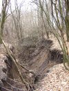
| natural | earth_bank | Large erosion gully or steep earth bank | |||
| natural | fumarole | A fumarole is an opening in a planet's crust, which emits steam and gases | |||
| natural | gully | Small scale cut in relief created by water erosion | |||
| natural | hill | Heuvel | currently not rendered by OSM Carto | ||
| natural | peak | Berg- of heuveltop | |||
| natural | ridge | A mountain or hill linear landform with a continuous elevated crest | |||
| natural | rock | A notable rock or group of rocks attached to the underlying bedrock. | currently not rendered by OSM Carto | ||
| natural | saddle | The lowest point along a ridge or between two mountain tops | |||
| natural | sand | Zandvlakte
Zandgebieden mogen spaarzaam wat vegetatie bevatten, bv Grassen of Vliegdennen. |
|||
| natural | scree | Steenvlakte
Vlakte van kleinere stenen en rotsblokken. Wordt ook wel een steengletsjer genoemd. |
|||
| natural | sinkhole | A natural depression or hole in the surface topography. | currently not rendered by OSM Carto | ||
| natural | stone | Alleenstaande grote steen of rotsblok | currently not rendered by OSM Carto | ||
| natural | valley | Vallei | currently not rendered by OSM Carto | ||
| natural | volcano | Vulkaan | |||
| natural | user defined | Zie ook Taginfo[1]] voor meer informatie. | |||
This table is a wiki template with a default description in English. Editable here.


