List of featured images/2008
Jump to navigation
Jump to search
These are featured images, which have been identified as the best examples of OpenStreetMap mapping, or as useful illustrations of the OpenStreetMap project.
If you know another image of similar quality, you can nominate it on Featured image proposals.
- See also: List of featured images/2007 and List of featured images/2009
| December 2008 | |||
| 27th | 
|
A frame from 'OSM 2008 - A year of edits. Other stills available on Flickr. Animation on the ITO Vimeo site from midnight (Australia time) on Dec 31st. | |
| 20th | 
|
Animation of the Bradford mapping party (using the Party renderer) | |
| 13th | 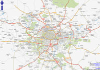
|
MapServer-rendered map of Paris and its suburbs | |
| 6th | 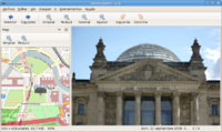
|
Geotagging a photo with OSM maps in Eye of GNOME. | |
| November 2008 | |||
| 29th | 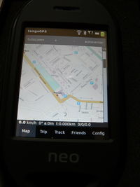
|
TangoGPS with OSM maps on Openmoko Freerunner | |
| 22nd | 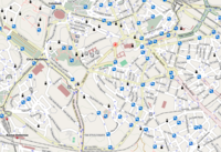
|
OpenCycleMap rendering with lots of amenity=drinking_water in Rome | |
| 15th | 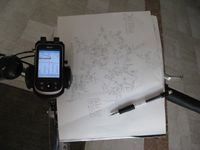
|
Mapping Toulouse with a PDA, BSGPSPDA, a bike, a pencil and some paper. | |
| 8th | 
|
The new OSM Inspector tool offers a range of debug views of OpenStreetMap data, among them the house number/postcode view shown here. | |
| 1st | 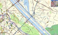
|
Mapsource rendering of Vienna | |
| October 2008 | |||
| 25th | 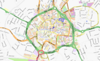
|
Coventry Ring Road (A4053) provides a good boundary for micro mapping. | |
| 18th | 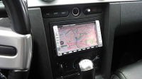
|
OSM maps in a car with gpsdrive (Install notes) | |
| 11th | 
|
Kosmos render showing an area without clutter | |
| 4th | 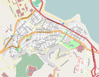
|
Mapping of Bab El Oued in Algiers, Algeria | |
| September 2008 | |||
| 27th | 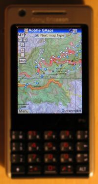
|
Screenshot of Mgmaps application showing Kosmos-generated map on a mobile phone. Visit Kosmos And MGMaps for more info. | |
| 20th | 
|
Michal Migurski's map of Oakland (see also historical maps on that site) | |
| 13th | 
|
Large Hadron Collider at CERN showing the layout of tunnels | |
| 6th | 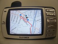
|
Gosmore running with OSM data on Windows CE and showing a route. | |
| August 2008 | |||
| 30th | 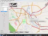
|
OSM data in KDE Marble, for Linköping (latest map) | |
| 23rd | 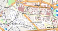
|
Some nice mapping done in Montpellier, France by AndrewT | |
| 16th | 
|
The PTGMAP application uses actual OSM data who is converted by Mkgmap into a garmin map file on your PC. Everything is ready for mapping. You see a district in Basel, Switzerland | |
| 9th | 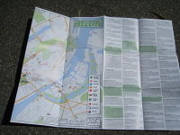
|
A real paper map of Copenhagen made with OSM data. The USE-IT organisation has published this map for free for all young travellers to Copenhagen. See User:Use-it/Map_of_Copenhagen_for_Young_Travellers for more information. | |
| 2nd | 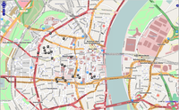
|
Map showing man_made=surveillance cameras from osm-cctv.hboeck.de | |
| July 2008 | |||
| 26th | 
|
If you think you live in a perfectly mapped area or city, try joining the house-numbering project... | |
| 19th | 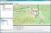
|
A screenshot of the new version of Kosmos (v2.0). See http://igorbrejc.net/openstreetmap/kosmos-20-is-here-at-last for more info. | |
| 12th | 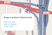
|
OpenStreetBugs help you to mark errors in OSM data. You can leave a short message on the map if something is missing or obviously wrong, like "oneway in wrong direction" or "bridge or level_crossing?". Someone will go there and check this. | |
| 5th | 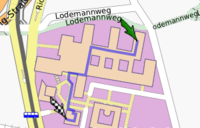
|
Routing with openrouteservice.org from one place to the cafeteria at FH Hannover-campus. | |
| June 2008 | |||
| 28th | 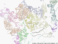
|
Kosmos render of postal_code=* tag on streets (Birmingham). | |
| 21st | 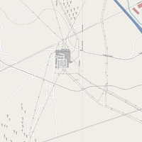
|
Substations, power lines, and wind farms in California | |
| 14th | 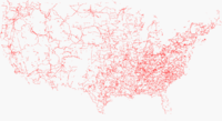
|
Power lines in the USA. Data selected with osmxapi and rendered by Kosmos with special render file | |
| 7th | 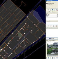
|
The JOSM map editor, with speed color-coded GPX tracks and the AgPiFOJ plugin, allowing lots of pictures to be synced with a GPS tracklog | |
| May 2008 | |||
| 31st | 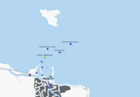
|
Lighthouse and buoy data, made public by the Commissioner of Irish lights. (OSM file, discussion) | |
| 24th | 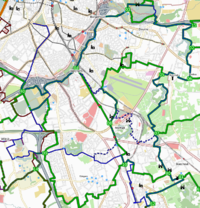
|
Custom rendering of a small part of the Belgian cycle network. | |
| 17th | 
|
The latest effort in the UK to spread the word of OSM whilst mapping on foot or bike - OSM Printed Hi-Vis Vests! | |
| 10th | 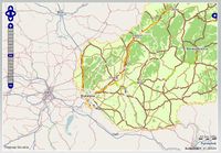
|
Freemap Slovakia rendered with customized styles and Osmarender extend its map outside Slovakia using OpenStreetMap's Mapnik layer with on-the-fly-stitching of its own and mapnik tiles for tiles near national boundaries of Slovakia into one browsable slippy map. | |
| 3rd | 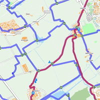
|
A map of the Dutch Regional cycling network, based on numbered nodes. This part of the network in particular has been completed into OSM even before the official launch and corrects several errors in the offical network map. This part has been generated in only 6 weeks, and in the same time a splendid proper look has been made.
Several other regions are currently in the phase of completion, but a lot of field work remains. | |
| April 2008 | |||
| 26th | 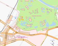
|
Internal map of a zoo in Berlin (link) | |
| 19th | 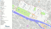
|
A map of the 1st arrondissement of Paris from Wikitravel.org, using OSM data, but annotated with attractions, restaurants, bars and hotels and with an automatically generated listing key. This map, and 20 others, are part of the printed Wikitravel Paris guidebook by Wikitravel Press | |
| 12th | 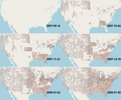
|
From late summer of 2007 until the end of January 2008 the TIGER data was imported into OSM. This animation (maps from Randomjunk, animated by Sciuro), shows progress over this period. Of course, there's still plenty to do during the TIGER fixup! | |
| 5th | 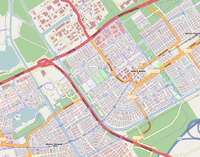
|
This is what you can do if you have too much time and Yahoo! Aerial Imagery. This is the city of Almere near Amsterdam. User:Skywave drew pretty much all of the buildings of the city using JOSM amd the WMS plugin. | |
| March 2008 | |||
| 29th | 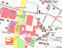
|
A high-quality printed map has been produced from OSM data for the FOSSGIS 2008 conference in Freiburg, Germany. | |
| 22nd | 
|
Artwork inspired by OpenStreetMap (Constantin Litvak) | |
| 15th | 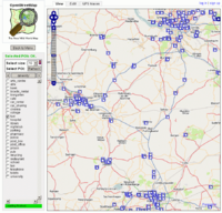
|
This is a screenshot from a brand new program made by Plenz which is available on www.lenz-online.de/osm. The user can select the POIs he wants to see from a list and he can even select the size of the icons. As an example, on this screenshot all fuel stations between Hamburg, Bremen and Hannover are displayed. | |
| 8th | 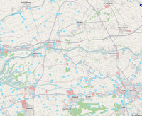
|
Dutch cyclists added hundreds of nodes to the cylemap using a custom-made script. Still they have to connect the nodes with eachother (a start is made in the upper-left corner of this image, near Schoonhoven) wich means a lot of cycling to do.... | |
| 1st | 
|
The cycle map is now showing contours from SRTM data. | |
| February 2008 | |||
| 23rd | 
|
Our project is the subject of a whole book (in German), out now and available from the usual online booksellers. The book has its own web page. An English version is being discussed. | |
| 16th | 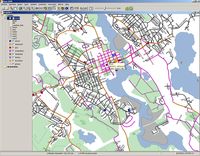
|
OSM data in OpenJUMP (a "traditional" GIS application). Note that all data in this picture is created solely using gps traces and surveying by foot as there is no high-quality free aerial source for this region. | |
| 9th | 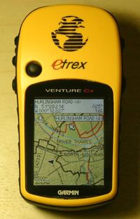
|
One year on from the February 2007 featured image, a picture of a GPS showing the same area, but customized for cycling with cycle routes highlighted in dark red in the same fashion as the cycle map | |
| 2nd | 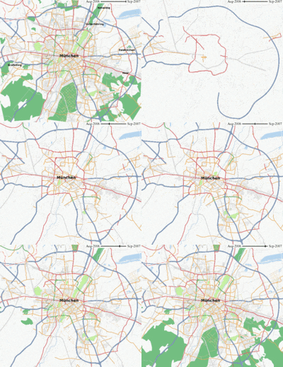
|
Animation showing the development of OSM in the area Munich, the capital of Bavaria, Germany. Time shown: August 2006 until September 2007. This animation is also shown at the German page on Munich. Animation has been rendered by RalfZ. | |
| January 2008 | |||
| 26th | 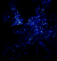
|
GPS traces uploaded to OSM don't normally get seen en-masse. OSM has 115 million points for this area of Europe. | |
| 19th | 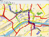
|
Navit is a great open-source (GPL) application for routing and navigation. It contains a utility to convert .osm-files to the binary file format used by the main application. There is a SDL and a GTK+ interface. The route calculation is rather fast and it will even guide you with speech-output using speechd or espeak. Since navit renders the map on-the-fly, there's no need for storing a large number of picture-files on the hard drive or even having an internet-connection while using it. Map data from GeoFabirk's Europe-extract from Dec, 30th 2007 is only 151MB in the binary file format. (The .osm.bz2 used to build the binary data was 320MB)
The image shows navit displaying a part of Frankfurt_am_Main using the GTK+ interface with a route calculated by navit. --Jannis 18:33, 4 January 2008 (UTC) | |
| 12th | 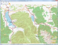
|
Screenshot containing a sample of a relief map around Tegernsee generated with the new map rendering engine Kosmos. Contours were generated using the Srtm2Osm tool from the SRTM3 dataset (notice relief voids). | |
| 5th | 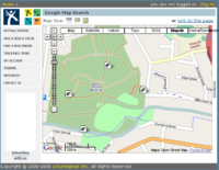
|
With the new version of the OSMify bookmarklet, you can now search for geocaches (or use any other site with Google Maps) using OSM maps. | |
