Template:Zh-hans:Map Features:landuse
Jump to navigation
Jump to search
土地利用
描述不同区域土地的用地性质。关于此标签的更多信息,参见土地利用页面。
| 关键字(key) | 值(value) | 元素(element) | 说明 | 渲染结果 | 照片 | |
|---|---|---|---|---|---|---|
土地利用常见关键字值-已开发土地 | ||||||
| landuse | commercial | 商业办公用地 | ||||
| landuse | construction | 建筑工地 | ||||
| landuse | education | An area predominately used for educational purposes/facilities. | ||||
| landuse | fairground | A site where a fair takes place | ||||
| landuse | industrial | 工业用地,包括工厂、车间和仓储用地。 | ||||
| landuse | residential | 居住区 | ||||
| landuse | retail | 商业零售用地 | ||||
| landuse | institutional | Land used for institutional purposes, see The meaning of this tag is ambiguous and unclear by some. Consider using another tag that better describes the object. For instance landuse=civic_admin. |
||||
| 关键字(key) | 值(value) | 元素(element) | 说明 | 渲染结果 | 照片 | |
土地利用常见关键字值-乡村与农业用地 | ||||||
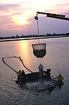
| landuse | aquaculture | Warning: currently, there is no convention on the exact meaning of this tag. Therefore, it makes sense to treat it like "boundary of aquaculture" (without implication of water body), which means, water body should be tagged by its own, using natural=water etc. |
||||
| landuse | allotments | 市民农场。当地居民的私人菜圃、花圃。 | ||||
| landuse | farmland | 农田,包括种植粮食、经济作物、蔬菜、水果、花卉以及放牧牲畜的土地。 | ||||
| landuse | farmyard | 农业设施,农业相关设施如农舍,农庄,庄园,棚架,马场,仓库,农机具车库,饲料仓库等,与该设施相邻之树林。 | ||||
| landuse | paddy | 土地形状和地表条件适合种植水稻的水田。 | ||||
| landuse | animal_keeping | An area of land that is used to keep animals, particularly horses and livestock. | ||||
| landuse | flowerbed | An area designated for flowers | ||||
| landuse | forest | 林业用地。天然林请改用natural=wood。 | ||||
| landuse | logging | An area where some or all trees have been cut down | ||||
| landuse | greenhouse_horticulture | 温室用地,用于种植蔬菜和花卉的大棚。 | ||||
| landuse | meadow | 牧草地,以栽种草本植物或牧草等作物(如甘蔗,玉米或牧草)为主要用途。 | ||||
| landuse | orchard | 果园 | ||||
| landuse | plant_nursery | 育种苗圃,人为栽培新品种植物。 | ||||
| landuse | vineyard | 葡萄园 | ||||
| 关键字(key) | 值(value) | 元素(element) | 说明 | 渲染结果 | 照片 | |
Common landuse key values - waterbody | ||||||
| landuse | basin | 人工挖掘的集水区。搭配basin=*标注集水区种类。 | ||||
| 水库 | ||||||
| landuse | salt_pond | 盐田,用于让海水蒸发以取得盐的土地。 | ||||
| 关键字(key) | 值(value) | 元素(element) | 说明 | 渲染结果 | 照片 | |
其他土地利用关键字值 | ||||||
| landuse | brownfield | 棕地,废弃的工商业用地,通常旧有建筑已被拆除并将进行更新改造的。 | ||||
| landuse | cemetery | 墓地。可使用religion=* (可选用的值列在place of worship page)。较小的墓地,如教堂边的也可使用amenity=grave_yard标签代替 | ||||
| Protected areas (deprecated) Alternate tagging of same thing: boundary=protected_area, protected_area=* | ||||||
| landuse | depot | An area used as a depot for e.g. vehicles (trains, buses or trams). Consider using rather standard landuse tags like landuse=railway, landuse=commercial, landuse=industrial, with subtag like industrial=depot. | ||||
| landuse | garages | 连片的车库。 | ||||
| landuse | grass | 人工管理的草坪。有些人认为这不是土地利用,请参阅主页landuse=grass以获取信息。 | ||||
| landuse | greenfield | 待开发的闲置土地。 |
| |||
| landuse | landfill | 垃圾堆放/填埋场地 | ||||
| landuse | military | 军事用地,包括由军队拥有控制的各种用途的土地。 | ||||
| landuse | port | 处理商业交通的沿海工业区。考虑将landuse=industrial+industrial=port用于此类工业区域。 | ||||
| landuse | quarry | 露天采矿/采石场 | ||||
| landuse | railway | 铁路用地,一般不对公众开放。 | ||||
| landuse | recreation_ground | 游憩用地。常包含球场,绿地等,多为公立,亦可能属于大学或私人公司。 | ||||
| landuse | religious | 宗教用地 | ||||
| landuse | village_green | 畸零绿地,常用于分环岛,分隔带等,原意为欧洲社区共有的绿地。 | ||||
| landuse | greenery | Used for any area covered with landscaping or decorative greenery, regardless of it being on a roundabout, along a street or in a park/garden, This tag has been used for vegetation that is hard to classify, either because its kind or because its diversity. | ||||
| landuse | winter_sports | An area dedicated to winter sports (e.g. skiing) | ||||
| landuse | 用户自定 | 到Taginfo查询常用标签值 | ||||
This table is a wiki template with a default description in English. Editable here.


