Uploads by GOwin
Jump to navigation
Jump to search
This special page shows all uploaded files.
| Date | Name | Thumbnail | Size | Description | Versions |
|---|---|---|---|---|---|
| 22:58, 14 April 2025 | Snap-py Talk 2025-04 VMPanes better-osm-org.pdf (file) |  |
984 KB | {{Information | description=Snap-py Talk presentation during Map-py Wednesday March 2025 session on using better-osm-org script s for the browser for add-on features for the OSM.org website. | source=Own work | date=2025-04016 | author=Vince Panes }} | 1 |
| 22:49, 14 April 2025 | Snap-py Talk 2025-03 Uzair-Ahmad OSM & Climate Change.pdf (file) |  |
1.4 MB | {{Information | description=Snap-py Talk session for March 2025 on utilizing OSM data for Climage Change action in Pakistan | source=Own work | date=2025-03-19 | authors=Uzair Ahmad | other_versions= }} | 1 |
| 21:59, 4 March 2025 | Screenshot 2025-02-19 at 17-34-56 BigBlueButton - Map-py Wednesdays - Default.png (file) |  |
1.56 MB | {{Information | description=Group photo of the 2025 February Map-py Wednesday Session | source=own work | date=2025-02-19 | author=Win Olario | other_versions= }} | 1 |
| 21:21, 4 March 2025 | MW2025-02-Olario-Setting-up-JOSM-for-Copernicus-Sentinel-2-Tiles.pdf (file) | 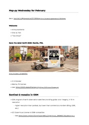 |
4.42 MB | {{Information | description=Snap-py Talk session on setting-up JOSM for Copernicus Sentinel-2 tiles | source=own work | date=2025-02-19 | author=Erwin Olario | other_versions= }} | 1 |
| 00:24, 16 January 2025 | Screenshot 2025-01-15 17-28-53.png (file) |  |
993 KB | {{Information | description=Group photo from the Map-py Wednesday session from January 2025 | source=own work | date= | author= | other_versions= }} | 1 |
| 00:19, 16 January 2025 | 5 Tips to Boost Community Participation-Madina TLM.pdf (file) |  |
1.62 MB | {{Information | description=Presenter's deck for a lighting talk about boosting community participation, based on their university experience in Palembang, Indonesia | source= | date= | author=Madina TLM | other_versions= }} | 1 |
| 00:16, 16 January 2025 | Field Mapping using QGIS-Ratu Belladina.pdf (file) |  |
5.76 MB | {{Information | description=Presenter's light talk deck on using QGIS to facilitate field mapping using OsmAnd | source= | date=2025-01-15 | author=Ratu Belladina | other_versions= }} | 1 |
| 09:06, 18 December 2024 | OsmAPP-snap-py talk 2024-12.pdf (file) |  |
165 KB | {{Information | description=ligthning talk about OsmApp, for the December 2024 session of Map-py Wednesday | source= | date=2024-12-18 | author=Win Olario | other_versions= }} | 1 |
| 23:59, 21 November 2024 | Map-py Wednesday Snap-py Talk-Nov-2024--Osm QA tools-Husni Falah.pdf (file) |  |
5.05 MB | {{Information | description=Deck on several OSM Quality Assurance Tools | source=Map-py Wednesday | date=2024-11-19 | author=Husni Fallah | other_versions= }} | 1 |
| 23:57, 21 November 2024 | Map-py Wednesday Snap-py Talk-Nov-2024--Presentasi OSM YM UNJ-Yabes Butar Butar.pdf (file) |  |
859 KB | {{Information | description=Universitas Negeri Jakarta YouthMappers presentation on students' contribution to Open Data | source=Map-py Wednesday | date=2024-11-19 | author=Yabes Butar Butar | other_versions= }} | 1 |
| 10:10, 24 October 2024 | Narrow highways in indonesia-KISMAWRDANI.pdf (file) |  |
3.24 MB | {{Information | description=local convention for mapping alleys, paths, and living streets in Indonesia | source= | date= | author= Ratu Kismawrdani | other_versions= }} | 1 |
| 10:08, 24 October 2024 | Map-making using Field papers through youth participation at Universitas Pendidikan Indonesia-MARDYAN.pdf (file) |  |
2.49 MB | {{Information | description=UPI Youthmappers experience using FieldPapers | source= | date= | author=Benny Mardyan | other_versions= }} | 1 |
| 01:53, 20 October 2024 | PublicTransportDataInKL-nabil-mys.pdf (file) | 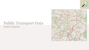 |
4.02 MB | {{Information | description=Public Transport Data in Kuala Lumpur | source= | date= | author=Nabil Ersyad | other_versions= }} | 1 |
| 01:52, 20 October 2024 | Collecting GoPro Max images Mapillary-MUHLIS.pdf (file) |  |
7.62 MB | {{Information | description=Collecting GoPro Max imagery for Mapillary | source= | date= | author=Andi Muhlis | other_versions= }} | 1 |
| 01:50, 20 October 2024 | Aerial imagery-PANES.pdf (file) |  |
4.12 MB | {{Information | description= Tips and Tricks when using aerial imagery for editing in OSM | source= | date= | author= Vince Panes | other_versions= }} | 1 |
| 01:49, 20 October 2024 | STM Map-py Together-win.pdf (file) |  |
2.89 MB | {{Information | description=Presentation on how to use the Simple Task Manager | source=my own | date= | author=Win Olario | other_versions= }} | 1 |
| 01:40, 20 October 2024 | OM Guru Presentation Summary.pdf (file) |  |
14.93 MB | {{Information | description=Asia Pacific Mapping Hub presentation about their Open Mapping Guru Network initiative | source= | date= | author=Mikko Tamura | other_versions= }} | 1 |
| 01:37, 20 October 2024 | 2024 02 24 Kaart LTk Using Strava For Improving Imagery Alignments DE LEON.pdf (file) |  |
2.45 MB | {{Information | description=Using Strava tracks for improving aerial imagery alignment | source= | date= | author=Rally de Leon | other_versions= }} | 1 |
| 01:32, 20 October 2024 | 2024-Feb UPI-YMC-bus-friendly.pdf (file) |  |
43.73 MB | {{Information | description=presentation of local YouthMappers chapter in their initiative to map bus stop and infrastructure | source= | date= | author= | other_versions= }} | 1 |
| 01:27, 20 October 2024 | 2024-Feb embracing the OSM Universe AHIRE.pdf (file) |  |
5.06 MB | {{Information | description=Tomtom community manager presentation | source= | date= | author=Kiran Ahire | other_versions= }} | 1 |
| 04:34, 19 October 2024 | 2024-Feb overpass turbo queries by example.pdf (file) |  |
1.13 MB | {{Information | description=Overpass Turbo queries by Example | source= | date= | author=Timeo Gut | other_versions= }} | 1 |
| 04:26, 19 October 2024 | 2024.March SCEE StreetComplete Intro-v1.pdf (file) |  |
34.73 MB | {{Information | description=An introductory training and walkthrough of SCEE app | source= | date= | author=Rally de Leon | other_versions= }} | 1 |
| 04:26, 19 October 2024 | OSM-PH outreach in Tagbilaran, PHL.pdf (file) |  |
3.64 MB | {{Information | description=Mapping spatial local knowledge with pen and paper. | source=own work | date= | author=Win Olario | other_versions= }} | 1 |
| 04:23, 19 October 2024 | Creating OSM Survey Routes with gpxStudio.pdf (file) |  |
2.35 MB | {{Information | description=Creating OSM survey routes with gpx.studio | source= | date= | author=Andi Muhlis | other_versions= }} | 1 |
| 04:21, 19 October 2024 | Integrating RSD with OSM.pdf (file) | 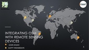 |
14.38 MB | {{Information | description=Integrating remote sending devices with OSM | source= | date= | author=Uzair Ahmad | other_versions= }} | 1 |
| 04:19, 19 October 2024 | 2024 Hualien Earthquake and Response from Local Community - HackMD.pdf (file) |  |
9.86 MB | {{Information | description=2024 Hualien, Taiwan earthquake and OSM-TW community response | source= | date= | author=Dennis Raylen Chen | other_versions= }} | 1 |
| 04:14, 19 October 2024 | RapID and MapWithAI Husni.pdf (file) |  |
4.36 MB | {{Information | description=a walkthrough of using RapID editor with MapWithAI | source= | date= | author=Husni Falah | other_versions= }} | 1 |
| 04:13, 19 October 2024 | Challenge of Mapping in Small Town.pdf (file) |  |
10.63 MB | {{Information | description= OSM contributor experience of mapping their small town in Indonesia | source= | date= | author=Bell Kismawrdani | other_versions= }} | 1 |
| 04:10, 19 October 2024 | SnappyTalk2024-171 OSM-PK-updates Uzair.pdf (file) |  |
2.16 MB | {{Information | description=Local OSM community updates in Pakistan, as June 2024 | source= | date= | author=Uzair Ahmad | other_versions= }} | 1 |
| 04:09, 19 October 2024 | SnappyTalk2024-171 Eskinita Rally v2.pdf (file) | 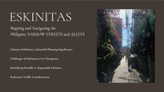 |
16.87 MB | {{Information | description=Sharing about local experience of tagging narrow highways in the Philippines | source= | date= | author=Rally de Leon | other_versions= }} | 1 |
| 04:04, 19 October 2024 | OSM GO app walkthrough by VMPanes.pdf (file) |  |
3.06 MB | {{Information | description=a walk-through of using OSM Go web app. | source= | date= | author=Vince Panes | other_versions= }} | 1 |
| 03:47, 19 October 2024 | MappyWednesdays-about.jpg (file) |  |
44 KB | {{Information | description=a one-page description of what to expect during Map-py Wednesday meetings | source=my own work | date= | author=Erwin Olario | other_versions= }} | 1 |
| 03:42, 19 October 2024 | MappyWednesday-generic-cover2024.png (file) |  |
88 KB | {{Information | description=typical cover page for Map-py Wednesday session | source=my own work | date= | author=Erwin Olario | other_versions= }} | 1 |
| 03:18, 19 October 2024 | Tracking your geotagged video on map.pdf (file) | 759 KB | {{Information | description=A presentation on how to use geotagged videos taken with GoPro cameras. | source= | date= | author=Andi Muhlis | other_versions= }} | 1 | |
| 03:15, 19 October 2024 | Bike Tour with OSM.pdf (file) | 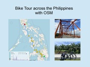 |
428 KB | {{Information | description=A presentation about using OpenStreetMap tools to plan and navigate a bike tour in the Philippines | source= | date=2024-10-16 | author=Timeo Gut | other_versions= }} | 1 |
| 23:47, 20 June 2024 | Flowchart for Tagging Barrier Access- r6a-v2.pdf (file) |  |
49 KB | Minor readability improvements: increase font size of decision labels, reposition some shapes. | 4 |
| 07:12, 14 August 2022 | OpenStreetMap@Pilipinas the UPRI YouthMappers contingent OSM18.jpg (file) |  |
722 KB | {{Information | description=A group photo of the UPRI YouthMappers contingent, during the local community's celebration of OpenStreetMaps' 18th anniversary in Manila. | source=own | date=2022-08-13 | author=E. Olario | permission= own | other_versions= }} | 1 |
| 07:04, 14 August 2022 | OpenStreetMap@Pilipinas showing off the cake.jpg (file) |  |
1.13 MB | {{Information | description=A woman in Manila, shows of a cake during a get-togeher in Manila, celebrating the 18th OpenStreetMap anniversary. | source=own | date=2022-08-13 | author=E. Olario | permission=own | other_versions= }} | 1 |
| 07:00, 14 August 2022 | OpenStreetMap@Pilipinas celebrating OSM18 in Intramuros,manila.jpg (file) |  |
927 KB | {{Information | description=A group photo of contributors from the Philippines during their OSM18 get together. | source=own | date=2022-08-13 | author=E. Olario | permission= | other_versions= }} | 1 |
| 00:59, 31 October 2021 | Wordcloud-heart osmapaaralanv2.png (file) | 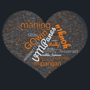 |
4.69 MB | 1 | |
| 01:09, 4 April 2021 | Hailhydrant-logo.svg (file) |  |
8 KB | Logo of the HailHydrant project in SVG. | 1 |
| 01:46, 22 May 2020 | Wemap-title-2.png (file) |  |
58 KB | 1 | |
| 01:44, 12 August 2019 | Philippines 15th Birthday group.jpg (file) | 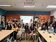 |
2.88 MB | OpenStreetMap enthusiasts in the Manila, Philippines pose for a group photo during the 15th year anniversary gathering | 1 |
| 01:43, 12 August 2019 | Philippines 15th Birthday group candlelit.jpg (file) |  |
2.97 MB | OpenStreetMap enthusiasts in the Manila, Philippines gather to celebrate the 15th year anniversary of the project, and to share updates about various local initiatives. | 1 |
| 03:02, 2 July 2019 | PnM logo+text.png (file) |  |
201 KB | 1 | |
| 07:08, 27 March 2019 | MapaTime 20190325 200945 077.jpg (file) | 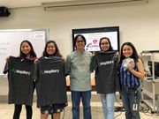 |
198 KB | Lucky students who got Mapillary schwags during the MapHer: When Women Map event organized by the student members of the Miriam Environmental Planning and Management. Category:Philippines Category:MapaTime | 1 |
| 07:07, 27 March 2019 | MapaTime 20190325 133852.jpg (file) |  |
3.33 MB | Random photo during the MapHer: When Women Map event organized by the student members of the Miriam Environmental Planning and Management. Category:Philippines Category:MapaTime | 1 |
| 07:06, 27 March 2019 | MapaTime IMG 20190325 132542.jpg (file) | 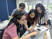 |
3.97 MB | Female students consulting each other while working on a map during MapHer: When Women Map event organized by the student members of the Miriam Environmental Planning and Management. Category:Philippines Category:MapaTime | 1 |
| 07:04, 27 March 2019 | MapaTime! IMG 20190325 094003-COLLAGE.jpg (file) | 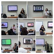 |
582 KB | MapaTime!_ Photo collage of resource persons during the MapHer: When Women Map event organized by the student members of the Miriam Environmental Planning and Management. Category:Philippines Category:MapaTime | 1 |
| 07:01, 27 March 2019 | MapaTime! IMG 20190325 122002.jpg (file) |  |
3.34 MB | A photo of (mostly) female participants of the mapHER women's month event in Miriam College, Quezon City | 1 |