DE:Bicycle/OSM-Radfahreranwendungen
Sammlung von Karten und anderen OSM-Anwendungen rund ums Fahrrad.
Online-Fahrradkarten auf OSM Basis
| Name, Weblink | Beschreibung | Abdeckung | Fahrradrouten | POIs für Radfahrer | Höhendarstellung | Bildschirmfoto |
|---|---|---|---|---|---|---|
| 4UMaps (4UMaps) | Outdoorkarte für Wanderer und Biker | weltweit | ja | ja | ja | 
|
| OpenCycleMap (www.opencyclemap.org) | die "offizielle" OSM-Fahrradkarte | weltweit | ja | ja | ja | 
|
| Radrouten-Overlay von Lonvia (cycling.lonvia.de) | Radrouten-Overlay | weltweit | ja | nein | ja | 
|
| Hike & Bike Map (www.hikebikemap.de) | Wander- und Radfahrkarte | weltweit | nein | ja | ja | 
|
| Velo Access Map (osm.t-i.ch/bicycle/map) | Fahrradkarte, die Restriktionen für Radfahrer darstellt
(Karten-Layer Velo wird zur Zeit nicht angezeigt. Stand: 20.08.2018) |
weltweit (Routen),
Europa (Routen und Velo-Layer) |
nein | nein | ja | 
|
| Openfietskaart (www.openfietskaart.nl) | Niederländische Fahrradkarte | Niederlande, Belgien, Luxemburg | ja | ja | nein | 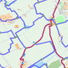
|
| Bicycle tags map ([1]) | Overlay Fahrradkarte mit OSM Radwege tags | weltweit | ja | ja | ja | 
|
| fahrrad-stadtplan.eu (www.fahrrad-stadtplan.eu) | Radwege, Radstreifen, Verbote, Kopfsteinpflaster und Radrouten
(Zur Zeit nicht erreichbar. Stand: 20.08.2018) |
weltweit | ja | nein | nein | 
|
| cycle.travel (cycle.travel/map) | Westeuropa, Nordamerika | ja | ja | ja | 
|
Diese Tabelle wird manuell gepflegt. Hilf mit, sie aktuell zu halten.
Spezialkarten
- Karte mit vielen Fahrradeigenschaften zum Ein- und Ausblenden http://mijndev.openstreetmap.nl/~ligfietser/fiets/index.html
- Fahrradparkplätze als Heatmap http://www.cycleparkingheatmap.com/
Routenplanung
| Name, Weblink | Beschreibung | Abdeckung | Fahrradrouten bevorzugen | Straßenbelag | Bildschirmfoto |
|---|---|---|---|---|---|
| MapQuest (en) (open.mapquest.de) | Prototyp eines Routenplaner auf für Radfahrer mit deutschprachiger Webseite | weltweit | nein | ja | 
|
| YOURS (www.yournavigation.org) (en) | Routenplaner für verschiedene Verkehrsmittel | weltweit | ja | nein | 
|
| OpenRouteService (www.openrouteservice.org) | plant auch Fahrradrouten | weltweit | ja | ja | 
|
| cycle.travel (en) (cycle.travel/map) | Westeuropa, Nordamerika | ja | ja | 
| |
| Routino (https://routino.arch.tu-dresden.de/routino/router.html) | Routenplaner für verschiedene Verkehrsmittel | Europa | ja | ja | |
| Komoot (www.komoot.de) | Routenplaner für verschiedene Freizeitaktivitäten mit vielen Optionen | Deutschland, Österreich, Schweiz | nein | ja | 
|
| Naviki (www.naviki.org) | Fahrrad-Routenplaner mit der Möglichkeit, eigene Wege zu dokumentieren, die dann ins Routing einbezogen werden | Europa | ja | ja | 
|
| bbbike.org (www.bbbike.org) | für Routen innerhalb einer Stadt. Optionen: Kopfsteinpflaster vermeiden, mit Anhänger, Ampeln vermeiden, … | verschiedene Städte | nein | ja | 
|
| GraphHopper (https://graphhopper.com) | Schneller und einfacher Routenplaner | weltweit | ja | ja | 
|
| Alminav (https://play.google.com/store/apps/details?id=com.almica.alminav]) | Offline GPS Navigator und Radroutenplaner für Mittel-Europa | Mittel-Europa | ja | nein | 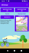
|
| BRouter (www.brouter.de) | Online-Radroutenplaner mit Auswahl von verschiedenen Radtypen und Anzeige von mehreren Alternativrouten. | weltweit | ?
|
?
|
|
| Fahrradies.net (www.fahrradies.net) | Prototyp eines Radroutenplaners der Uni Osnabrück für die Stadt Osnabrück | Osnabrück | nein | ja | 
|
Diese Tabelle wird manuell gepflegt. Hilf mit, sie aktuell zu halten.
| Name, Weblink | Beschreibung | Abdeckung | Aktualisierung | routingfähig |
|---|---|---|---|---|
| Velomap (www.velomap.org) | Karte für Touren- und Alltagsfahrer | weltweit | wöchentlich | ja |
| Openmtbmap (openmtbmap.org) | Mountainbike-Karte | weltweit | wöchentlich | ja |
| 4UMaps (4UMaps) | Topografische Outdoorkarte für Biker und Wanderer | Europa | wöchentlich | nein |
| Radkarte von Johannes Formann (www.formann.de) | Weiterentwicklung der nicht mehr aktualisierten Karte vom User:Radfahrer | Deutschland | zweimal pro Woche | ja |
| Radkarte vom User:Radfahrer | topographische Fahrradkarte, die nicht mehr aktualisiert wird | Deutschland | 19. September 2010 | ja |
| OpenFietsMap (www.openfietsmap.nl) | Niederländische Fahrradkarte mit Erweiterung für Deutschland | Niederlande, Belgien, Luxemburg, Deutschland, Alpen, Europa | regelmäßig | ja |
| OpenFietsMap Lite (garmin.openstreetmap.nl) | Weltweit | regelmäßig | ja |
Diese Tabelle wird manuell gepflegt. Hilf mit, sie aktuell zu halten.
Vorlagen zur eigenen Kartenerstellung
| Name, Weblink | Beschreibung | Sprachen |
|---|---|---|
| DE:OSM Map On Garmin/Cycle map | (de) | |
| DE:User:Radfahrer/Radkarte/Development | allgemeine Fahrradkarte | (de) |
| User:Drahtesel/Garmin | allgemeine Fahrradkarte | (de) |
| User:Speedpilgrim | für Fahrrad/Mountainbike | (de) |
| OSM Map On Garmin/Cycle map/SpeedCycling | für das Rennrad | (en) |
| OSM Map On Garmin/mtb map | für das Mountainbike | (en) |
Diese Tabelle wird manuell gepflegt. Hilf mit, sie aktuell zu halten.
Mobile Anwendungen
Android
Siehe auch: Android
| Name | Beschreibung | Preis | Version | Karte anzeigen | Speichert Kartendaten on-board | Bildschirmfoto |
|---|---|---|---|---|---|---|
| Alminav [2] | Alminav is an Android map and navigation application using offline vector maps. | free + InApp payment | 2015-05-21 1.0.0.43 |
ja | ja | |
| AndNav2 [3] | No longer actively developed, map (online/offline-"andnav_atlas_format"), routing (online) | free | ?
|
ja | ja (cache) | 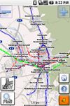
|
| AndRoad [4] | Open-source fork of AndNav2 | free | ?
|
ja | ja (cache) | 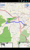
|
| Bike Citizens [5] | Designed for cyclists in urban areas incl. Insider tours. | nonfree5Eur per city | 2014-07-24 3.1 |
ja | ja | 
|
| CartoType [6] | portable library | ?
|
2013-07-17 2.9 |
ja | ja | 
|
| Cruiser [7] | Cruiser is an Android map and navigation application using offline vector maps. | free | 2014-10-17 1.2.12 |
ja | ja | 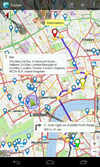
|
| CycleStreets Android App [8] | UK only | nonfreeFree | 2011-11-17 1.1 |
ja | ja (cache) | 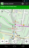
|
| ForeverMap [9] | ForeverMap is an offline navigation app, providing address/POI search and route calculation | nonfreeiPhone: 1,59€, Android: 1,59€ (Free Android version available) | 2013-10-05 3.2 |
ja | ja | 
|
| Goosm [10] | Contains an advanced search engine for POIs. Search any tags and display matching results, then send their position to any application that support intent filters if needed (google streetview, waze, navit, etc.). Create, Update or delete a POI, in two clicks. Autocomplete with most often-used tags, or use custom tags. | free | 2014-02-26 1.0.2 |
ja | nein | 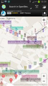
|
| GoPenS [11] | Open source Android GPS for OpenStreetMap, map (online/offline), routing (online) | free | 2011-01-10 0.7.5 |
ja | ja (cache) | 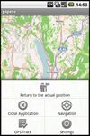
|
| Gosmore [12] | free | 2011-11-22 - |
ja | ja | 
| |
| GpsMid [13] | very portable navi for Android and J2ME mobile phones, uses offline vector maps, audio navigation | free | 2012-09-08 0.8.2 |
ja | ja | 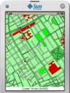
|
| Android offline navigation | free | 2014-05-11 3.0 |
ja | ja | 
| |
| komoot - Outdoor Routplaner [14] | free | 2012-11-12 4.3 |
ja | ja (cache) | 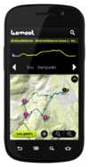
| |
| Locus [15] | Online/Offline map viewer (area downloader or tile cache), support slippy (non-free too) and vector maps (MapsForge library), guiding, routing and basic navigation (online only), track recording with detailed POIs (including photos) and altitude correction, extensive geocaching support, WMS maps and more | nonfreefree, paid | 2014-02-21 v2.19.1 |
ja | ja | 
|
| mAPPedplanet [16] | Online/Offline map viewer (own area vector maps with special informations), many standard tools build in | nonfreefree, paid | 2012-10-21 v3.0 |
ja | ja | 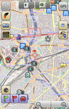
|
| MyTrails [17] | MyTrails is an Android application that makes it easy and fun to view online and offline maps, and to record and share GPS tracks. It is designed to offer an uncluttered map area, and the smoothest map navigation (drag, pinch-zooming, etc.) on a mobile device. | nonfreefree;paid | 2012-05-31 1.2.40 |
ja | ja | 
|
| Navitel [18] | Popular in Russia | nonfree17€ | 2011-06-10 5.0.0.1620 |
ja | ja | 
|
| Nogago [19] | Topographic Offline-Maps and Navigation for Hiking, Cycling and Biking | nonfreefree, offline maps: 4,95 Euro; licence key: 7,99 Euro | 2012-12-22 3.14 |
ja | ja | 
|
| OpenSatNav [20] | Routing and recording trip; maps (online+cache); navigation (online) | free | 2009-12-29 0.9 |
ja | ja (cache) | 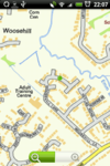
|
| OpenTripPlanner for Android [21] | An Android app for multi-modal trip planning using any OpenTripPlanner server | free | 2014-07-07 v2.0.5 |
ja | nein | 
|
| OsmAnd [22] | nonfreefree or 5.99€ | 2014-07-16 1.8.2 |
ja | ja | 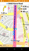
| |
| OsmPad [23] | Utility to gather house numbers for OpenStreetMap | free | 2012-04-19 1.0 |
ja | ja | 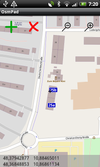
|
| PocketNavigator [24] | Android navigation application, aiming at pedestrians. Information on the next waypoint can be encoded in tactile feedback. | free | 2012-03-16 3.3 |
ja | ja (cache) | 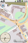
|
| ShareNav [25] | very portable navi for Android&J2ME mobile phones, uses offline vector maps, audio navigation | nonfree€2.99 on Google Play Store (may vary depending on local taxes) | 2012-11-12 0.8.8 |
ja | ja | 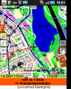
|
| Skobbler GPS Navigation [26] | Online and offline worldwide turn-by-turn navigation. Includes pedestrian and cyclist route planner, TripAdvisor, Foursquare and speed camera warning integration. | nonfreeAndroid: €1.00, free Version available (no offline maps); iOS: €1.79 | 2014-09-11 6.0 |
ja | ja | 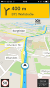
|
| TripGo [27] | Calendar-aware trip planner with real-time transport suggestions | ?
|
2014-08-29 4.0.1 |
ja | ja (cache) | 
|
Diese Tabelle wird automatisch von einem Bot erzeugt. Bearbeite sie bitte nicht von Hand. Mehr erfahren.
Apple iOS
Siehe auch: Apple iOS
| Name | Beschreibung | Preis | Version | Karte anzeigen | Speichert Kartendaten on-board | Bildschirmfoto |
|---|---|---|---|---|---|---|
| Bike Citizens [28] | Designed for cyclists in urban areas incl. Insider tours. | nonfree5Eur per city | 2014-07-24 3.1 |
ja | ja | 
|
| CartoType [29] | portable library | ?
|
2013-07-17 2.9 |
ja | ja | 
|
| ForeverMap [30] | ForeverMap is an offline navigation app, providing address/POI search and route calculation | nonfreeiPhone: 1,59€, Android: 1,59€ (Free Android version available) | 2013-10-05 3.2 |
ja | ja | 
|
| GPS Tuner [31] | Google Earth like 3D Navi with DEM | nonfree$6.99 / free | 2012-05-31 1.0.10 |
ja | ja | 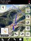
|
| komoot iPhone App [32] | free usage in a small region, larger/different regions can be bought | ?
|
2013-08-07 5.2 |
ja | ja (cache) | 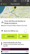
|
| Navigon Urban [33] | Offline router esp. for pedestrians/cyclists | nonfree4.49€ | 2013-02-20 1.2.0 |
ja | ja | 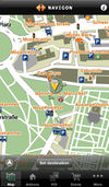
|
| Navitel [34] | Popular in Russia | nonfree17€ | 2011-06-10 5.0.0.1620 |
ja | ja | 
|
| OpenMaps [35] | Share & comment on OSM places via Twitter | nonfree2,39€ , free | 2011-10-12 4.5.4 |
ja | ja (cache) | 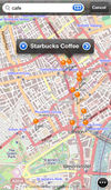
|
| OsmPad [36] | Utility to gather house numbers for OpenStreetMap | free | 2012-04-19 1.0 |
ja | ja | 
|
| Skobbler GPS Navigation [37] | Online and offline worldwide turn-by-turn navigation. Includes pedestrian and cyclist route planner, TripAdvisor, Foursquare and speed camera warning integration. | nonfreeAndroid: €1.00, free Version available (no offline maps); iOS: €1.79 | 2014-09-11 6.0 |
ja | ja | 
|
| Terra Map GPS [38] | Amazingly clear map rendering, nice UI, import of KMZ, KML, GPX files. | nonfree2.99$;4.99$ | ? 2.3 |
ja | ja | 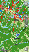
|
| TripGo [39] | Calendar-aware trip planner with real-time transport suggestions | ?
|
2014-08-29 4.0.1 |
ja | ja (cache) | 
|
Diese Tabelle wird automatisch von einem Bot erzeugt. Bearbeite sie bitte nicht von Hand. Mehr erfahren.
BlackBerry OS
Siehe auch: BlackBerry OS
| Name | Beschreibung | Preis | Version | Karte anzeigen | Speichert Kartendaten on-board | Bildschirmfoto |
|---|
Diese Tabelle wird automatisch von einem Bot erzeugt. Bearbeite sie bitte nicht von Hand. Mehr erfahren.
Maemo
Siehe auch: Software/Maemo
| Name | Beschreibung | Preis | Version | Karte anzeigen | Speichert Kartendaten on-board | Bildschirmfoto |
|---|---|---|---|---|---|---|
| Gosmore [40] | free | 2011-11-22 - |
ja | ja | 
| |
| Marble Touch | Mobile version of Marble | free | 2012-02-12 1.3.2 |
ja | ja (cache) | |
| MoNav [41] | Contraction Hierarchies routing, custom speed profiles, extremely fast and resource conservative routing, can handle huge graphs like Europe on mobile devices. Only source code available for download - has to be compiled by yourself! |
free | 2011-04-23 0.3 |
ja | ja | 
|
Diese Tabelle wird automatisch von einem Bot erzeugt. Bearbeite sie bitte nicht von Hand. Mehr erfahren.
Symbian
Siehe auch: Symbian
| Name | Beschreibung | Preis | Version | Karte anzeigen | Speichert Kartendaten on-board | Bildschirmfoto |
|---|---|---|---|---|---|---|
| MoNav [42] | Contraction Hierarchies routing, custom speed profiles, extremely fast and resource conservative routing, can handle huge graphs like Europe on mobile devices. Only source code available for download - has to be compiled by yourself! |
free | 2011-04-23 0.3 |
ja | ja | 
|
| Navitel [43] | Popular in Russia | nonfree17€ | 2011-06-10 5.0.0.1620 |
ja | ja | 
|
Diese Tabelle wird automatisch von einem Bot erzeugt. Bearbeite sie bitte nicht von Hand. Mehr erfahren.
Windows Mobile
Siehe auch: Windows Mobile
| Name | Beschreibung | Preis | Version | Karte anzeigen | Speichert Kartendaten on-board | Bildschirmfoto |
|---|---|---|---|---|---|---|
| Find & Route [44] | Fast rendering, no install; easy to use | nonfree50€ | 2012-03-08 2.0 |
ja | ja | 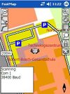
|
| GPS Tuner [45] | Google Earth like 3D Navi with DEM | nonfree$6.99 / free | 2012-05-31 1.0.10 |
ja | ja | 
|
| MoNav [46] | Contraction Hierarchies routing, custom speed profiles, extremely fast and resource conservative routing, can handle huge graphs like Europe on mobile devices. Only source code available for download - has to be compiled by yourself! |
free | 2011-04-23 0.3 |
ja | ja | 
|
| NaviPOWM [47] | free | 2011-07-05 0.2.6 |
ja | ja | 
| |
| Navitel [48] | Popular in Russia | nonfree17€ | 2011-06-10 5.0.0.1620 |
ja | ja | 
|
| PTGMAP [49] | free | 2010-11-16 1.2.9 |
ja | ja | 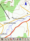
|
Diese Tabelle wird automatisch von einem Bot erzeugt. Bearbeite sie bitte nicht von Hand. Mehr erfahren.
