On Wheels app
| On Wheels | ||||||||||||||||||||||||||||||||||||||||||||||||||||||||||||||||||||||||||||||||||||||||||||||||
|---|---|---|---|---|---|---|---|---|---|---|---|---|---|---|---|---|---|---|---|---|---|---|---|---|---|---|---|---|---|---|---|---|---|---|---|---|---|---|---|---|---|---|---|---|---|---|---|---|---|---|---|---|---|---|---|---|---|---|---|---|---|---|---|---|---|---|---|---|---|---|---|---|---|---|---|---|---|---|---|---|---|---|---|---|---|---|---|---|---|---|---|---|---|---|---|---|
| Author: | On Wheels and Icapps | |||||||||||||||||||||||||||||||||||||||||||||||||||||||||||||||||||||||||||||||||||||||||||||||
| License: | Proprietary (free of charge) | |||||||||||||||||||||||||||||||||||||||||||||||||||||||||||||||||||||||||||||||||||||||||||||||
| Platforms: | Android and iOS | |||||||||||||||||||||||||||||||||||||||||||||||||||||||||||||||||||||||||||||||||||||||||||||||
| Status: | Active | |||||||||||||||||||||||||||||||||||||||||||||||||||||||||||||||||||||||||||||||||||||||||||||||
| Version: | 3.0.3 (2025-04-13) | |||||||||||||||||||||||||||||||||||||||||||||||||||||||||||||||||||||||||||||||||||||||||||||||
| Languages: | Dutch, English, German, French, Portuguese, and Spanish
| |||||||||||||||||||||||||||||||||||||||||||||||||||||||||||||||||||||||||||||||||||||||||||||||
| Website: | https://www.onwheelsapp.com/ | |||||||||||||||||||||||||||||||||||||||||||||||||||||||||||||||||||||||||||||||||||||||||||||||
| Install: | ||||||||||||||||||||||||||||||||||||||||||||||||||||||||||||||||||||||||||||||||||||||||||||||||
| ||||||||||||||||||||||||||||||||||||||||||||||||||||||||||||||||||||||||||||||||||||||||||||||||
On Wheels organisation
The On Wheels organisation was formed in 2014 by a group of wheelchair users in Belgium, trying to solve the problem of finding a café, restaurant, parking place, ... which is wheelchair accessible.
The main focus was to develop a user friendly app to share and collect accessibility data about public buildings. On Wheels has collected information about 20 000 locations, mainly in Belgium.
Today the organisation focusses on:
- Providing correct and objective accessibility information about public buildings to wheelchair users and less mobile people (app).
- Gather new big data sets with teambuildings, volunteers, users app, schools and universities, measuring days.
- Working with cities and governments to improve the accessibility of public buildings (data dashboard platform).
Contact info
info@onwheelsapp.com
https://github.com/onwheelsapp
On Wheels app
The first version of the app was launched in 2015 and has over 10 000 downloads on IOS and Android. The new app was developed in 2023-2024 with the goal of providing fully open data sharing with OpenStreetMap.
New accessibility tags were developed and discussed with the community. The app has some amazing features:
- Platform: IOS, Android and Web.
- Languages: Dutch, English, French, German, Spanish, Portuguese, more to come.
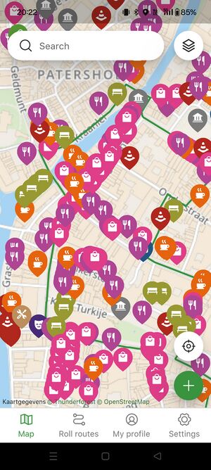
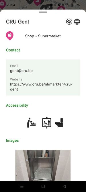
- View accessible places on an interactive map. Select a place and get detailed information (measurements, contact, opening hours, pictures, ...) about the entrance, toilets, elevator, ...
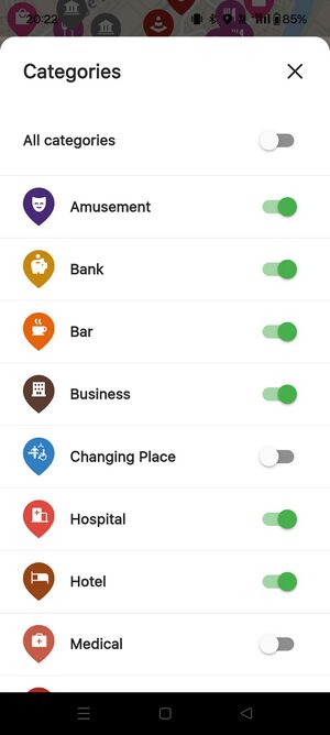
- Choose which of our 24 categories you want to see on the map, like cafe's, restaurants, parking spaces, banks, hotels, public transport, shops, ...
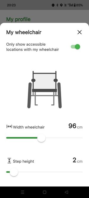
- Create your own wheelchair profile (by setting the width of your wheelchair and the possible kerb height) and see only the places that are accessible for you.
- Create and log in with an OpenStreetMap account and edit/add locations.
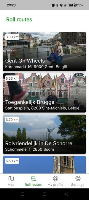
- Rolroutes: wheelchair accessible walk/bike routes.
Updates and bug fixes
Version 3.0.3 (13/04/25)
- viewing and editing ways
- adding wheelchair accessible parking spaces
- bug fix: empty fields (answer=no)
- bug fix: answer field with CAPITAL letters
- bug fix: 509: Bandwidth limit exceeded
- bug fix: missing tagging shops and public buildings
Version 3.0.4 (research)
- search map for location names and city names
- welcome message download new version app
- toilets wheelchair optimization
- change to vector tiles
- add accessibility check date
OSM Tagging
The On Wheels app collects and shares accessibility data with the OSM database about public buildings, public space and public transport. This happens through a direct connections between the app and OSM.
All data and tags (entrance and toilet) are added to the amenity nodes/ways of the building function (like shops, restaurant, ...). For the moment we don't have the option to add or view info to/of separate entrance or toilet nodes.
Categories
Entrance
| Main tag | Meaning | Keys | Rendering |
|---|---|---|---|
| entrance | Main entrance door to the building |
|
|
| wheelchair:turning_circle | Possible to do a 360° turn with a wheelchair on both sides of the entrance door | ||
| ramp:wheelchair | Wheelchair ramp in front of the entrance |
Toilets and changing table
| Main tag | Meaning | Keys | Rendering |
|---|---|---|---|
| toilets:wheelchair | Wheelchair accessible toilets | ||
| changing table | Changing table baby | ||
| changing table:adult | Changing table adults | ||
| shower:wheelchair | Wheelchair accessible shower |
Elevator
| Main tag | Meaning | Keys | Rendering |
|---|---|---|---|
| highway=elevator | Wheelchair accessible elevator |
|
External discussions
- https://community.openstreetmap.org/t/big-import-of-accessibility-data-from-the-on-wheels-app/101897
- tagging-request@openstreetmap.org
- Proposal:Accessibility#Proposal
- https://community.openstreetmap.org/t/create-changeset-api/109502
- https://community.openstreetmap.org/t/wheelchair-accessible-parking-spaces/110824

