Template:Fi:Map Features:highway
(Redirected from Fi:Template:Map Features:highway)
Jump to navigation
Jump to search
Tiet / highway
Teiden luokittelusta Suomessa, sekä taajamissa että niiden ulkopuolella, on joitain tarkempia ohjeita sivulla Fi:WikiProject_Finland/Piirto-ohjeet
| Avain | Arvo | Elementti | Kommentti | Esitystapa | Valokuva | |
|---|---|---|---|---|---|---|
Tiet ja kadut | ||||||
|
This group lists the 7 main tags for the road network, from most to least functionally important for motor vehicle traffic. | ||||||
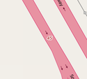
| highway | motorway | Moottoritie. | ||||
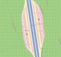
| highway | trunk | Valtatie/moottoriliikennetie. Tienumerot 1-39. Kylttien mukaisille moottoriliikenneteille sopii myös motorroad=yes. | ||||
| highway | primary | Kantatie. Tienumerot 40-99 | ||||
| highway | secondary | Seututie. Tienumerot 100-999 | ||||
| highway | tertiary | Yhdystie (tai entinen paikallistie). Tienumerot 1000-19999 | ||||
| highway | unclassified | Numeroimaton yleinen tie tai yksityistie. Pienille teille katso kohtaa highway=track. | ||||
| highway | residential | Asuinalueiden tiet. Katso myös WikiProject_Finland#Within_urban_areas teiden luokittelusta taajamissa. | ||||
Liittymät | ||||||
| highway | motorway_link | Moottoritien liittymäramppi. Yksisuuntaisia | ||||
| highway | trunk_link | Valtatien liittymäramppi | ||||
| highway | primary_link | Kantatien liittymäramppi | ||||
| highway | secondary_link | Seututien liittymäramppi | ||||
| highway | tertiary_link | Yhdystien liittymäramppi | ||||
Special road types | ||||||
| highway | living_street | Pihakatu: läpiajo kielletty, pysäköinti sallittu vain merkatuilla paikoilla, nopeusrajoitus 20 km/h ellei muuta mainita ja autoilla aina väistämisvelvollisuus. Vain saman nimisellä liikennemerkillä merkatuille kaduille. | ||||
| highway | service | Erityisesti autoille tarkoitettuja väyliä, esim. yksittäisille asuinrakennuksille vievät tiet, pysäköintialueiden väylät, huoltotiet lastauslaitureille. Katso mahdolliset lisämääreet kohdasta service=* | ||||
| highway | pedestrian | Kävelykatu | ||||
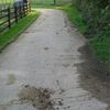
| highway | track | Mökkitie/metsätie - ainakin jollain autolla ajettavissa. | ||||
| highway | bus_guideway | Erityinen bussien akseli/raideleveyteen sovitettu väylä, jolla kapeammat henkilöautot eivät pysty ajamaan. Ei käytössä Suomessa. | ||||
| highway | escape | For runaway truck ramps, runaway truck lanes, emergency escape ramps, or truck arrester beds. It enables vehicles with braking failure to safely stop. | ||||
| highway | raceway | Moottorirata | ||||
| highway | road | Tuntematon tie. Tarkoitettu merkitsemään väliaikaisesti sellaisia teitä, joiden sijainti on tiedossa mutta luokitus tuntematon. | ||||
| highway | busway | A dedicated roadway for bus rapid transit systems | ||||
Kevyen liikenteen väylät ja muut kulkuväylät | ||||||
| highway | footway | Jalkakäytävä (vain jalankulkijoille sallittu). Taajamien ulkopuolella myös jalankulkuun erityisesti tarkoitettu väylä. Luontopolku jne. | ||||
| highway | bridleway | Ratsastustie. Suomessa yleensä muilta tienkäyttäjiltä kielletty (jos alussa pelkkä liikennemerkki ratsastustie [1]), jolloin lisätään foot=no ja bicycle=no, koska "bridleway" nimenomaisesti sallii jalankulun ja pyöräilyn. | ||||
| highway | steps | Portaikko / portaat | ||||
| highway | corridor | For a hallway inside of a building. | ||||
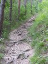
| highway | path | Polku. Määrittelemättömään tai useamman kulkumuodon käyttöön osoitettu väylä. Ensisijainen tai -sijaiset kulkumuodot merkitään foot=designated (esimerkkinä jalankulku) ja lisäksi niillä kulkumuodoilla, joilla sallittua ja mahdollista tyylillä bicycle=yes (esimerkkinä pyöräily). | ||||
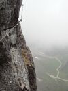
| highway | via_ferrata | A via ferrata is a route equipped with fixed cables, stemples, ladders, and bridges in order to increase ease and security for climbers. These via ferrata require equipment : climbing harness, shock absorber and two short lengths of rope, but do not require a long rope as for climbing. | ||||
When sidewalk/crosswalk is tagged as a separate way | ||||||
| footway | sidewalk | Sidewalk that runs typically along residential road. Use in combination with highway=footway or highway=path | ||||
| footway | crossing | Suojatie | ||||
| footway | traffic_island | The way between two crossings, safespot for pedestrians, has micromapping characteristics as a detailed alternative to =*. Use in combination with highway=footway or highway=path. | ||||
When sidewalk (or pavement) is tagged on the main roadway (see Sidewalks) | ||||||
| sidewalk | both | left | right | no | Specifies that the highways has sidewalks on both sides, on one side or no sidewalk at all | ||||
When cycleway is drawn as its own way (see Bicycle) | ||||||
| highway | cycleway | Pyörätie tai yhdistetty pyörätie ja jalkakäytävä, jolloin käytetään lisäksi tagia foot=designated. | ||||
Cycleway tagged on the main roadway or lane (see Bicycle) | ||||||
| cycleway | lane | Erillinen pyöräkaista ajoradan vieressä. | ||||
| cycleway | Käytetään pyöräkaistojen merkitsemiseen yksisuuntaisilla teillä, joilla pyöräily on sallittu molempiin suuntiin (ainoastaan maissa, joissa se on lainsäädännön osalta mahdollista). | |||||
| cycleway | Deprecated variant for ways with oneway=yes that have a cycling lane going the opposite direction of normal traffic flow (a "contraflow" lane). Replaced by oneway:bicycle=no + cycleway:left=lane/cycleway:right=lane + cycleway:left:oneway=-1/cycleway:right:oneway=-1. | |||||
| cycleway | track | A track provides a route that is separated from traffic. In the United States, this term is often used to refer to bike lanes that are separated from lanes for cars by pavement buffers, bollards, parking lanes, and curbs. Note that a cycle track may alternatively be drawn as a separate way next to the road which is tagged as highway=cycleway. | ||||
| cycleway | Deprecated variant for ways with oneway=yes that have a cycling track going the opposite direction of normal traffic flow. Replaced by oneway:bicycle=no + cycleway:left=track/cycleway:right=track + cycleway:left:oneway=-1/cycleway:right:oneway=-1. | |||||
| cycleway | share_busway | There is a bus lane that cyclists are permitted to use. | ||||
| cycleway | Deprecated variant for ways with oneway=yes that have a bus lane that cyclists are also permitted to use, and which go in the opposite direction to normal traffic flow (a "contraflow" bus lane). Replaced by oneway:bicycle=no + cycleway:left=share_busway/cycleway:right=share_busway + cycleway:left:oneway=-1/cycleway:right:oneway=-1. | |||||
| cycleway | shared_lane | Cyclists share a lane with motor vehicles, there are markings reminding about this. In some places these markings are known as "sharrows" ('sharing arrows') and this is the tag to use for those. | ||||
Busways tagged on the main roadway or lane (see Bus lanes) | ||||||
| lane | Deprecated variant to tag bus lanes. Replaced by bus/psv lane tagging lanes:bus=* / lanes:psv=*) / bus:lanes=* / psv:lanes=* | |||||
| opposite | Deprecated variant for ways with oneway=yes where buses are legally permitted to travel in both directions. Replaced by oneway:bus=no | |||||
| opposite_lane | Deprecated variant for ways with oneway=yes that have a bus lane which go in the opposite direction to normal traffic flow (a "contraflow" bus lane). Replaced by oneway:bus=no and lanes:bus=* / lanes:psv=*) / bus:lanes=* / psv:lanes=* | |||||
Street parking tagged on the main roadway (see Street parking) | ||||||
| parking:left / :right / :both (hereafter: parking:side) |
lane | street_side | on_kerb | half_on_kerb | shoulder | no | separate | yes | Primary key to record parking along the street. Describes the parking position of parked vehicles in the street. | ||||
| parking:sideorientation=* | parallel | diagonal | perpendicular | To specify the orientation of parked vehicles if there is street parking. | ||||
Lifecycle (see also lifecycle prefixes) | ||||||
| highway | proposed | Teille, jotka ovat suunnitteilla. Käytä yhdessä proposed=*:in kanssa kertomaan tien tyyppi. | ||||
| highway | construction | Teille, jotka ovat rakenteilla. Käytä yhdessä construction=*:in kanssa kertomaan millaista tietä rakennetaan. | different colours | |||
Attributes | ||||||
| abutters | commercial | industrial | mixed | residential | retail etc. | See Key:abutters for more details. | ||||
| bicycle_road | yes | A bicycle road is a road designated for bicycles. If residential streets get the status of bicycle roads, normally, by special signs, motor traffic is admitted with limited speed, often only for residents. | ||||
| bus_bay | both | left | right | A bus bay outside the main carriageway for boarding/alighting | ||||
| change | yes | no | not_right | not_left | only_right | only_left | Specify the allowed/forbidden lane changes | ||||
| destination | <place name of destination> | Destination when following a linear feature | ||||
| embankment | yes | dyke | A dyke or a raised bank to carry a road, railway, or canal across a low-lying or wet area. | ||||
| embedded_rails | yes | <type of railway> | A highway on which non-railway traffic is also allowed has railway tracks embedded in it but the rails are mapped as separate ways. | ||||
| ford | yes | Kahluupaikka, kohta jossa tie ylittää hyvin matalan joen tai muun veden ilman siltaa. | ||||
| frontage_road | yes | A frontage road. | ||||
| ice_road | yes | Ainoastaan talvisin käytössä oleva jäätie. | ||||
| incline | Number % | ° | up | down | Jyrkkä mäki, voi hidastaa pyöräilijöiden ja raskaiden ajoneuvojen nopeuksia. Huomaa että tämä koskee solmuja, ehdotus tagin käyttämisestä teille hylättiin. | ||||
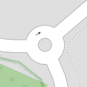
| junction | roundabout | Kiertoliittymä eli/tai liikenneympyrä. Tie pitää piirtää liikenteen kiertosuunnan suuntaisesti, tämä tagi sisältää tiedon oneway=yes. Huomaa että tämä arvo annetaan liikenneympyrän muodostavalle tielle. Tämä tie täytyy merkata myös tagilla highway=*, jossa highway-tagin arvoksi asetataan yleensä sama kuin on ympyrään saapuvista teistä korkeimman luokituksen saaneella tiellä. Tien solmuille ei kiertoliittymän takia tarvita tageja. Pienimmät kiertoliittymät ilman keskikoroketta voi merkata teiden risteyssolmulle annetulla arvolla highway=mini_roundabout, katso siitä ohjeita ylempää. | ||||
| lanes | <number> | Ajokaistojen lukumäärä. | ||||
| lane_markings | yes | no | Specifies if a highway has painted markings to indicate the position of the lanes. | ||||
| lit | yes | no | Tievalaistus. Yksittäiset valaisinpylväät merkitään highway=street_lamp-tagilla. | ||||
| maxspeed | <number> | Specifies the maximum legal speed limit on a road, railway or waterway. | ||||
| motorroad | yes | no | Moottoriliikennetie | ||||
| mountain_pass | yes | The highest point of a mountain pass. | ||||
| mtb:scale | 0-6 | Applies to highway=path and highway=track. A classification scheme for mtb trails (few inclination and downhill). | ||||
| mtb:scale:uphill | 0-5 | A classification scheme for mtb trails for going uphill if there is significant inclination. | ||||
| mtb:scale:imba | 0-4 | The IMBA Trail Difficulty Rating System shall be used for bikeparks. It is adapted to mtb trails with artificial obstacles. | ||||
| mtb:description | Text | Applies to highway=path and highway=track. A key to input variable infos related to mtbiking on a way with human words | ||||
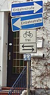
| oneway | yes | no | reversible | Oneway streets are streets where you are only allowed to drive in one direction. | ||||
| oneway:bicycle | yes | no | | Used on ways with oneway=yes where it is legally permitted to cycle in both directions. | ||||
| overtaking | yes | no | caution | both | forward | backward | Tieosuus, jolla ohittaminen on kielletty. | ||||
| parallel | diagonal | perpendicular | marked | no_parking | no_stopping | fire_lane. | Deprecated variant to map parking along streets. See section on street parking above or the street parking page for more details. | |||||
| free | ticket | disc | residents | customers | private | Deprecated variant to map parking conditions along streets. See section on street parking above or the street parking page for more details. | |||||
| passing_places | yes | A way which has frequent passing places (See also: highway=passing_place) | ||||
| priority | forward | backward | Traffic priority for narrow parts of roads, e.g. narrow bridges. | ||||
| priority_road | designated | yes_unposted | end | Specifying roads signposted as priority roads. | ||||
| sac_scale | strolling | hiking | mountain_hiking | demanding_mountain_hiking | alpine_hiking | demanding_alpine_hiking | difficult_alpine_hiking | Applies to highway=path and highway=footway. A classification scheme for hiking trails. | ||||
| service | alley | driveway | parking_aisle etc. | See Key:service for more details. | ||||
| shoulder | no | yes | right | both | left | Presence of shoulder in highway | ||||
| side_road | yes | A side road. | ||||
| smoothness | excellent | good | intermediate | bad | very_bad | horrible | very_horrible | impassable | Specifies the physical usability of a way for wheeled vehicles due to surface regularity/flatness. See Key:smoothness for more details. | ||||
| surface | paved | unpaved | asphalt | concrete | paving_stones | sett | cobblestone | metal | wood | compacted | fine_gravel | gravel | pebblestone | plastic | grass_paver | grass | dirt | earth | mud | sand | ground | See Key:surface for more details. | ||||
| tactile_paving | yes | no | A paving in the ground to be followed with a blindman's stick. | ||||
| tracktype | grade1 | grade2 | grade3 | grade4 | grade5 | To describe the quality of the surface. See Key:tracktype for more information. | ||||
| traffic_calming | bump | hump | table | island | cushion | yes | etc. | Hidasteita (töyssyjä, shikaaneja, korotettuja suojateitä, kavennuksia). Joko koko tielle tai yksittäiset hidasteet. | ||||
| trail_visibility | excellent | good | intermediate | bad | horrible | no | Applies to highway=path, highway=footway, highway=cycleway and highway=bridleway. A classification for hiking trails visibility | ||||
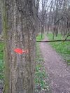
| trailblazed | yes | no | poles | cairns | symbols | Applies to highway=*. Describing trail blazing and marking. See Key:trailblazed for more information. | ||||
| trailblazed:visibility | excellent | good | intermediate | bad | horrible | no | Applies to trailblazed=*. A classification for visibility of trailblazing. See Key:trailblazed:visibility for more information. | ||||
| turn | left | slight_left | through | right | slight_right | merge_to_left | merge_to_right | reverse | The key turn can be used to specify the direction in which a way or a lane will lead. | ||||
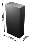
| width | <number> | The width of a feature. | ||||
| winter_road | yes | A highway functions during winter, probably can't be driven in summer. | ||||
Muita teihin liittyviä kohteita | ||||||
| highway | bus_stop | Bussipysäkki. Yleisin käytäntö on lisätä tien viereen irrallinen solmu, jolle tämä arvo. Isommat bussiasemat merkataan amenity=bus_station | ||||
| highway | crossing | A.k.a. crosswalk. Pedestrians can cross a street here; e.g., zebra crossing | ||||
| highway | cyclist_waiting_aid | Street furniture for cyclists that are intended to make waiting at esp. traffic lights more comfortable. | ||||
| highway | elevator | An elevator or lift, used to travel vertically, providing passenger and freight access between pathways at different floor levels. | ||||
| highway | emergency_bay | An area beside a highway where you can safely stop your car in case of breakdown or emergency. | ||||
| highway | emergency_access_point | Ei käytössä Suomessa. | ||||
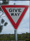
| highway | give_way | Väistämisvelvollisuus risteyksessä -liikennemerkki | ||||
| emergency | phone | Hätäpuhelin | ||||
| highway | ladder | A vertical or inclined set of steps or rungs intended for climbing or descending of a person with the help of hands. | ||||
| highway | milestone | Highway location marker | ||||
| highway | mini_roundabout | Hyvin pieni kiertoliittymä, jonka keskijakajan yli voi tarvittaessa ajaa. Huomaa että tämä arvo asetetaan vain yhdelle eli sille solmulle jossa tiet kohtaavat. Jos piirrät liikenneympyrän ympyrän kiertävänä ympyrän muotoisena tienä, tuo tie merkataan tageilla highway=* ja junction=roundabout ja silloin kiertoliittymän solmuille ei anneta arvoa highway=mini_roundabout - tarkemmin alempana. | ||||
| highway | motorway_junction | Käytetään yhdessä tagin name=* tai ref=* kanssa ja kertoo että annettu name tai ref on liittymän nimi tai numero. Lisää tämä siihen solmuun, josta moottoritieltä erkaneva ramppi alkaa. | ||||
| highway | passing_place | Kohtaamispaikka kapealla tiellä. | ||||
| highway | platform | Linja-autoaseman tai pysäkin laituri | ||||
| highway | rest_area | Place where drivers can leave the road to rest, but not refuel. | ||||
| highway | services | A service station to get food and eat something, often found at motorways | ||||
| highway | speed_camera | Automaattinen nopeudenvalvontakamera | ||||
| highway | speed_display | A dynamic electronic sign that displays the speed of the passer-by motorist. | ||||
| highway | stop | Pakollinen pysähtyminen | ||||
| highway | street_lamp | Katuvalo. Käytetään vain yksittäisten valaisimien merkitsemiseen. Valaistut tieosuudet merkitään lit=*-tagilla. | ||||
| highway | toll_gantry | A toll gantry is a gantry suspended over a way, usually a motorway, as part of a system of electronic toll collection. For a toll booth with any kind of barrier or booth see: barrier=toll_booth | ||||
| highway | traffic_mirror | Mirror that reflects the traffic on one road when direct view is blocked. | ||||
| highway | traffic_signals | Liikennevalot | ||||
| highway | trailhead | Designated place to start on a trail or route | ||||
| highway | turning_circle | Kääntöpaikka. Levennys tiessä tai tien päässä helpottamaan ajoneuvon kääntämistä. Tällaisen kääntöpaikan halkaisija on yleensä 150-200% tien leveydestä. Suuremmat kääntöpaikat voi piirtää itseensä palaavana tienä todellisen ympyrän koon mukaan, mahdollisesti area=yes -tagin kanssa. | ||||
| highway | turning_loop | A widened area of a highway with a non-traversable island for turning around, often circular and at the end of a road. | ||||
| highway | User Defined | All commonly used values according to Taginfo | ||||
