Template:Oc:Map Features:highway
Jump to navigation
Jump to search
Via (highway)
L'etiqueta highway=* es l'etiqueta principala per tota mena de via de comunicacion terrèstra (rota, carriera, dralha e dralhòu...). Es la marca minimala per figurar sus la mapa.
Lei convencions e caracteristicas legalas pòdon variar segon lei país. Per França, cf. FR:France roads tagging.
E avisatz-vos ben que "route" (faus amic), tèrme anglés designa l'itinerari, lo percors, la linha d'un tren ò d'un autobus !
| Clau | Valor | Element | Comentari | Representacion | Fòto | |
|---|---|---|---|---|---|---|
Rotas | ||||||
|
This group lists the 7 main tags for the road network, from most to least functionally important for motor vehicle traffic. | ||||||
| highway | motorway | Autorota Per defaut : lanes=2 (per direccion), maxspeed=130 D'ajustar ref=A xx + oneway=yes + int_ref=E xx s'aquò s'aplica. De veire tanben lo Wikiproject E-road network + name=* (per ex. "Autorota dau Soleu") (option) + maxspeed=* se <> 130 (option) + lanes=* se <> 2 (option) |
||||
| highway | trunk | Via rapida ò exprès A lei caracteristica d'una autorota. En generau, una 2x2 vias amb benda de desseparacion centrala. Per defaut : lanes=2, maxspeed=110 (alevat perif. París: 80km/h) D'ajustar ref=N xx ò ref=D xx + oneway=yes + maxspeed=* se <> 110 (option) + lanes=* se <> 2 (option) |
||||
| highway | primary | Rota principala entre grandei vilas & Carriera principala. En França aquò correspond ai rotas nationalas, ai grandei rotas despartamentalas e mai ais carrieras principalas de vila Per defaut : lanes=2, maxspeed=50 (aglomeracion) ò maxspeed=90 (fòra aglo.) D'ajustar ref=N xx ò ref=D xx + name=* nom s'exista (option) / name:oc=* mencion occitana |
||||
| highway | secondary | Rota segondària & Carriera importanta Rota dau malhum nacionau que se pòt pas considerar majora (primary). En França de despartamentalas ò de carrieras importantas en vilas mai pas pron per meritar "primary" Per defaut : lanes=2, maxspeed=50 (agglomeracion) ò maxspeed=90 (fòra aglo.) D'ajustar ref=N xx ò ref=D xx + name=* nom s'exista (option) / name:oc=* mencion occitana |
||||
| highway | tertiary | Rota & Carriera terça Rota entre de villatges ò de quartiers dintre lei vilas. En França aiçò correspond a de rotas pichonas ò de carrieras que representan un trafec inferior a una "secondary" (entre pargues residenciaus, comerciaus, industriaus, eca. Per defaut : lanes=2, maxspeed=90 ò maxspeed=50 D'ajustar ref=D xx (ò ref=C xx) + name=* mencion/ name:oc=* mencion occitana s'existon |
||||
| highway | unclassified | Via de dessèrta locala sensa trafec de transit e en fòra lei zònas residencialas (per ex. dins un pargue comerciau, industriau, espitau, en campanha, eca.). De pas mesclar amb highway=road utilisé emplegat per lei rotas de categoria inconeguda |
||||
| highway | residential | Rota a l'interior d'una zòna residenciala (carriera, carreiron, androna, alèa...). Per defaut: maxspeed=50 en aglomeracion D'ajustar maxspeed=* se <> 50 ò se fòra-aglomeracion |
||||
Conexions rotieras | ||||||
| highway | motorway_link | Bretèla d'accès (rampas) ò de sortida d'una autorota. Per defaut : lanes=1 D'ajustar oneway=yes + maxspeed=* (option) E de veire highway=motorway_junction çai-sota per lo numèro de la sortida |
||||
| highway | trunk_link | Accès a una via rapida Via d'accès (rampas) a una via rapida ò exprès Per defaut : lanes=1 D'ajustar oneway=yes + maxspeed=* E de veire highway=motorway_junction çai-sota per lo numèro de la sortida |
||||
| highway | primary_link | Accès a una via principala Via d'accès (rampas) a una rota "primary" D'ajustar oneway=yes se sens unic + lanes=* (option) |
||||
| highway | secondary_link | Accès a una via segondària Via d'accès a una rota "secondary" D'ajustar oneway=yes se sens unic + lanes=* (option) |
||||
| highway | tertiary_link | Accès a una via tèrça Via d'accès a una rota "tertiary". E lei ligasons rotiera que menan a una rota tèrça de / vèrs una rota de categoria inferiora. |
||||
Rotas particularas | ||||||
| highway | living_street | Zòna pedoniera (Zòna de rescòntre). Caminament enquitranat ò caladat en zòna d'abitacion. Lei pedons i an la prioritat e ges d'obligacion de caminar sus lo trepador. Per defaut : maxspeed=20 |
||||
| highway | service | Via de servici Accès que mena a un edifici unic, site industriau, plaja, campament, aparcament... D'ajustar service=* per la mena d'usatge service=parking_aisle/driveway/alley (option) + access=* per leis particularitats d'usatge. |
||||
| highway | pedestrian | Carriera pedoniera, reservada principalament ò exclusivament ai pedons en vila, dins un pargue comerçant ò residenciau. L'accès dei veïcul(e)s motorizats i es permés ren que per de temporadas limitadas de la jornada. Per una plaça pedoniera se traça un poligòn barrat e s'ajusta area=yes |
||||
| highway | track | Camin Camin carrossable en generau de tèrra (camin rurau, agricòla, boscatier, d'explecha...) D'ajustar tracktype=1..5 per precisar. |
||||
| highway | bus_guideway | Via d'autobus guidats adaptada ais autobus guidats (per rai, trepadors, sistèma optic ò ràdio). Per lei vias d'autobus simplas, d'emplegar access=no, psv=yes. |
||||
| highway | escape | Via d'urgéncia se tròba de costat dins lei devaladas per que lei caimons e d'autrei veïculs i posquèsson s'arrèstar per cas que lei frens petèsson. | ||||
| highway | raceway | Pista de circuit per la corsa motorizada. | ||||
| highway | road | Via de categoria non coneguda Segon un imatge satellit, lo cadastre... | ||||
| highway | busway | A dedicated roadway for bus rapid transit systems | ||||
Camins, Dralhas & dralhòus (non carrossables) | ||||||
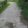
| highway | footway | Dralha Camin reservat ai pedons : passatges pedoniers urbans, percors per lei pargues publics, dralhòus entretenguts e non a l'estat naturau. D'ajustar bicycle=yes se lei bicicletas i son permesas. Avís ! Es d'emplegar highway=pedestrian per leis caminaments dins lei relargs comerciaus. |
||||
| highway | bridleway | Camin equèstre | ||||
| highway | steps | Escaliers | ||||
| highway | corridor | Passatge cubèrt ò corredor dintre d'un edifici. | ||||
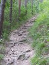
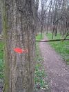
| highway | path | Dralhòu Camin non carrossable, per d'usatges divèrs. S'ajustan lei caracteristicas utilas per l'escorreguda (dificultat, visibilitat), per la MTB (mtb:scale=*, la natura dau sòu (surface=*. | ||||
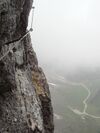
| highway | via_ferrata | A via ferrata is a route equipped with fixed cables, stemples, ladders, and bridges in order to increase ease and security for climbers. These via ferrata require equipment : climbing harness, shock absorber and two short lengths of rope, but do not require a long rope as for climbing. | ||||
When sidewalk/crosswalk is tagged as a separate way | ||||||
| footway | sidewalk | Sidewalk that runs typically along residential road. Use in combination with highway=footway or highway=path | ||||
| footway | crossing | Passatge pedonier D'ajustar crossing=* en opcion |
||||
| footway | traffic_island | The way between two crossings, safespot for pedestrians, has micromapping characteristics as a detailed alternative to =*. Use in combination with highway=footway or highway=path. | ||||
Quand lo trepador ò la cauçada son etiquetats amb la via principala (Veire Trepadors) | ||||||
| sidewalk | both | left | right | no | Specifies that the highways has sidewalks on both sides, on one side or no sidewalk at all | ||||
Quand la pista ciclabla es desenhada coma via separada (Voir Cyclisme) | ||||||
| highway | cycleway | Pista ciclabla D'ajustar foot=yes se lei pedons i son permés. |
||||
Quand la pista ciclabla es desenhada amb la via principala (Voir Cyclisme) | ||||||
| cycleway | lane | Benda ciclabla Via per bicicletas sus la cauçada e desseparada dau trafec per de marcas de pintura ò de muretas. | ||||
| cycleway | Ciclable de sens doble Lei bicicletas i circulan dins lei doas direccions oneway=yes. Ges de marcas per sòu, au còntra de cycleway=opposite_lane. | |||||
| cycleway | Benda ciclabla Lei bicicletas i circulan a còntrasens dau trafec normau. Necessita una rota amb oneway=yes. | |||||
| cycleway | track | Pista ciclabla Camin desseparat de la rota. D'ajustar oneway=yes se fau. | ||||
| cycleway | Rota amb una pista ciclabla a còntrasens. oneway=yes | |||||
| cycleway | share_busway | Via de bus ciclabla Lei ciclistas pòdon passarper la via de bus. | ||||
| cycleway | Deprecated variant for ways with oneway=yes that have a bus lane that cyclists are also permitted to use, and which go in the opposite direction to normal traffic flow (a "contraflow" bus lane). Replaced by oneway:bicycle=no + cycleway:left=share_busway/cycleway:right=share_busway + cycleway:left:oneway=-1/cycleway:right:oneway=-1. | |||||
| cycleway | shared_lane | Via partejada amb lei veïcul(e)s motorizats. (marcas per sòu particularas) | ||||
Busways tagged on the main roadway or lane (see Bus lanes) | ||||||
| lane | Vias de bus deis dos costats de la rota. | |||||
| opposite | Deprecated variant for ways with oneway=yes where buses are legally permitted to travel in both directions. Replaced by oneway:bus=no | |||||
| opposite_lane | Deprecated variant for ways with oneway=yes that have a bus lane which go in the opposite direction to normal traffic flow (a "contraflow" bus lane). Replaced by oneway:bus=no and lanes:bus=* / lanes:psv=*) / bus:lanes=* / psv:lanes=* | |||||
Street parking tagged on the main roadway (see Street parking) | ||||||
| parking:left / :right / :both (hereafter: parking:side) |
lane | street_side | on_kerb | half_on_kerb | shoulder | no | separate | yes | Primary key to record parking along the street. Describes the parking position of parked vehicles in the street. | ||||
| parking:sideorientation=* | parallel | diagonal | perpendicular | To specify the orientation of parked vehicles if there is street parking. | ||||
Temporada (see also lifecycle prefixes) | ||||||
| highway | proposed | Rota en projècte. De combinar amb proposed=* |
||||
| highway | construction | Rota a se bastir De combinar amb construction=* (veire çai)-sota) |
different colours | |||
Attributs | ||||||
| abutters | commercial | industrial | mixed | residential | retail etc. | See Key:abutters for more details. | ||||
| bicycle_road | yes | Une |
||||
| bus_bay | key=Oc:Key:bus_bay | A bus bay outside the main carriageway for boarding/alighting | ||||
| change | yes | no | not_right | not_left | only_right | only_left | Specify the allowed/forbidden lane changes | ||||
| destination | key=Oc:Key:destination | Destination when following a linear feature | ||||
| embankment | yes | dyke | A dyke or a raised bank to carry a road, railway, or canal across a low-lying or wet area. | ||||
| embedded_rails | yes | <type of railway> | A highway on which non-railway traffic is also allowed has railway tracks embedded in it but the rails are mapped as separate ways. | ||||
| ford | yes | Ga La rota passa un riu. | ||||
| frontage_road | yes | A frontage road. | ||||
| ice_road | yes | Route empruntant des cours d'eau, lacs gelés. Cette route n'existe plus à la fonte des glaces. | ||||
| incline | Number % | ° | up | down | Route inclinée, où l'on peut rencontrer des véhicules lents (camions, caravanes, etc) à cause de la pente. | ||||
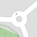
| junction | roundabout | Rotonda, interseccion, forca, quatre-camins, caireforc... (Lo sens de circulacion se definís per lo sens dei segments.) De combinar amb highway=* (e chausir la categoria de highway plus auta entre lei vias que i arrivan). D'ajustar name=* quand la rotonda pòrta un nom particular. De pas metre oneway=yes, ni ref=* ! |
||||
| lanes | nombre | Nombre de vias de circulacion per lo trafec generau, autobus e autrei veïcul(e)s comprés. | ||||
| lane_markings | yes | no | Specifies if a highway has painted markings to indicate the position of the lanes. | ||||
| lit | yes | no | Esclairatge se la via a de lumes | ||||
| maxspeed | <number> | Specifies the maximum legal speed limit on a road, railway or waterway. | ||||
| motorroad | yes | no | Rotas d'accès reglamentat Aquela etiqueta s'emplega per descriure de rotas sotmesas a de restriccions semblablas ais autorotas. | ||||
| mountain_pass | yes | Pas en montanha | ||||
| mtb:scale | 0-6 | Complement de highway=path e highway=track. Esquèma de classificacion per lei dralhas VTT (nivèu de montada e de descenda). | ||||
| mtb:scale:uphill | 0-5 | Precision per lei dralhas VTT que montan fòrt. | ||||
| mtb:scale:imba | 0-4 | Lo IMBA Trail Difficulty Rating System a de s'emplegar per lei pargues que lo VTT i es permés (descenda, campèstre, obstacles, endurança...). Convèn ai pistas de VTT amb d'obstacles artificiaus. | ||||
| mtb:description | Text | Per completar highway=path e highway=track. Una clau per marcar divèrsei informacions ligadas au percors a VTT. | ||||
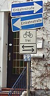
| oneway | yes | no | reversible | Oneway streets are streets where you are only allowed to drive in one direction. | ||||
| oneway:bicycle | yes | no | | Used on ways with oneway=yes where it is legally permitted to cycle in both directions. | ||||
| overtaking | yes | no | caution | both | forward | backward | Despassament Indicacion legala d'autorizacion ò d'interdiccion de despassar dins de seccions de rota. | ||||
| parallel | diagonal | perpendicular | marked | no_parking | no_stopping | fire_lane. | Ample de l'aparcament De veire parking:lane=* per lo menut. | |||||
| free | ticket | disc | residents | customers | private | Aparcament Indica lei condicions d'aparcament. De veire parking:condition=* per lo menut. | |||||
| passing_places | yes | Crosieras Luòc per passar de frònt sus una soleta via. Se plaça sus una linha (way) |
||||
| priority | forward | backward | Indica la prioritat per un passatge estrech. (forward | ||||
| priority_road | designated | yes_unposted | end | Specifying roads signposted as priority roads. | ||||
| sac_scale | strolling | hiking | mountain_hiking | demanding_mountain_hiking | alpine_hiking | demanding_alpine_hiking | difficult_alpine_hiking | Denivelat en complement de highway=path e highway=footway. per leis escorregudas. | ||||
| service | alley | driveway | parking_aisle etc. | Alèa de servici Se tròba de costuma entre lei proprietats per menar ai utilitaires (bordilhiers, eca.) De combinar amb highway=service |
||||
| shoulder | no | yes | right | both | left | Presence of shoulder in highway | ||||
| side_road | yes | A side road. | ||||
| smoothness | excellent | good | intermediate | bad | very_bad | horrible | very_horrible | impassable | Specifies the physical usability of a way for wheeled vehicles due to surface regularity/flatness. See Key:smoothness for more details. | ||||
| surface | paved | unpaved | asphalt | concrete | paving_stones | sett | cobblestone | metal | wood | compacted | fine_gravel | gravel | pebblestone | plastic | grass_paver | grass | dirt | earth | mud | sand | ground | De veire la clau surface=*per lo menut. | ||||
| tactile_paving | yes | no | Podotactil Equipament de senhalisacion e de guida per avugles e mauvesents | ||||
| tracktype | grade1 | grade2 | grade3 | grade4 | grade5 | Per descriure la qualitat de la superficia. Veire tracktype=* e surface=* per mai d'informacion. | ||||
| traffic_calming | bump | hump | table | island | cushion | yes | etc. | Alentidor Dispositiu plaçat sus la rota per alentir lo trafec automobil : Gibas dichas esquina d'ase, ziga-zaga, benda brusenta... | ||||
| trail_visibility | excellent | good | intermediate | bad | horrible | no | Bòla Marca de la traça. En complement de highway=path, highway=footway, highway=cycleway e highway=bridleway. Una classificacion per la bòla deis dralhòus d'escorreguda. | ||||
| trailblazed | yes | no | poles | cairns | symbols | Applies to highway=*. Describing trail blazing and marking. See Key:trailblazed for more information. | ||||
| trailblazed:visibility | excellent | good | intermediate | bad | horrible | no | Applies to trailblazed=*. A classification for visibility of trailblazing. See Key:trailblazed:visibility for more information. | ||||
| turn | left | slight_left | through | right | slight_right | merge_to_left | merge_to_right | reverse | The key turn can be used to specify the direction in which a way or a lane will lead. | ||||
| width | <number> | The width of a feature. | ||||
| winter_road | yes | A highway functions during winter, probably can't be driven in summer. | ||||
Autras | ||||||
| highway | bus_stop | Arrèst d'autobus. (Ponch d'arrèst sus la rota en cors de linha.) De pas mesclar amb amenity=bus_station per lei terminaux d'autobus (estacions rotieras) nimai amb leis equipaments de l'arrèst (sosta, banc...). De consultar public_transport=*. |
||||
| highway | crossing | A.k.a. crosswalk. Pedestrians can cross a street here; e.g., zebra crossing | ||||
| highway | cyclist_waiting_aid | Street furniture for cyclists that are intended to make waiting at esp. traffic lights more comfortable. | ||||
| highway | elevator | Ascensor | ||||
| highway | emergency_bay | An area beside a highway where you can safely stop your car in case of breakdown or emergency. | ||||
| highway | emergency_access_point | Panneau numéroté pouvant être utilisé pour indiquer sa position en cas d'urgence. N'existe pas en France. | ||||
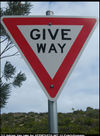
| highway | give_way | Laissatz passar Panèu "Cédez le passage". | ||||
| emergency | phone | Bòrna de comunicacion particulara per sonar lei secors. | ||||
| highway | ladder | A vertical or inclined set of steps or rungs intended for climbing or descending of a person with the help of hands. | ||||
| highway | milestone | Highway location marker | ||||
| highway | mini_roundabout | Rotondeta Giratòri pichonet que lo terraplen central se i pòt passar dessús (encara quand se marca). S'i pòt trovar una elevacion centrala que passa pas lei 15 cm e lo diamètre es au mai de 2m40. De veire junction=roundabout per lei rotondas classicas |
||||
| highway | motorway_junction | Sortida d'autorota D'ajustar ref=numèro de sortida |
||||
| highway | passing_place | Crosiera Relargament de la rota per permetre de se crosar. De plaçar sus un nos (node) |
||||
| highway | platform | A platform at a bus stop or station. | ||||
| highway | rest_area | Airau de repaus ò de sosta òfre uniqcament un espaci de picanica, e de còps, de sanitàris. | ||||
| highway | services | Airau de servicis (sovent sus autorotas), amb l'aparcament, l'estacion-servici, la botiga, lei sanitàris, l'airau de repaus, de còps de restaurants emai de mòstras e d'airaus de leser ò de jòcs. | ||||
| highway | speed_camera | Radar fixe sus lo costat ò subre la rota. De veire tanben la relacion enforcement. |
||||
| highway | speed_display | A dynamic electronic sign that displays the speed of the passer-by motorist. | ||||
| highway | stop | Stòp Senhau de stòp. | ||||
| highway | street_lamp | Lampadari, lumenier. Lume per esclairar la rota. | ||||
| highway | toll_gantry | A toll gantry is a gantry suspended over a way, usually a motorway, as part of a system of electronic toll collection. For a toll booth with any kind of barrier or booth see: barrier=toll_booth | ||||
| highway | traffic_mirror | Mirror that reflects the traffic on one road when direct view is blocked. | ||||
| highway | traffic_signals | Semafòr, fuòc dei tres colors. | ||||
| highway | trailhead | Designated place to start on a trail or route | ||||
| highway | turning_circle | Càncel, canci Relargament au fons d'una androna per poder virar lo pè. | ||||
| highway | turning_loop | A widened area of a highway with a non-traversable island for turning around, often circular and at the end of a road. | ||||
| highway | User Defined | De consultar Taginfo[1] per trovar d'autrei valors. | ||||


