Template:Et:Map Features:highway
(Redirected from Et:Template:Map Features:highway)
Jump to navigation
Jump to search
Teed
Teed ja tänavad. Liigitus lähtub üldiselt nende olulisusest teedevõrgustikus (mitte laiusest, kattematerjalist vms). Lähtekohad olulisuse hindamiseks on teeregister (kaardirakendus) ja kohalike omavalitsuste õigusaktid (nt. Tallinna tänavate liigitus). Seadusekohased definitsioonid vt Teeseadusest
| Silt | Väärtus | Element | Kirjeldus | Renderdus | Foto | |
|---|---|---|---|---|---|---|
|
| ||||||
|
This group lists the 7 main tags for the road network, from most to least functionally important for motor vehicle traffic. | ||||||
| highway | motorway | Kiirtee -- Eestis ei ole. Eraldusribaga tee, enamasti mõlemas suunas vähemalt kaks sõidurada ning kattega teepeenar hädaolukordade tarbeks. Eri riikides kasutusel nt. nimetused freeway, autobahn. | ||||
| highway | trunk | E-tähistusega põhimaantee (Tallinn-Narva (E20), Tallinn-Tartu-Võru-Luhamaa (E263), Jõhvi-Tartu-Valga (E264), Tallinn-Pärnu-Ikla (E67), Tallinn-Paldiski, Tallinna ringtee (E265)). Asulais -- samade trasside osad. | ||||
| highway | primary | Põhimaantee. Tee number enamasti 1-kohaline aga ka mõned erandid (10: Risti - Virtsu - Kuivastu - Kuressaare, 92: Tartu - Viljandi - Kilingi-Nõmme). Trassiosad (asulate piires) sama olulisusega. Tallinnas -- põhitänav (eranditega, nt v.a. Majaka, ...). | ||||
| highway | secondary | Tugimaantee. Tee number enamasti 2-kohaline, kontrollimiseks Teeregister. Tallinnas -- Jaotustänav (ühistranspordiga). | ||||
| highway | tertiary | Kõrvalmaantee. Kui tee pole tegelikkuses niivõrd olulise tähtsusega, võib olulisust vähendada. Tallinnas -- Jaotustänav (ühistranspordita), Kõrvaltänav (ühistranspordiga) ning Veotänav (ühistranspordiga).Eestis mõnel pool kruusateed, siis tähistada lisaks surface=unpaved. | ||||
| highway | unclassified | Olulise tähtsusega kohalikud teed (võib eksisteerida ka teeregistris mitmekohalise numbriga). Igasugused külavaheteed ja kruusateed käivad enamasti siia. Kruusatee puhul lisaks sildistus surface=compacted. Tallinnas -- enamkasutatavamad kõrvaltänavad või veotänavad. NB! Ei tähenda, et tee olulisus pole teada -- selleks on highway=road. | ||||
| highway | residential | Tänav ehk asulasisene tee. Kannab nimetust. Asula on linn/alev/alevik või ka küla, mis on tähistatud selgelt asula algus/lõpp liiklusmärgiga. | ||||
Link roads | ||||||
| highway | motorway_link | Ühendustee teise kiirtee või madalamaliigilise teega. Peale- ja mahasõiduteed (rambid), enamasti ühesuunalised ning kiirteega samade liikluspiirangutega. | ||||
| highway | trunk_link | Peale- ja mahasõiduteed (rambid) | ||||
| highway | primary_link | Põhimaantee peale- ja mahasõiduteed | ||||
| highway | secondary_link | Tugimaantee peale- ja mahasõiduteed. | ||||
| highway | tertiary_link | The link roads (sliproads/ramps) leading to/from a tertiary road from/to a tertiary road or lower class highway. | ||||
Special road types | ||||||
| highway | living_street | Õueala teed (liiklusmärkidega "Õueala" tähistatud alal). | ||||
| highway | service | Erinevad, peamiselt juurdesõiduteed, nt. talude juurde, nimetamata tänavad, sõiduteed tööstusparkides, samuti teenindusjaamades ja parklates. Vaata täpsemalt service=* | ||||
| highway | pedestrian | Jalakäijate tänav (nt. vanalinnas), väljakute puhul (area=yes). | ||||
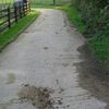
| highway | track | Põllu- ja metsateed, enamasti pinnasteed. Läbitavuse tähistamiseks kasutusel tracktype=*. | ||||
| highway | bus_guideway | Spetsiaalne juht-rada ühistranspordile (võimaldades sõidukitel liikuda neid juhi poolt roolimata). | ||||
| highway | escape | For runaway truck ramps, runaway truck lanes, emergency escape ramps, or truck arrester beds. It enables vehicles with braking failure to safely stop. | ||||
| highway | raceway | Ringrada, võidusõidurada. | ||||
| highway | road | Teadmata olulisusega tee ajutiseks tähistamiseks, kuni tee olulisus on kindlaks tehtud. | ||||
| highway | busway | A dedicated roadway for bus rapid transit systems | ||||
Kergliiklusteed | ||||||
| highway | footway | Jalgtee (kõnnitee). Ka jalgtee, kus võib liigelda jalgrattaga (vastavate liiklusmärkide olemasolul, nt. highway=footway, bicycle=designated, segregated=*). | ||||
| highway | bridleway | ratsutamisrada. Lisasildid vajaduse korral foot=no ja bicycle=no. | ||||
| highway | steps | Trepiastmed, eelkõige jalgteedel. Astmete arvu äratoomiseks step_count=*. | ||||
| highway | corridor | For a hallway inside of a building. | ||||
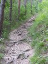
| highway | path | Rada (nt. jalgrada metsas). | ||||
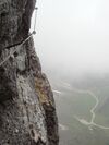
| highway | via_ferrata | A via ferrata is a route equipped with fixed cables, stemples, ladders, and bridges in order to increase ease and security for climbers. These via ferrata require equipment : climbing harness, shock absorber and two short lengths of rope, but do not require a long rope as for climbing. | ||||
When sidewalk/crosswalk is tagged as a separate way | ||||||
| footway | sidewalk | Sidewalk that runs typically along residential road. Use in combination with highway=footway or highway=path | ||||
| footway | crossing | Ülekäigurada | ||||
| footway | traffic_island | The way between two crossings, safespot for pedestrians, has micromapping characteristics as a detailed alternative to =*. Use in combination with highway=footway or highway=path. | ||||
When sidewalk (or pavement) is tagged on the main roadway (see Sidewalks) | ||||||
| sidewalk | both | left | right | no | Specifies that the highways has sidewalks on both sides, on one side or no sidewalk at all | ||||
When cycleway is drawn as its own way (see Bicycle) | ||||||
| highway | cycleway | Jalgrattatee, liiklemiseks ainult jalgratta ja mopeediga. NB! Jalgsi liiklemine keelatud. Kergliiklustee/kergtee tähistamiseks kasuta highway=cycleway, foot=designated. | ||||
Cycleway tagged on the main roadway or lane (see Bicycle) | ||||||
| cycleway | lane | A lane is a route that lies within the roadway | ||||
| cycleway | Deprecated variant for ways with oneway=yes where it is legally permitted to cycle in both directions. Replaced by oneway:bicycle=no. | |||||
| cycleway | Deprecated variant for ways with oneway=yes that have a cycling lane going the opposite direction of normal traffic flow (a "contraflow" lane). Replaced by oneway:bicycle=no + cycleway:left=lane/cycleway:right=lane + cycleway:left:oneway=-1/cycleway:right:oneway=-1. | |||||
| cycleway | track | A track provides a route that is separated from traffic. In the United States, this term is often used to refer to bike lanes that are separated from lanes for cars by pavement buffers, bollards, parking lanes, and curbs. Note that a cycle track may alternatively be drawn as a separate way next to the road which is tagged as highway=cycleway. | ||||
| cycleway | Deprecated variant for ways with oneway=yes that have a cycling track going the opposite direction of normal traffic flow. Replaced by oneway:bicycle=no + cycleway:left=track/cycleway:right=track + cycleway:left:oneway=-1/cycleway:right:oneway=-1. | |||||
| cycleway | share_busway | There is a bus lane that cyclists are permitted to use. | ||||
| cycleway | Deprecated variant for ways with oneway=yes that have a bus lane that cyclists are also permitted to use, and which go in the opposite direction to normal traffic flow (a "contraflow" bus lane). Replaced by oneway:bicycle=no + cycleway:left=share_busway/cycleway:right=share_busway + cycleway:left:oneway=-1/cycleway:right:oneway=-1. | |||||
| cycleway | shared_lane | Cyclists share a lane with motor vehicles, there are markings reminding about this. In some places these markings are known as "sharrows" ('sharing arrows') and this is the tag to use for those. | ||||
Busways tagged on the main roadway or lane (see Bus lanes) | ||||||
| lane | Deprecated variant to tag bus lanes. Replaced by bus/psv lane tagging lanes:bus=* / lanes:psv=*) / bus:lanes=* / psv:lanes=* | |||||
| opposite | Deprecated variant for ways with oneway=yes where buses are legally permitted to travel in both directions. Replaced by oneway:bus=no | |||||
| opposite_lane | Deprecated variant for ways with oneway=yes that have a bus lane which go in the opposite direction to normal traffic flow (a "contraflow" bus lane). Replaced by oneway:bus=no and lanes:bus=* / lanes:psv=*) / bus:lanes=* / psv:lanes=* | |||||
Street parking tagged on the main roadway (see Street parking) | ||||||
| parking:left / :right / :both (hereafter: parking:side) |
lane | street_side | on_kerb | half_on_kerb | shoulder | no | separate | yes | Primary key to record parking along the street. Describes the parking position of parked vehicles in the street. | ||||
| parking:sideorientation=* | parallel | diagonal | perpendicular | To specify the orientation of parked vehicles if there is street parking. | ||||
Lifecycle (see also lifecycle prefixes) | ||||||
| highway | proposed | Kavandatud tee. Teede tähistamiseks, mille rajamine pole veel alanud. Lisa silt proposed=* kavandatava tee klassi tähistamiseks. | ||||
| highway | construction | Rajatav tee. Teede tähistamiseks, mille ehitus on alanud. Lisa silt proposed=* rajatava tee klassi tähistamiseks. | different colours | |||
Atribuudid | ||||||
| abutters | commercial | industrial | mixed | residential | retail etc. | See Key:abutters for more details. | ||||
| bicycle_road | yes | A bicycle road is a road designated for bicycles. If residential streets get the status of bicycle roads, normally, by special signs, motor traffic is admitted with limited speed, often only for residents. | ||||
| bus_bay | both | left | right | A bus bay outside the main carriageway for boarding/alighting | ||||
| change | yes | no | not_right | not_left | only_right | only_left | Specify the allowed/forbidden lane changes | ||||
| destination | <place name of destination> | Destination when following a linear feature | ||||
| embankment | yes | dyke | A dyke or a raised bank to carry a road, railway, or canal across a low-lying or wet area. | ||||
| embedded_rails | yes | <type of railway> | A highway on which non-railway traffic is also allowed has railway tracks embedded in it but the rails are mapped as separate ways. | ||||
| ford | yes | Koolmekoht. | ||||
| ice_road | yes | Jäätee. Tee mis on rajatud külmunud veekogule. Ei eksisteeri soojal ajal. | ||||
| incline | Number % | ° | up | down | Kallak, mis piirab kiirust, vt Incline. | ||||
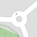
| junction | roundabout | This automatically implies oneway=yes, the oneway direction is defined by the sequential ordering of nodes within the Way. This applies on a way, tagged with highway=* already. | ||||
| lanes | <number> | The number of traffic lanes for general purpose traffic, also for buses and other specific classes of vehicle. | ||||
| lane_markings | yes | no | Specifies if a highway has painted markings to indicate the position of the lanes. | ||||
| lit | yes | no | Street lighting | ||||
| maxspeed | <number> | Specifies the maximum legal speed limit on a road, railway or waterway. | ||||
| motorroad | yes | no | The motorroad tag is used to describe highways that have motorway-like access restrictions but that are not a motorway. | ||||
| mountain_pass | yes | The highest point of a mountain pass. | ||||
| mtb:scale | 0-6 | Applies to highway=path and highway=track. A classification scheme for mtb trails (few inclination and downhill). | ||||
| mtb:scale:uphill | 0-5 | A classification scheme for mtb trails for going uphill if there is significant inclination. | ||||
| mtb:scale:imba | 0-4 | The IMBA Trail Difficulty Rating System shall be used for bikeparks. It is adapted to mtb trails with artificial obstacles. | ||||
| mtb:description | Text | Applies to highway=path and highway=track. A key to input variable infos related to mtbiking on a way with human words | ||||
| oneway | yes | no | reversible | Oneway streets are streets where you are only allowed to drive in one direction. | ||||
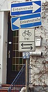
| oneway:bicycle | yes | no | | Used on ways with oneway=yes where it is legally permitted to cycle in both directions. | ||||
| overtaking | yes | no | caution | both | forward | backward | Märkimaks tee osi, kus möödumine on lubatud. | ||||
| parallel | diagonal | perpendicular | marked | no_parking | no_stopping | fire_lane. | Deprecated variant to map parking along streets. See section on street parking above or the street parking page for more details. | |||||
| free | ticket | disc | residents | customers | private | Deprecated variant to map parking conditions along streets. See section on street parking above or the street parking page for more details. | |||||
| passing_places | yes | Tee, millel on sagedased möödumiskohad. | ||||
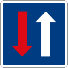
| priority | forward | backward | Traffic priority for narrow parts of roads, e.g. narrow bridges. | ||||
| priority_road | designated | yes_unposted | end | Specifying roads signposted as priority roads. | ||||
| sac_scale | strolling | hiking | mountain_hiking | demanding_mountain_hiking | alpine_hiking | demanding_alpine_hiking | difficult_alpine_hiking | Applies to highway=path and highway=footway. A classification scheme for hiking trails. | ||||
| service | alley | driveway | parking_aisle etc. | See Key:service for more details. | ||||
| shoulder | no | yes | right | both | left | Presence of shoulder in highway | ||||
| smoothness | excellent | good | intermediate | bad | very_bad | horrible | very_horrible | impassable | Specifies the physical usability of a way for wheeled vehicles due to surface regularity/flatness. See Key:smoothness for more details. | ||||
| surface | paved | unpaved | asphalt | concrete | paving_stones | sett | cobblestone | metal | wood | compacted | fine_gravel | gravel | pebblestone | plastic | grass_paver | grass | dirt | earth | mud | sand | ground | See Key:surface for more details. | ||||
| tactile_paving | yes | no | A paving in the ground to be followed with a blindman's stick. | ||||
| tracktype | grade1 | grade2 | grade3 | grade4 | grade5 | To describe the quality of the surface. See Key:tracktype for more information. | ||||
| traffic_calming | bump | hump | table | island | cushion | yes | etc. | Features used to slow down traffic. See Key:traffic calming for more details. | ||||
| trail_visibility | excellent | good | intermediate | bad | horrible | no | Applies to highway=path, highway=footway, highway=cycleway and highway=bridleway. A classification for hiking trails visibility | ||||
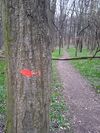
| trailblazed | yes | no | poles | cairns | symbols | Applies to highway=*. Describing trail blazing and marking. See Key:trailblazed for more information. | ||||
| trailblazed:visibility | excellent | good | intermediate | bad | horrible | no | Applies to trailblazed=*. A classification for visibility of trailblazing. See Key:trailblazed:visibility for more information. | ||||
| turn | left | slight_left | through | right | slight_right | merge_to_left | merge_to_right | reverse | The key turn can be used to specify the direction in which a way or a lane will lead. | ||||
| width | <number> | The width of a feature. | ||||
| winter_road | yes | Talvetee. Tee mis toimib talvel. Arvatavasti ei ole läbitav suvisel ajal. Jäätee tähistamiseks kasuta ice_road=yes. | ||||
Muud tunnused | ||||||
| highway | bus_stop | Bussipeatus. Bussijaamade tähistamiseks amenity=bus_station. Täpsemaks kaardistamiseks public_transport=stop_position märkimaks kohta kus sõiduk peatub ja public_transport=platform tähistamaks kohta kus reisjad ootavad. Vaata public_transport=* täpsemateks detailideks. | ||||
| highway | crossing | A.k.a. crosswalk. Pedestrians can cross a street here; e.g., zebra crossing | ||||
| highway | cyclist_waiting_aid | Street furniture for cyclists that are intended to make waiting at esp. traffic lights more comfortable. | ||||
| highway | elevator | An elevator or lift, used to travel vertically, providing passenger and freight access between pathways at different floor levels. | ||||
| highway | emergency_bay | An area beside a highway where you can safely stop your car in case of breakdown or emergency. | ||||
| highway | emergency_access_point | Hädaabi kutsepaigad (nt. kiirteedel). | ||||
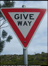
| highway | give_way | Anna teed märk | ||||
| emergency | phone | A calling device can be used to tell on your current position in case of an emergency. Use with ref=NUMBER_ON_THE_SIGN | ||||
| highway | ladder | A vertical or inclined set of steps or rungs intended for climbing or descending of a person with the help of hands. | ||||
| highway | milestone | Highway location marker | ||||
| highway | mini_roundabout | Miniatuurne ringtee, sama mis junction=roundabout kuid ringtee on kas asfaldile joonistatud või on keskmine kõrgendatud koht vajadusel ülesõidetav. | ||||
| highway | motorway_junction | Indicates a junction (UK) or exit (US). ref=* should be set to the exit number or junction identifier. (Some roads – e.g., the A14 – also carry junction numbers, so the tag may be encountered elsewhere despite its name) | ||||
| highway | passing_place | Möödumiskoha asukoht. | ||||
| highway | platform | A platform at a bus stop or station. | ||||
| highway | rest_area | Place where drivers can leave the road to rest, but not refuel. | ||||
| highway | services | Teenindusjaama ala maantee ääres. | ||||
| highway | speed_camera | Kiiruskaamera. | ||||
| highway | speed_display | A dynamic electronic sign that displays the speed of the passer-by motorist. | ||||
| highway | stop | Stopp märk | ||||
| highway | street_lamp | Tänavavalgusti. | ||||
| highway | toll_gantry | A toll gantry is a gantry suspended over a way, usually a motorway, as part of a system of electronic toll collection. For a toll booth with any kind of barrier or booth see: barrier=toll_booth | ||||
| highway | traffic_mirror | Mirror that reflects the traffic on one road when direct view is blocked. | ||||
| highway | traffic_signals | Valgusfoor | ||||
| highway | trailhead | Designated place to start on a trail or route | ||||
| highway | turning_circle | Tagasipöörde koht, enamasti, kuid mitte tingimata, tee lõpus, hõlbustamaks tagasipööramist. | ||||
| highway | turning_loop | A widened area of a highway with a non-traversable island for turning around, often circular and at the end of a road. | ||||
| highway | User Defined | All commonly used values according to Taginfo | ||||
