Ko:Key:highway
| 설명 |
|---|
| 도로 태그는 모든 종류의 도로나 길을 나타낼 때 사용하는 중요 태그입니다. |
| 그룹: 도로 |
| 해당 요소의 사용 |
| 문서화된 값: 19 |
| 함축하는 의미 |
| 유용한 조합 |
| 상태:승인 |
| 이 태그를 위한 도구 |
사용법
- 주요 문서: Highways
highway=* 태그는 모든 종류의 도로나 거리, 경로를 식별하기 위해 사용되는 주요 키 입니다. 키의 값은 도로의 중요성을 표시하는 용도로 사용됩니다. 가장 중요한 도로 (motorway)부터 가장 중요하지 않은 도로(service)를 아래 표에서 확인하시기 바랍니다.
본 태그를 다른 나라의 도로망에서 사용하는 방법은 Highway:International equivalence 문서를 참고하시기 바랍니다.
OSM의 기준을 한국의 실정에 맞게 요약, 정리한 글은 한국의 도로 문서를 보시기 바랍니다.
예시
- 도로를 나타내는 예시를 참고하세요.
종류
일반적으로 사용되는 값을 보려면 아래 표를 참고하시기 바랍니다.
도로
도로는 차도나 보도에서 사용합니다. 사용 방법은 도로 문서를 참고하시기 바랍니다. 교통수단의 종류, 시간, 날짜, 혼잡도와 용도 별 접근 제한에 관해서는 제한 문서를 참고하시기 바랍니다.
한국(남한)의 길 체계를 오픈스트리트맵의 길 체계에 맞게 정리한 글은 한국의 도로 체계를 보시기 바랍니다.
| 키 | 값 | 요소 | 설명 | 렌더링 | 사진 | |
|---|---|---|---|---|---|---|
주요 도로 | ||||||
|
아래는 도로망을 위한 주요 태그들입니다. 주요 도로 순으로 나열되어 있습니다. | ||||||
| highway | motorway | 아무 차량이나 들어갈 수 없고, 중앙 분리대가 있으며, 비상용 갓길이 있는 2차로 이상의 도로입니다. 프리웨이나 아우토반 등이 이에 속합니다. | ||||
| highway | trunk | 국가 교통체계에서 motorways 다음으로 중요한 도로입니다(중앙 분리대가 필수적이지 않은 도로입니다). | ||||
| highway | primary | 국가 교통체계에서 trunk 다음으로 중요한 도로입니다(주로 대형 시내를 연결합니다). | ||||
| highway | secondary | 국가 교통체계에서 primary 다음으로 중요한 도로입니다(주로 시내를 연결합니다). | ||||
| highway | tertiary | 국가 교통체계에서 secondary 다음으로 중요한 도로입니다(주로 작은 마을과 작은 시내를 연결합니다). | ||||
| highway | unclassified | 국가 교통체계에서 가장 중요하지 않은 도로입니다. tertiary 보다는 덜 중요한 도로이지만, 소유지로의 출입과는 다른 목적을 갖고 있는 도로입니다. 일반적으로 마을과 촌락을 연결합니다. ('unclassified'는 영국에서 옛날부터 사용하던 명칭이며, 분류가 알려지지 않았다는 뜻이 아닙니다. (분류를 알 수 없는 도로는 highway=road를 사용하시기 바랍니다.) | ||||
| highway | residential | 마을(주거지) 사이를 연결하는 기능은 없으며 주택 접근 시 사용하는 도로입니다. 보동 주택과 같이 그립니다. | ||||
연결 도로 | ||||||
| highway | motorway_link | motorway끼리 또는 그 이하의 도로를 잇는 연결 도로(램프)입니다. 일반적으로 motorway와 동일한 통행 제한이 적용됩니다. | ||||
| highway | trunk_link | trunk끼리 또는 그 이하의 도로를 잇는 연결 도로입니다. | ||||
| highway | primary_link | primary끼리 또는 그 이하의 도로를 잇는 연결 도로입니다. | ||||
| highway | secondary_link | secondary끼리 또는 그 이하의 도로를 잇는 연결 도로입니다. | ||||
| highway | tertiary_link | tertiary끼리 또는 그 이하의 도로를 잇는 연결 도로입니다. | ||||
비주요 도로 | ||||||
| highway | living_street | 생활 도로(living street) 혹은 주택가 도로. 법적으로 자동차보다 보행자가 우선되고, 속도가 매우 낮게 억제되어 어린이가 도로에서 놀 수 있는 주거 지역의 도로입니다. | ||||
| highway | service | 산업단지, 야영장, 업무 단지, 주차장, 골목길 등의 진입로 또는 안 길. service=*와 함께 사용하여 사용 유형을 표시하고 access=*와 함께 사용하여 누가 어떤 상황에서 사용할 수 있는지 표시할 수 있습니다. | ||||
| highway | pedestrian | 보행자만 이용할 수 있는 도로. 상업 및 일부 주거 지역에서 주로/우선적으로 보행자 전용으로 사용되는 도로로, 하루 중 매우 제한된 시간 동안만 자동차의 접근이 허용될 수 있습니다. 광장이나 플라자를 만들고 싶다면 닫힌 선을 그리고 highway=pedestrian와 area=yes 태그를 같이 붙이십시오. | ||||
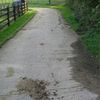
| highway | track | '농업 및 임업용'으로 사용되는 도로. 도로의 품질(포장 정도)을 나타내려면 tracktype=* 태그를 사용하세요. 참고: 보통 농로나 임도는 비포장 도로인 경우가 많지만, 그렇다고 해서 이 태그만으로 도로의 포장 여부를 알 수는 없습니다. 일반적인 용도의 도로를 나타내려면 도로 단락을 참고하세요. | ||||
| highway | bus_guideway | 가이드웨이 버스(철도처럼 노선 버스만 이용할 수 있는 도로를 별도로 깔아서 교통 체증의 영향을 받지 않도록 하는 대중교통 체계)용 도로. 일반적인 버스 전용차로에는 access=no + psv=yes 태그를 대신 붙이세요! | ||||
| highway | escape | 브레이크가 작동하지 않을 때 자동차를 멈출 수 있도록 고안한 비상 탈출 도로. 한국에서는 대관령 등지에 설치되어 있습니다. | ||||
| highway | raceway | (자동차) 레이싱 트랙. | ||||
| highway | road | 유형을 알 수 없는 도로/거리 등. 이 태그는 오솔길부터 고속도로까지의 모든 도로를 아우를 수 있습니다. 이 태그는 도로의 정확한 유형을 알아내기 전까지만 임시로 사용해야 합니다. 도로의 정확한 유형을 알고 있다면 절대 이 태그를 사용하지 말고, 더 구체적인 값을 highway=* 에 집어넣으세요. | ||||
| highway | busway | A dedicated roadway for bus rapid transit systems | ||||
인도 등 | ||||||
| highway | footway | 보행자만 통행할 수 있는 인도로 설계된 도로. 자전거도 통행할 수 있다면 bicycle=yes 태그를 덧붙여 주세요. 도로의 주 목적 및 설계 의도를 알 수 없다면 이 태그를 사용하지 마세요. 상업 지구나 주거 지역의 보행자 도로에는 highway=pedestrian 태그를 붙이고, 경운기 등이 다니는 농로에는 highway=track을 붙이세요. | ||||
| highway | bridleway | 말이 다니는 길. highway=path + horse=designated와 의미가 같습니다. | ||||
| highway | steps | 인도 한가운데에 설치된 계단입니다. 계단의 단 수를 나타내려면 step_count=*를 사용하세요. | ||||
| highway | corridor | For a hallway inside of a building. | ||||
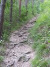
| highway | path | 구체적인 용도가 명시되지 않은 오솔길. 사람이 주로 이용하는 길에는 highway=footway 태그를, 자전거가 다니는 도로에는 highway=cycleway 태그를, 말과 사람이 다니는 길에는 highway=bridleway 태그를, 농로 등으로 사용하는 길에는 highway=track 태그를 붙여 주세요. | ||||
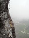
| highway | via_ferrata | A via ferrata is a route equipped with fixed cables, stemples, ladders, and bridges in order to increase ease and security for climbers. These via ferrata require equipment : climbing harness, shock absorber and two short lengths of rope, but do not require a long rope as for climbing. | ||||
When sidewalk/crosswalk is tagged as a separate way | ||||||
| footway | sidewalk | Sidewalk that runs typically along residential road. Use in combination with highway=footway or highway=path | ||||
| footway | crossing | 횡단보도. 사람이 도로를 건널 때 사용하는 부분입니다. | ||||
| footway | traffic_island | The way between two crossings, safespot for pedestrians, has micromapping characteristics as a detailed alternative to =*. Use in combination with highway=footway or highway=path. | ||||
차도 옆에 붙어 있는 인도(인도 문서 참조). | ||||||
| sidewalk | both | left | right | no | Specifies that the highways has sidewalks on both sides, on one side or no sidewalk at all | ||||
자전거 도로를 별개의 선으로 나타내기(자전거 문서 참조). | ||||||
| highway | cycleway | 자전거 전용도로를 나타냅니다. 기본 접근 제한이 적용되지 않는 경우에만 foot=* 태그를 덧붙이세요. | ||||
자전거 도로를 차도와 함께 나타내기(자전거 문서 참조) | ||||||
| cycleway | lane | 자전거 도로가 차도의 일부분(차로)을 차지한다는 사실을 나타냅니다. | ||||
| cycleway | Deprecated variant for ways with oneway=yes where it is legally permitted to cycle in both directions. Replaced by oneway:bicycle=no. | |||||
| cycleway | oneway=yes(일방통행로) 태그가 붙은 선에 사용하며, 차도의 방향과 자전거 도로의 방향이 서로 반대 방향인 경우에 사용합니다. oneway:bicycle=no 태그와 함께 사용하세요. | |||||
| cycleway | track | 차도와 자전거 도로가 같은 노면을 공유하되, 서로 다른 포장재를 깔거나 봉(볼라드), 도로변 주차장, 연석 등으로 차도와 분리한 자전거 도로를 나타낼 때 사용합니다. 참고: 이 태그를 사용하는 대신 차도 옆에 별개의 선을 그린 후 highway=cycleway 태그를 붙일 수도 있습니다. | ||||
| cycleway | oneway=yes(일방통행로) 태그가 붙은 선에 사용하며, 차도의 방향과 자전거 도로의 방향이 서로 반대 방향인 경우에 사용합니다. oneway:bicycle=no 태그와 함께 사용하세요. | |||||
| cycleway | share_busway | 버스 전용차로로 자전거가 통행할 수 있을 때 사용하는 태그입니다. | ||||
| cycleway | 버스 전용차로로 자전거가 통행할 수 있는 일방통행로(oneway=yes)에 사용하며, 버스 전용차로의 방향과 자전거 도로의 방향이 서로 반대 방향인 경우에 사용합니다. oneway:bicycle=no 태그와 함께 사용하세요. | |||||
| cycleway | shared_lane | 자동차와 자전거가 같은 차로를 이용하라고 명시적으로 나와 있는 경우에 사용하는 태그입니다. | ||||
Busways tagged on the main roadway or lane (see Bus lanes) | ||||||
| lane | 도로 양쪽에 버스 전용차로가 있다는 사실을 나타냅니다. | |||||
| opposite | Deprecated variant for ways with oneway=yes where buses are legally permitted to travel in both directions. Replaced by oneway:bus=no | |||||
| opposite_lane | Deprecated variant for ways with oneway=yes that have a bus lane which go in the opposite direction to normal traffic flow (a "contraflow" bus lane). Replaced by oneway:bus=no and lanes:bus=* / lanes:psv=*) / bus:lanes=* / psv:lanes=* | |||||
Street parking tagged on the main roadway (see Street parking) | ||||||
| parking:left / :right / :both (hereafter: parking:side) |
lane | street_side | on_kerb | half_on_kerb | shoulder | no | separate | yes | Primary key to record parking along the street. Describes the parking position of parked vehicles in the street. | ||||
| parking:sideorientation=* | parallel | diagonal | perpendicular | To specify the orientation of parked vehicles if there is street parking. | ||||
수명 주기 (see also lifecycle prefixes) | ||||||
| highway | proposed | 계획 단계의 도로입니다. 도로의 종류(고속도로, 주거 도로, ...)는 proposed=* 태그로 나타낼 수 있습니다. | ||||
| highway | construction | 공사 중인 도로입니다. 도로의 종류(고속도로, 주거 도로, ...)는 construction=* 태그로 나타낼 수 있습니다. | different colours | |||
속성 | ||||||
| abutters | commercial | industrial | mixed | residential | retail etc. | 자세한 내용은 Ko:Key:abutters를 참조하세요. | ||||
| bicycle_road | yes | 자전거 전용도로. 주거 도로가 자전거 전용도로로 지정되어 있다면 거주자에 한해 자동차도 저속으로 통행할 수 있는 경우가 일반적입니다. | ||||
| bus_bay | both | left | right | A bus bay outside the main carriageway for boarding/alighting | ||||
| change | yes | no | not_right | not_left | only_right | only_left | Specify the allowed/forbidden lane changes | ||||
| destination | <place name of destination> | Destination when following a linear feature | ||||
| embankment | yes | dyke | A dyke or a raised bank to carry a road, railway, or canal across a low-lying or wet area. | ||||
| embedded_rails | yes | <type of railway> | A highway on which non-railway traffic is also allowed has railway tracks embedded in it but the rails are mapped as separate ways. | ||||
| ford | yes | 강이나 하천을 가로지르는 도로에 사용합니다. | ||||
| frontage_road | yes | A frontage road. | ||||
| ice_road | yes | 얼어붙은 저수지 위로 놓은 도로를 나타냅니다. 여름에는 존재할 수 없는 도로입니다. | ||||
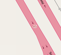
| incline | Number % | ° | up | down | 도로의 경사를 퍼센트("5%")나 각도("20°")로 나타냅니다. 양수 값은 선 방향으로 도로가 오르막길이라는 것을 의미하고, 음수 값은 내리막길이라는 것을 의미합니다. | ||||
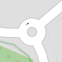
| junction | roundabout | oneway=yes(일방통행)의 의미를 함축하며, 통행 방향은 선 방향으로 결정됩니다. highway=*가 붙은 선에 사용하세요. | ||||
| lanes | <number> | 버스, 승용차, 자전거를 비롯한 모든 차량이 통행할 수 있는 차로의 수를 나타냅니다. | ||||
| lane_markings | yes | no | Specifies if a highway has painted markings to indicate the position of the lanes. | ||||
| lit | yes | no | 도로에 조명(가로등 등)이 있는지를 나타냅니다. | ||||
| maxspeed | <number> | Specifies the maximum legal speed limit on a road, railway or waterway. | ||||
| motorroad | yes | no | 고속도로는 아니지만 고속도로와 유사한 통행 규제가 적용되는 도로(=자동차 전용도로)를 나타냅니다. | ||||
| mountain_pass | yes | 언덕의 가장 높은 지점을 나타냅니다. | ||||
| mtb:scale | 0-6 | Applies to highway=path and highway=track. A classification scheme for mtb trails (few inclination and downhill). | ||||
| mtb:scale:uphill | 0-5 | MTB 노선의 분류 기준 중 오르막길 경사도를 나타낼 때 사용하는 태그입니다. | ||||
| mtb:scale:imba | 0-4 | IMBA 노선 난이도 평가 체계를 나타낼 때 사용하는 태그입니다. 인공 장애물이 있는 MTB 노선에 사용합니다. | ||||
| mtb:description | Text | MTB 노선의 정보를 사람이 알아볼 수 있는 형태로 나타낼 때 사용하는 태그입니다. highway=path(오솔길)과 highway=track(농로/임도)에 사용합니다. | ||||
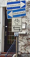
| oneway | yes | no | reversible | Oneway streets are streets where you are only allowed to drive in one direction. | ||||
| oneway:bicycle | yes | no | | Used on ways with oneway=yes where it is legally permitted to cycle in both directions. | ||||
| overtaking | yes | no | caution | both | forward | backward | 과적이 법적으로 허용/금지되는 부분을 나타내는 태그입니다. 방향별로 적용되는 규제가 다르다면 overtaking:forward=yes/no/caution(선 방향)과 overtaking:backward=yes/no/caution(선 반대 방향) 태그를 사용할 수 있습니다. | ||||
| parallel | diagonal | perpendicular | marked | no_parking | no_stopping | fire_lane. | 주차 공간을 나타내는 태그입니다. 자세한 정보는 parking:lane=* 문서를 참고하세요. | |||||
| free | ticket | disc | residents | customers | private | 주차 가능 조건(시간대)를 나타내는 태그입니다. 자세한 정보는 parking:condition=* 문서를 참고하세요. | |||||
| passing_places | yes | 좁은 길에서 두 차량이 교행할 수 있는 공간을 나타내는 태그입니다. | ||||
| priority | forward | backward | Traffic priority for narrow parts of roads, e.g. narrow bridges. | ||||
| priority_road | designated | yes_unposted | end | Specifying roads signposted as priority roads. | ||||
| sac_scale | strolling | hiking | mountain_hiking | demanding_mountain_hiking | alpine_hiking | demanding_alpine_hiking | difficult_alpine_hiking | 하이킹 노선의 분류 체계를 나타낼 때 사용하는 태그입니다. highway=path(오솔길)과 highway=footway(보도)에 사용합니다. | ||||
| service | alley | driveway | parking_aisle etc. | 자세한 정보는 Ko:Key:service 문서를 참조하세요. | ||||
| shoulder | no | yes | right | both | left | Presence of shoulder in highway | ||||
| side_road | yes | A side road. | ||||
| smoothness | excellent | good | intermediate | bad | very_bad | horrible | very_horrible | impassable | Specifies the physical usability of a way for wheeled vehicles due to surface regularity/flatness. See Key:smoothness for more details. | ||||
| surface | paved | unpaved | asphalt | concrete | paving_stones | sett | cobblestone | metal | wood | compacted | fine_gravel | gravel | pebblestone | plastic | grass_paver | grass | dirt | earth | mud | sand | ground | 자세한 정보는 Ko:Key:surface 문서를 참조하세요. | ||||
| tactile_paving | yes | no | 도로에 시각 장애인을 위한 촉각 포장이 있는지를 나타냅니다. | ||||
| tracktype | grade1 | grade2 | grade3 | grade4 | grade5 | 노면의 질을 나타내는 태그입니다. 자세한 정보는 Ko:Key:tracktype 문서를 참고하세요. | ||||
| traffic_calming | bump | hump | table | island | cushion | yes | etc. | 교통을 억제하기 위한 목적으로 설치되는 지물. 자세한 내용은 Ko:Key:traffic calming 문서를 참조하세요. | ||||
| trail_visibility | excellent | good | intermediate | bad | horrible | no | 하이킹 노선의 가시성을 나타내기 위한 태그입니다. highway=path(오솔길), highway=footway(보도), highway=cycleway(자전거 도로), highway=bridleway(승마로)에 사용합니다. | ||||
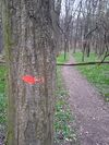
| trailblazed | yes | no | poles | cairns | symbols | Applies to highway=*. Describing trail blazing and marking. See Key:trailblazed for more information. | ||||
| trailblazed:visibility | excellent | good | intermediate | bad | horrible | no | Applies to trailblazed=*. A classification for visibility of trailblazing. See Key:trailblazed:visibility for more information. | ||||
| turn | left | slight_left | through | right | slight_right | merge_to_left | merge_to_right | reverse | The key turn can be used to specify the direction in which a way or a lane will lead. | ||||
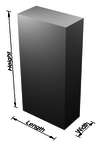
| width | <number> | The width of a feature. | ||||
| winter_road | yes | 겨울에만 이용할 수 있고 여름에는 이용하지 못하는 도로를 나타냅니다. | ||||
기타 도로 지물 | ||||||
| highway | bus_stop | A small bus stop. Optionally one may also use public_transport=stop_position for the position where the vehicle stops and public_transport=platform for the place where passengers wait. | ||||
| highway | crossing | A.k.a. crosswalk. Pedestrians can cross a street here; e.g., zebra crossing | ||||
| highway | cyclist_waiting_aid | Street furniture for cyclists that are intended to make waiting at esp. traffic lights more comfortable. | ||||
| highway | elevator | 엘리베이터. | ||||
| highway | emergency_bay | An area beside a highway where you can safely stop your car in case of breakdown or emergency. | ||||
| highway | emergency_access_point | 등산로나 기타 오지에 설치된, 고유한 일련번호가 적인 표지판. 길을 잃었거나 문제가 생겼을 때 표지판의 일련번호를 불러 주면 응급 요원들이 현재 위치를 찾을 수 있습니다. ref='일련번호' 태그와 함께 사용하세요. | ||||
| highway | give_way | A "give way," or "Yield" sign | ||||
| emergency | phone | 비상시에 사용할 수 있는 전화기. ref='일련번호' 태그와 함께 사용하세요. | ||||
| highway | ladder | A vertical or inclined set of steps or rungs intended for climbing or descending of a person with the help of hands. | ||||
| highway | milestone | Highway location marker | ||||
| highway | mini_roundabout | 회전교차로와 비슷하지만, 교차로 가운데에 페인트로 그려진 원이 있거나 가로지를 수 있는(순회 가능) 공간이 있습니다. 교차로 가운데에 화단 등으로 이루어진 섬이 있다면, 이 태그 대신 junction=roundabout 태그를 사용하세요. 기본값은 반시계 방향(direction=anticlockwise)입니다. 시계 방향을 나타내고 싶으시다면 direction=clockwise 태그를 추가하세요. | ||||
| highway | motorway_junction | 고속도로의 나들목이나 분기점을 나타냅니다. 나들목의 고유 번호(ref=*)를 반드시 명시해야 합니다. | ||||
| highway | passing_place | 좁은 길에서 두 차량이 교행할 수 있는 공간을 나타내는 태그입니다. | ||||
| highway | platform | A platform at a bus stop or station. | ||||
| highway | rest_area | 운전자가 잠시 쉬었다 갈 수 있는 장소(졸음쉼터, 간이 휴게소 등)입니다. 주유는 불가능합니다. | ||||
| highway | services | 음식 등을 취급하는 휴게소입니다. 주로 고속도로에 있습니다. | ||||
| highway | speed_camera | 고정된 과속 단속 카메라입니다. | ||||
| highway | speed_display | A dynamic electronic sign that displays the speed of the passer-by motorist. | ||||
| highway | stop | 정지 표지판. | ||||
| highway | street_lamp | 도로변에 설치된 가로등. 특정 시간대에 켜집니다. | ||||
| highway | toll_gantry | A toll gantry is a gantry suspended over a way, usually a motorway, as part of a system of electronic toll collection. For a toll booth with any kind of barrier or booth see: barrier=toll_booth | ||||
| highway | traffic_mirror | Mirror that reflects the traffic on one road when direct view is blocked. | ||||
| highway | traffic_signals | 신호등. | ||||
| highway | trailhead | Designated place to start on a trail or route | ||||
| highway | turning_circle | 도로가 끝나는 지점의 둥근 부분. 영어(또는 프랑스어)에서는 cul de sac이라고도 합니다. | ||||
| highway | turning_loop | A widened area of a highway with a non-traversable island for turning around, often circular and at the end of a road. | ||||
| highway | 사용자 지정 | 자주 사용되는 값을 Taginfo에서 볼 수 있습니다. | ||||
전제
오직 highway=motorway/motorway_link만이 품질의 의미를 내포합니다. 다른 도로 종류나 highway=trunk부터 highway=tertiary 및 highway=residential=residential/service까지 혹은 highway=path/footway/cycleway/track에는 도로 품질의 의미를 포함하지 마세요.
주요 도로망을 형성하는 기반시설 도로가 열악한 공간, 지역 내 가장 중요한 도로는 고품질의 넓은 아스팔트 도로 혹은 다른 지역의 highway=service보다 나쁜 저품질의 좁은 지대인지 아닌지와는 관계 없이 highway=trunk로 나타내도록 합니다. 아프리카의 일부 지방도는 비포장입니다.
도로의 품질을 묘사하는 surface나 tracktype, 다른 꼬리표가 없는 도로는 고속도로 꼬리표의 값에서 이 정보의 추정을 시도해야할 수도 있습니다. 이는 모든 지역에 대해 조율이 필요하다는 것을 참고하세요. 대표적인 highway=primary가 전 세계에 걸친 다양한 장소 내에서는 대폭 다를지도 모릅니다.
도로의 품질을 묘사하는 surface와 같은 꼬리표는 적극적인 추천으로 추가하여 사용합니다. 특정 한 지역 내의 모든 highway=tertiary가 포장이고 highway=track이 비포장이라는 것은 명백할지도 모르나, 전 세계 모두가 동일할 것이라 전제하지는 마세요.

