My:Map Features
ပကတိမြေပြင် အခြေအနေမှာရှိနေတဲ့ လမ်း ၊အဆောက်အဦး စတဲ့ ပုံသဏ္ဍာန်တစ်ခုခု ကို OpenStreetMap ပေါ်မှာ ရေးဆွဲတဲ့အခါ အခြေခံအချက်အလက်တွေ ဖြစ်တဲ့ node ၊ ways နဲ့ relation တွေကို ဖလှယ်ပြီး ရေးဆွဲကြရသလို ဒီ node တွေ way တွေက ဘယ်အဆောက်အဦး ဘယ်လမ်းတွေ ဖြစ်ပါတယ် ဆိုတဲ့အချက်ကို နောက်ဆက်တွဲ အညွှန်းတွေနဲ့ ဖော်ပြကြပါတယ်။ ဒီလို အညွှန်းတွေ ထည့်သွင်းရာမှာလည်း ပုံသဏ္ဍာန်တစ်ခုချင်းစီရဲ့ အညွှန်းကို တစ်ခုထက်မက ပိုမိုပြီး အကန့်အသတ်မရှိ ထည့်သွင်းလို့ရပါတယ်(ဥပမာ - လမ်းတစ်လမ်းကို ရေးဆွဲပြီးတဲ့အခါမှာ လမ်းအမည် ၊အကျယ် ၊ အမျိုးအစား ၊ ခံနိုင်ဝန် ၊ စတင်ဖောက်လုပ်သည့် ခုနှစ် စတဲ့နောက်ဆက်တွဲ အညွှန်းတွေကို သိသလောက် အကန့်အသတ်မရှိ ထည့်သွင်းလို့ရပါတယ်) ။
ဒီလိုအညွှန်းတွေ ကို ထည့်သွင်းရာမှာလည်း OpenStreetMap ကို အသုံးပြုသူ အသိုင်းအဝိုင်းမှာ လက်ခံနားလည်ကြပြီး လိုက်နာကျင့်သုံးနေတဲ့ ယေဘူယျ အညွှန်းတွေ ရှိပြီးသားဖြစ်ပါတယ် ။ ဒါတွေကလည်း အဖွဲ့အစည်းတစ်ခုက တရားဝင် သတ်မှတ်ပေးထားတာမဟုတ်ဘဲ အထက်က ပြောခဲ့သလို အသုံးပြုသူတွေ အချင်းချင်း နားလည်မှု နဲ့ လိုက်နာနေတဲ့ စံသတ်မှတ်ချက်တွေဖြစ်ပါတယ်။ OpenStreetMap ကို အသုံးပြုသူမည်သူမဆို မိမိရေးဆွဲတာတွေ နဲ့ကိုက်ညီပြီး ပိုမိုကောင်းမွန်တဲ့ အညွှန်းတွေကို ဖန်တီးလို့ရပါတယ်။ ဒီလိုဖန်းတီးတဲ့အခါမှာ ဖန်တီးခဲ့တဲ့ အညွှန်းအသစ် နဲ့ ဆက်စပ်သက်ဆိုင်တဲ့ ခေါင်းစဉ်တစ်ခုအောက်မှာ အညွှန်း အသုံးပြုပုံ ရှင်းလင်းချက်ကို သွားရောက်ထည့်သွင်းပေးစေချင်ပါတယ်။ ဒါမှလည်း နောက်ထပ်အသုံးပြုသူများအနေနဲ့ အညွှန်းအသစ်တစ်ခု ဖန်တီးစရာမလိုအပ်တော့ပဲ မိမိဖန်တီးထားတဲ့ အညွှန်းကို ပြန်လည် အသုံးချနိုင်မှာဖြစ်ပါတယ်။
အများအားဖြင့် ပုံသဏ္ဍာန်တွေ ကို နောက်ဆက်တွဲ အညွှန်းတစ်ခု နှစ်ခုလောက် နဲ့တင်ဘယ်လိုအရာမျိုးဆိုတာ သဲသဲကွဲကွဲ ဖော်ပြလို့ရပါတယ်။ (ဥပမာ- လမ်းတစ်ကြောင်း ကို ရေးဆွဲလိုက်ပြီး နောက်မှာ အညွှန်းအနေနဲ့ highway=footway , name=*) ဆိုရင် နားလည်သဘောပေါက်နိုင်ပေမယ့် OpenStreetMap ဟာ ကမ္ဘာတစ်ဝှမ်းလုံးလွှမ်းခြုံတဲ့ ၊ အချက်အလက်တွေ အားလုံးပါဝင်နေတဲ့ မြေပုံစနစ်တစ်ခုဖြစ်တာကြောင့် မတူကွဲပြားတဲ့ ပုံသဏ္ဍာန်မျိုးစုံကိုလည်း မြင်တွေ့ရနိုင်ပါတယ်။ ဒီလို အခြေအနေမှာ ပုံသဏ္ဍာန်တစ်ခုကို နောက်ဆက်တွဲ အညွှန်းများစွား နဲ့ ဖော်ပြရတဲ့ အခြေအနေတွေလည်းရှိနေတတ်ပါတယ်။
ရှိပြီးသားအညွှန်းတွေကို ပိုမိုကောင်းမွန်အောင် ပြုပြင်ချင်တယ် ၊ ပိုမိုပြီး အညွှန်းတွေကို အသေးစိတ်သိရှိချင်တယ်ဆိုရင် Proposed features , Inactive Features နဲ့ Deprecated features တွေမှာ သွားရောက်ကြည့်ရှုနိုင်ပါတယ်။ အကယ်၍ မိမိရေးဆွဲခဲ့တဲ့ ပုံသဏ္ဍာန်ကို ညွှန်းဆိုရမယ့် အညွှန်းအမျိုးအစား က ဒီအောက်ကစာရင်းထဲမှာ မရှိသေးဘူးဆိုရင် သင့်လျော်တဲ့ အညွှန်းမျိုးကို လွတ်လပ်စွာ ဖန်တီးပြုလုပ်လို့ရပါတယ်။မိမိ ဖန်တီးခဲ့တဲ့ အညွှန်းမှန်မမှန်ကို သုံးစွဲသူအချင်းချင်းက နောက်ပိုင်း ပြန်လည်သတ်မှတ်ပေးပါလိမ့်မယ်။ အများရဲ့ ဆန္ဒသတ်မှတ်ချက်အရ ပြောင်းလဲထားတဲ့ အညွှန်းအမျိုးအစားတွေကိုလည်း ရှာတွေနိုင်ပါတယ်။
Primary features
ကောင်းကင်ကြိုးနှင့်ဆိုင်သော
ကောင်းကင်ကြိုးအသုံးပြုပြီး လူများ သို့မဟုတ် ကုန်ပစ္စည်းများကို သယ်ယူပို့ဆောင်တဲ့စနစ် အမျိုးမျိုးကို ညွှန်းဆိုရာမှာ အသုံးပြုတဲ့ အညွှန်းများဖြစ်ပါတယ်။ ဥပမာ - cable-cars, chair-lift and drag-lifts
| Key | Value | Elemen | Comment | Rendering | Photo |
|---|---|---|---|---|---|
| aerialway | cable_car | လူစီးအခန်းအကြီးတစ်ခုသို့မဟုတ်နှစ်ခု။ ဆွဲကြိုး ကေဘယ်ကြိုး သည် အစနှင့်အဆုံးဆက်ပြီးကွင်းဖြစ်နေသည် သို့သော် လူစီးအခန်းများကတော့ ဝိုင်းပတ်ပြီးမသွားကြပါ။ သူတို့က ကိုယ့်ဘက်ခြမ်းမှာသာ တက်လိုက်ဆင်းလိုက်လုပ်နေပြီး သူတို့ကိုတွဲလောင်းချိတ်ထားသည့် လျောက်လမ်းကေဘယ်ကြိုးများပေါ်မှာရွေ့လျားနေကြသည်။ | 
|
||
| aerialway | chair_lift | တစ်ယောက်ထိုင် ထိုင်ခုံ များချိတ်ဆွဲထားပြီး အစနှင့်အဆုံးဆက်ထားသည့် ကေဘယ်ကြိုးစနစ်။ ပြင်ပလေနှင့်ထိတွေ့စေသည် (စက်လုံးပုံမှန်ခန်းအဖြစ်လည်းရှိသည်) အကယ်၍ chair_lift ဟာ တစ်လမ်းသွားဆိုရင် oneway=yes. နှစ်လမ်းသွား ဖြစ်ခဲ့မယ်ဆိုရင် oneway=no. | 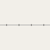
|

| |
| aerialway | drag_lift | နှင်းလျှောစီးသူများ တောင်ကုန်းအမြင့်ပေါ်သို့ ပြန်လည် သယ်ယူပို့ဆောင်ပေးသော ကောင်းကင်ကြိုး | same as chair_lift | ||
| aerialway | gondola | တစ်ပတ်လည်ဆက်ထားသော ကေဘယ်ကြိုးတွင်ချိတ်ဆွဲထားသောလူစီးအခန်းများ | 
|
||
| aerialway | goods | ကုန်ပစ္စည်းများကို သယ်ယူပို့ဆောင်သည့် အရာဖြစ်ပါသည်။ အများအားဖြင့် ခရီးသွားအသုံးမပြုကြပါ။ | 
|
||
| aerialway | mixed_lift | mixed lift,ကေဘယ်ကြိုးတွင် ချိတ်ဆွဲထားသော လူစီးအခန်းများတွင် ထိုင်ခုံများတပ်ဆင်ထားသည့် အရာဖြစ်သည်။. | 
|
||
| aerialway | pylon | ကောင်းကင် ကေဘယ်ကြိုး များသွယ်တန်းရန် ထောက်ပို့ပေးသော ထောက်တိုင် ဖြစ်သည်။ | |||
| aerialway | station | ကောင်းကင် ကေဘယ်ကား များကို အသုံးပြုမည့် ခရီးသွားများ အဝင်/အထွက် ပြုလုပ်မည့်နေရာ | |||
| aerialway | User Defined | All commonly used values according to Taginfo |
အထက်ပါ ဇယားကွက်သည် မြန်မာဘာသာဖြင့် ပြုလုပ်ထားသော Template တစ်ခုဖြစ်ပါသည်။ ပြုပြင်စရာရှိလှျင် ဒီနေရာမှာ သွားပြီးပြင်လို့ရပါတယ်.
Aeroway
{{{ }}}
| Key | Value | Elemen | Deskripsi | Rendering | Foto |
|---|---|---|---|---|---|
| aeroway | aerodrome | Airport (US), bandar udara (Indonesia),စမ်းသပ်ခြင်း | |||
| aeroway | apron | Tempat Parkir Pesawat. | 
|
||
| aeroway | gate | Menandai nomor gerbang di bandara udara. | |||
| aeroway | helipad | Tempat helikopter dan helipad | |||
| aeroway | runway | tempat pesawat untuk melakukan take off (terbang) dan landing(mendarat) (Other languages) | 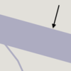
|
||
| aeroway | taxiway | Tempat diantara bandar udara dan tempat parkir. | 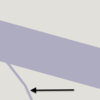
|

| |
| aeroway | terminal | ခရီးသည်များအတွက်နေရာ | |||
| aeroway | windsock | Untuk mengetahui arah hembusan angin. | 
| ||
| aeroway | user defined | Semua "value" yang umum digunakan sesuai dengan Taginfo |
Tabel ini adalah sebuah template wiki, dengan deskripsi dalam Bahasa Indonesia. Edit di sini.
Amenitas
Dipergunakan untuk memetakan fasilitas untuk pengunjung dan penguni, seperti toilet, telephone, bank, dan farmasi (untuk membeli obat-obatan), sekolah. Lihat Amenities untuk penjelasan.
| Key | Value | Elemen | Deskripsi | Rendering | Foto | |
|---|---|---|---|---|---|---|
အစားအစာနှင့် အဖျော်၊ယမကာ | ||||||
| amenity | bar | Bar is a purpose-built commercial establishment that sells alcoholic drinks to be consumed on the premises. They are characterised by a noisy and vibrant atmosphere, similar to a party and usually don't sell food. See also the description of the tags amenity=pub;bar;restaurant for a distinction between these. | ||||
| amenity | biergarten | အခန်းအတွင်းမဟုတ်ဘဲ ၊ အပြင်ဘက် မြက်ခင်ပြင် စသည့်နေရာများတွင် ခင်းကျင်းထားခြင်းဖြစ်ပြီး ဘီယာ၊အရက်၊အချိုရည်များ အပြင် အခြားအစားအစာများ ရရှိနိုင်သည့်နေရာ၊ အများအားဖြင့် အရက်၊ဘီယာဆိုင်များတွင် တွဲ၍ ပါဝင်သည်။ အရက်၊ဘီယာ ဆိုင်များကို amenity=pub;bar;restaurantတို့ဖြင့်ညွှန်းဆိုပြီး အပြင်ဘက် နေရာ ရှိ/မရှိ ပေါ်မူတည်ပြီး biergarten=yes နှင့် biergarten=no ဟုသတ်မှတ်ကြသည် | ||||
| amenity | cafe | Sebuah kafe. Jenis makanan yang di hidangkan dapat menggunakan tag cuisine=* dandiet:*=*. | ||||
| amenity | fast_food | Restoran cepat saji (see also amenity=restaurant). Jenis makanan yang disajikan dapat menggunakan tag cuisine=* dan diet:*=*. | ||||
| amenity | food_court | Sebuah tempat dimana dihidangkan beberapa jenis gerai restoran dan menggunakan area tempat makan bersama-sama. Biasanya terdapat di mal, bandar udara, dll. | ||||
| amenity | ice_cream | Toko es krim. Sebuah tempat yang menjual es krim dan yoghurt beku. | ||||
| amenity | pub | Sebuah tempat dimana menjual beer dan minuman beralkohol lainnya, bisa juga menyediakan makanan dan tempat menginap (di Inggris). Lihat deskripsi dari amenity=bar dan amenity=pub untuk membedakan antara bar dengan pub. | ||||
| amenity | restaurant | Restoran (bukan menyediakan makanan cepat saji, lihatamenity=fast_food). Jenis hidangan yang disajikan dapat menggunakan tag cuisine=* dan diet:*=*. | ||||
ပညာရေး | ||||||
| amenity | college | Campus or buildings of an institute of Further Education (aka continuing education) | ||||
| amenity | dancing_school | A dancing school or dance studio | ||||
| amenity | driving_school | ယာဉ်မောင်းသင်တန်းကျောင်း | ||||
| amenity | first_aid_school | A place where people can go for first aid courses. | ||||
| amenity | kindergarten | မူကြိုကျောင်း | ||||
| amenity | language_school | Language School: an educational institution where one studies a foreign language. | ||||
| amenity | library | စာကြည့်တိုက် | ||||
| amenity | surf_school | A surf school is an establishment that teaches surfing. | ||||
| amenity | toy_library | A place to borrow games and toys, or play with them on site. | ||||
| amenity | research_institute | An establishment endowed for doing research. | ||||
| amenity | training | Public place where you can get training. | ||||
| amenity | music_school | A music school, an educational institution specialized in the study, training, and research of music. | ||||
| amenity | school | ကျောင်း နှင့် ကျောင်းမြေနေရာ | ||||
| amenity | traffic_park | Juvenile traffic schools | ||||
| amenity | university | တက္ကသိုလ်နယ်မြေ၊ ပရိဝုဏ် | ||||
သယ်ယူပို့ဆောင်ရေး | ||||||
| amenity | bicycle_parking | စက်ဘီးရပ်နားရန်နေရာ | ||||
| amenity | bicycle_repair_station | General tools for self-service bicycle repairs, usually on the roadside; no service | ||||
| amenity | bicycle_rental | စက်ဘီးအငှားဆိုင် | ||||
| amenity | bicycle_wash | Clean a bicycle | ||||
| amenity | boat_rental | လှေအငှားဆိုင် | ||||
| amenity | boat_sharing | Share a Boat | ||||
| amenity | bus_station | ဘတ်စ်ကားမှတ်တိုင် | ||||
| amenity | car_rental | ကားအငှားလိုက်သည့်နေရာ | ||||
| amenity | car_sharing | Share a car | ||||
| amenity | car_wash | ကားရေဆေး/ဆီထိုးဆိုင် | ||||
| amenity | compressed_air | A device to inflate tires/tyres (e.g. motorcar, bicycle) | ||||
| amenity | vehicle_inspection | Government vehicle inspection | ||||
| amenity | charging_station | Charging facility for electric vehicles | ||||
| amenity | driver_training | A place for driving training on a closed course | ||||
| amenity | ferry_terminal | လှေဆိပ် ၊ဇက်ဆိပ် | ||||
| amenity | fuel | ဆီဆိုင် ၊ ဂက်စ်ဆိုင် ကားလမ်းဘေးများတွင်တွဲလျှက်တွေ့ရသည့်ဆိုင်များကို highway=service နှင့်တွဲ၍ အသုံးပြုသည်. | ||||
| amenity | grit_bin | A container that holds grit or a mixture of salt and grit. | ||||
| amenity | motorcycle_parking | Parking for motorcycles | ||||
| amenity | parking | ကားရပ်နားရန်နေရာ ။ ကားရပ်နားဝန်း ။ ထိုကားရပ်နားဝန်းအတွင်းရှိ လမ်းများကို ဆွဲရာတွင် အညွှန်းကိုhighway=service နှင့်service=parking_aisleဟုသတ်မှတ်ကြသည်။ | ||||
| amenity | parking_entrance | မြေအောက်ထပ်ကားရပ်နားခန်း သို့မဟုတ် အထပ်မြင့်ကားရပ်နားခန်းများ ၏ ဝင်ပေါက် သို့မဟုတ် ထွက်ပေါက် type=site နှင့် site=parkingတို့နှင့်တွဲသုံးကြသည်။ amenity=parkingဆိုသောအညွှန်းကို သုံးလေ့မရှိကြပါ။ | Underground Multi-storey | |||
| amenity | parking_space | ကားတစ်နေရာစာ အတွက်ရပ်နားနိုင်သည့်နေရာ(တစ်နေရာစာရပ်နားနိုင်သည့်နေရာများကို စုပေါင်းပြီး type=site နှင့် site=parking တို့နှင့်တွဲသုံးကြသည်။ amenity=parking ဆိုသောအညွှန်းကို သုံးလေ့မရှိကြပါ. | ||||
| amenity | taxi | အငှားယာဉ်(တက်စီ)များ ခရီးသည်စောင့်ဆိုင်းသည့်နေရာ | ||||
| amenity | weighbridge | A large weight scale to weigh vehicles and goods | ||||
ငွေကြေးဆိုင်ရာ | ||||||
| amenity | atm | ATMစက် (အလိုအလျောက် ငွေထုတ်စက်) | ||||
| amenity | payment_terminal | Self-service payment kiosk/terminal | ||||
| amenity | bank | ဘဏ်။ ATM စက်တွဲလျက်ရှိသည့် ဘဏ်အဆောက်အဦများအတွက် ATM စက်ကို သီးသန့် node အဖြစ် ထည့်သွင်းသင့်သည်။ | ||||
| amenity | bureau_de_change | ငွေလဲလှယ်သည့်နေရာ | ||||
| amenity | money_transfer | A place that offers money transfers, especially cash to cash | ||||
| amenity | payment_centre | A non-bank place, where people can pay bills of public and private services and taxes. | ||||
ကျန်းမာရေ | ||||||
| amenity | baby_hatch | ကလေးငယ်များအား စနစ်တကျ ပြုစုစောင့်ရှောက်နိုင်ရန်၊ မွေးစားနိုင်ရန်အတွက် အမည်မဖော်ဘဲ ချန်ရစ်ခဲ့နိုင်သည့်နေရာ | ||||
| amenity | clinic | ဆေးခန်း | ||||
| amenity | dentist | သွားဘက်ဆိုင်ရာဆေးခန်း | ||||
| amenity | doctors | ကိုယ်ပိုင်ဆေးခန်း | ||||
| amenity | hospital | ဆေးရုံ၊ အရေးပေါ်ပြုစုကုသပေးနိုင်သည့် အဆောက်အအုံများရှိပါကemergency=* ထည့်သွင်းရန် | ||||
| amenity | nursing_home | သက်ကြီးရွယ်အိုများ၊ မသန်စွမ်းများအား စောင့်ရှောက်သည့်ဂေဟာ၊ ယခုနောက်ပိုင်းတွင် ဤ အညွှန်းအစား amenity=social_facility + social_facility=nursing_home ဟုပြောင်းလဲအသုံးပြုရန် တိုက်တွန်းသည်။ | ||||
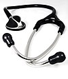
| amenity | pharmacy | ဆေးဆိုင် ၊ ဆေးပေးခန်း | ||||
| amenity | social_facility | လူမှုရေးဝန်ဆောင်မှု/ ကိစ္စရပ်များ ပံ့ပိုးပေးသည့်နေရာ | ||||
| amenity | veterinary | တိရိစ္ဆာန်ဆေးကုခန်း | ||||
ဖျော်ဖြေရေး ၊ အနုပညာ နှင့် ယဉ်ကျေးမှု} | ||||||
| amenity | arts_centre | အနုပညာပြခန်း၊ အနုပညာများ တင်ဆက်သည့်နေရာ | ||||
| amenity | brothel | An establishment specifically dedicated to prostitution | ||||
| amenity | casino | A gambling venue with at least one table game(e.g. roulette, blackjack) that takes bets on sporting and other events at agreed upon odds. | ||||
| amenity | cinema | ရုပ်ရှင်ရုံ) | ||||
| amenity | community_centre | ရပ်ရွာနှင့်သက်ဆိုင်သည့် လုပ်ငန်းများ၊ ပွဲတော်များနှင့် ရပ်ရွာလူထုနှင့်ပတ်သတ်သည့်လုပ်ငန်းများ ပြုလုပ်ရန်နေရာ | ||||
| amenity | conference_centre | A large building that is used to hold a convention | ||||
| amenity | events_venue | A building specifically used for organising events | ||||
| amenity | exhibition_centre | An exhibition centre | ||||
| amenity | fountain | အပန်းဖြေရန်၊ အလှဆင်ရန်၊ ယဉ်ကျေးမှုပြယုဂ်အဖြစ် တည်ဆောက်ထားသည့် ရေပန်း | ||||
| amenity | gambling | A place for gambling, not being a shop=bookmaker, shop=lottery, amenity=casino, or leisure=adult_gaming_centre.
Games that are covered by this definition include bingo and pachinko. |
||||
| amenity | love_hotel | A love hotel is a type of short-stay hotel operated primarily for the purpose of allowing guests privacy for sexual activities. | ||||
| amenity | music_venue | An indoor place to hear contemporary live music. | ||||
| amenity | nightclub | နိုက်ကလပ် | ||||
| amenity | planetarium | A planetarium. | ||||
| amenity | public_bookcase | A street furniture containing books. Take one or leave one. | ||||
| amenity | social_centre | ငွေကြေးအကျိုးအမြတ်မရသည့် သို့မဟုတ် အခမဲ့လူမှုရေးအကျိုးဆောင်ပေးသည့် လုပ်ငန်းများပြုလုပ်ရန်နေရာ။ | ||||
| amenity | stage | A raised platform for performers. | ||||
| amenity | stripclub | A place that offers striptease or lapdancing (for sexual services use amenity=brothel). | ||||
| amenity | studio | စတူဒီယို၊ ရုပ်ရှင်/ရေဒီယို/အသံသွင်းသည့်နေရာ | ||||
| amenity | swingerclub | A club where people meet to have a party and group sex. | ||||
| amenity | theatre | ကပွဲရုံ၊ ရုပ်ရှင်/ရေဒီယို/အသံသွင်းသည့်နေရာ | ||||
Public Service | ||||||
| amenity | courthouse | တရားရုံး | ||||
| amenity | fire_station | မီးသတ်စခန်း | ||||
| amenity | police | ရဲစခန်း | ||||
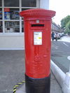
| amenity | post_box | စာတိုက်ပုံး ၊ စာပို့စာသယ် လုပ်ပေးသည့် အဖွဲ့အစည်းရှိလျှင်operator=*ကိုသုံးရမည်။ | ||||
| amenity | post_depot | Post depot or delivery office, where letters and parcels are collected and sorted prior to delivery. | ||||
| amenity | post_office | စာတိုက်ရုံး | ||||
| amenity | prison | အကျဉ်းထောင် | ||||
| amenity | ranger_station | National Park visitor headquarters: official park visitor facility with police, visitor information, permit services, etc | ||||
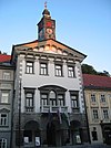
| amenity | townhall | Bangunan di mana administrasi sebuah desa atau kota terletak, atau hanya sebuah tempat komunitas untuk bertemu. | ||||
Facilities | ||||||
| amenity | bbq | BBQ or Barbecue is a permanently built grill for cooking food, which is most typically used outdoors by the public. For example these may be found in city parks or at beaches. Use the tag fuel=* to specify the source of heating, such as fuel=wood;electric;charcoal. For mapping nearby table and chairs, see also the tag tourism=picnic_site. For mapping campfires and firepits, instead use the tag leisure=firepit. | ||||
| amenity | bench | ထိုင်ရန် ၊ အနားယူရန်နေရာ | ||||
| amenity | dog_toilet | Area designated for dogs to urinate and excrete. | ||||
| amenity | dressing_room | Area designated for changing clothes. | ||||
| amenity | drinking_water | Sumber air minum yang biasanya berada di tengah kota, taman atau tempat wisata. | ||||
| amenity | give_box | A small facility where people drop off and pick up various types of items in the sense of free sharing and reuse. | ||||
| amenity | lounge | A comfortable waiting area for customers, usually found in airports and other transportation hubs. Typically has extra amenities or sustenance. | ||||
| amenity | mailroom | A mailroom for receiving packages or letters. | ||||
| amenity | parcel_locker | Machine for picking up and sending parcels | ||||
| amenity | shelter | Tempat berlindung kecil dari cuaca buruk. Untuk menjelaskan tipe menggunakan tag shelter_type=*. | ||||
| amenity | shower | Tempat pemandian umum. | ||||
| amenity | telephone | Telefon umum | ||||
| amenity | toilets | Toilet umum | ||||
| amenity | water_point | Place where you can get large amounts of drinking water | ||||
| amenity | watering_place | Tempat dimana air berada dan binatang bisa minum. | ||||
Waste Management | ||||||
| amenity | sanitary_dump_station | A place for depositing human waste from a toilet holding tank. | ||||
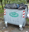
| amenity | recycling | ပြန်လည်အသုံးချနိုင်သောစွန့်ပစ်ပစ္စည်းများ စွန့်ပစ်နိုင်သည့်နေရာ ၊ အမှိုက်ပုံးများဆိုလျှင် recycling_type=containerနှင့်တွဲသုံးပြီး စက်ရုံ နေရာအဖြစ်တည်ရှိလျှင် recycling_type=centre နှင့်တွဲသုံသည်။ | ||||
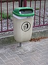
| amenity | waste_basket | Tempat sampah umum. | ||||
| amenity | waste_disposal | Tempat pembuangan sampah akhir. | ||||
| amenity | waste_transfer_station | A waste transfer station is a location that accepts, consolidates and transfers waste in bulk. | ||||
အခြား | ||||||
| amenity | animal_boarding | A facility where you, paying a fee, can bring your animal for a limited period of time (e.g. for holidays) | ||||
| amenity | animal_breeding | A facility where animals are bred, usually to sell them | ||||
| amenity | animal_shelter | A shelter that recovers animals in trouble | ||||
| amenity | animal_training | A facility used for non-competitive animal training | ||||
| amenity | baking_oven | An oven used for baking bread and similar, for example inside a building=bakehouse. | ||||
| amenity | clock | နာရီစင် | ||||
| amenity | crematorium | သဂြိုလ်စက် | ||||
| amenity | dive_centre | A dive center is the base location where sports divers usually start scuba diving or make dive guided trips at new locations. | ||||
| amenity | funeral_hall | A place for holding a funeral ceremony, other than a place of worship. | ||||
| amenity | grave_yard | မြေနေရာကျဉ်းသော သုသာန်အမျိုးအစားများ ၊ မြေနေရာကျယ်ဝန်းသော သုသာန်အမျိုးအစားများကိုlanduse=cemeteryဖြင့်တွဲဖက်အသုံးပြုသည်။ | ||||
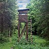
| amenity | hunting_stand | အမဲလိုက်စင် | ||||
| amenity | internet_cafe | A place whose principal role is providing internet services to the public. | ||||
| amenity | kitchen | A public kitchen in a facility to use by everyone or customers | ||||
| amenity | kneipp_water_cure | Outdoor foot bath facility. Usually this is a pool with cold water and handrail. Popular in German speaking countries. | ||||
| amenity | lounger | An object for people to lie down. | ||||
| amenity | marketplace | A marketplace where goods and services are traded daily or weekly. | ||||
| amenity | monastery | Monastery is the location of a monastery or a building in which monks and nuns live. | ||||
| amenity | mortuary | A morgue or funeral home, used for the storage of human corpses. | ||||
| amenity | photo_booth | A stand to create instant photos. | ||||
| amenity | place_of_mourning | A room or building where families and friends can come, before the funeral, and view the body of the person who has died. | ||||
| amenity | place_of_worship | ဘုရားကျောင်း ၊ ဗလီ ၊ ဗုဒ္ဓဘာသာကျောင်းဆောင်များ၊ religion=* ကိုတွဲသုံးရသည်။ , အများအားဖြင့်denomination=*၊ အမည်သိလျှင် name=* နှင့် amenity=place_of_worshipကိုတွဲသုံးသည်။. အသေးစိတ်ကို ဒီမှာ သွားပြီးကြည့်လို့ရပါတယ် | ||||
| amenity | public_bath | A location where the public may bathe in common, etc. japanese onsen, turkish bath, hot spring | ||||
| A generic public building. Don't use! See office=government. | ||||||
| amenity | refugee_site | A human settlement sheltering refugees or internally displaced persons | ||||
| amenity | vending_machine | Mesin penjual makanan, koran, minuman, dll. Untuk menambahkan jenis barang yang dijual gunakan tag vending=*. | ||||
| amenity | user defined | All commonly used values according to Taginfo | ||||
This table is a wiki template with a default description in English. Editable here. အထက်ပါ ဇယားကွက်သည် မြန်မာဘာသာဖြင့် ပြုလုပ်ထားသော Template တစ်ခုဖြစ်ပါသည်။ ပြုပြင်စရာရှိလျှင် ဒီနေရာမှာ သွားပြီးပြင်လို့ရပါတယ်.
{{MY:Map Features:barrier}} {{MY:Map Features:craft}}
Highway
This is used to describe roads and footpaths. For an introduction on its usage see the page titled Highways. See the page titled Restrictions for an introduction on access limitations by vehicles type, time, day, load and purpose, etc.
| Key | Value | Element | Comment | Rendering carto | Examples | |
|---|---|---|---|---|---|---|
Roads | ||||||
|
This group lists the 7 main tags for the road network, from most to least functionally important for motor vehicle traffic. | ||||||
| highway | motorway | A restricted access major divided highway, normally with 2 or more running lanes plus emergency hard shoulder. Equivalent to the Freeway, Autobahn, etc.. | ||||
| highway | trunk | The most important roads in a country's system that aren't motorways. (Need not necessarily be a divided highway.) | ||||
| highway | primary | The next most important roads in a country's system. (Often link larger towns.) | ||||
| highway | secondary | The next most important roads in a country's system. (Often link towns.) | ||||
| highway | tertiary | The next most important roads in a country's system. (Often link smaller towns and villages) | ||||
| highway | unclassified | The least important through roads in a country's system – i.e. minor roads of a lower classification than tertiary, but which serve a purpose other than access to properties. (Often link villages and hamlets.)
The word 'unclassified' is a historical artefact of the UK road system and does not mean that the classification is unknown; you can use highway=road for that. |
||||
| highway | residential | Roads which serve as an access to housing, without function of connecting settlements. Often lined with housing. | ||||
Link roads | ||||||
| highway | motorway_link | The link roads (sliproads/ramps) leading to/from a motorway from/to a motorway or lower class highway. Normally with the same motorway restrictions. | ||||
| highway | trunk_link | The link roads (sliproads/ramps) leading to/from a trunk road from/to a trunk road or lower class highway. | ||||
| highway | primary_link | The link roads (sliproads/ramps) leading to/from a primary road from/to a primary road or lower class highway. | ||||
| highway | secondary_link | The link roads (sliproads/ramps) leading to/from a secondary road from/to a secondary road or lower class highway. | ||||
| highway | tertiary_link | The link roads (sliproads/ramps) leading to/from a tertiary road from/to a tertiary road or lower class highway. | ||||
Special road types | ||||||
| highway | living_street | For living streets, which are residential streets where pedestrians have legal priority over cars, speeds are kept very low. | ||||
| highway | service | For access roads to, or within an industrial estate, camp site, business park, car park, alleys, etc. Can be used in conjunction with service=* to indicate the type of usage and with access=* to indicate who can use it and in what circumstances. | ||||
| highway | pedestrian | For roads used mainly/exclusively for pedestrians in shopping and some residential areas which may allow access by motorised vehicles only for very limited periods of the day. To create a 'square' or 'plaza' create a closed way and tag as pedestrian and also with area=yes. | ||||
| highway | track | Roads for mostly agricultural or forestry uses. To describe the quality of a track, see tracktype=*. Note: Although tracks are often rough with unpaved surfaces, this tag is not describing the quality of a road but its use. Consequently, if you want to tag a general use road, use one of the general highway values instead of track. | ||||
| highway | bus_guideway | A busway where the vehicle guided by the way (though not a railway) and is not suitable for other traffic. Please note: this is not a normal bus lane, use access=no, psv=yes instead! | ||||
| highway | escape | For runaway truck ramps, runaway truck lanes, emergency escape ramps, or truck arrester beds. It enables vehicles with braking failure to safely stop. | ||||
| highway | raceway | A course or track for (motor) racing | ||||
| highway | road | A road/way/street/motorway/etc. of unknown type. It can stand for anything ranging from a footpath to a motorway. This tag should only be used temporarily until the road/way/etc. has been properly surveyed. If you do know the road type, do not use this value, instead use one of the more specific highway=* values. | ||||
| highway | busway | A dedicated roadway for bus rapid transit systems | ||||
Paths | ||||||
| highway | footway | For designated footpaths; i.e., mainly/exclusively for pedestrians. This includes walking tracks and gravel paths. If bicycles are allowed as well, you can indicate this by adding a bicycle=yes tag. Should not be used for paths where the primary or intended usage is unknown. Use highway=pedestrian for pedestrianised roads in shopping or residential areas and highway=track if it is usable by agricultural or similar vehicles. For ramps (sloped paths without steps), combine this tag with incline=*. | ||||
| highway | bridleway | For horse riders. Pedestrians are usually also permitted, cyclists may be permitted depending on local rules/laws. Motor vehicles are forbidden. | ||||
| highway | steps | For flights of steps (stairs) on footways. Use with step_count=* to indicate the number of steps | ||||
| highway | corridor | For a hallway inside of a building. | ||||
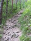
| highway | path | A non-specific path. Use highway=footway for paths mainly for walkers, highway=cycleway for one also usable by cyclists, highway=bridleway for ones available to horse riders as well as walkers and highway=track for ones which is passable by agriculture or similar vehicles. | ||||
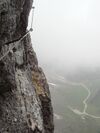
| highway | via_ferrata | A via ferrata is a route equipped with fixed cables, stemples, ladders, and bridges in order to increase ease and security for climbers. These via ferrata require equipment : climbing harness, shock absorber and two short lengths of rope, but do not require a long rope as for climbing. | ||||
When sidewalk/crosswalk is tagged as a separate way | ||||||
| footway | sidewalk | Sidewalk that runs typically along residential road. Use in combination with highway=footway or highway=path | ||||
| footway | crossing | Crosswalk that connects two sidewalks on the opposite side of the road. Often recognized by painted markings on the road, road sign or traffic lights. Use in combination with highway=footway or highway=path. Useful information is presence of tactile_paving=*, wheelchair=* suitability and kerb=* represented as a node on the crosswalk way. | ||||
| footway | traffic_island | The way between two crossings, safespot for pedestrians, has micromapping characteristics as a detailed alternative to =*. Use in combination with highway=footway or highway=path. | ||||
When sidewalk (or pavement) is tagged on the main roadway (see Sidewalks) | ||||||
| sidewalk | both | left | right | no | Specifies that the highways has sidewalks on both sides, on one side or no sidewalk at all | ||||
When cycleway is drawn as its own way (see Bicycle) | ||||||
| highway | cycleway | For designated cycleways. Add foot=*, though it may be avoided if default-access-restrictions do apply. | ||||
Cycleway tagged on the main roadway or lane (see Bicycle) | ||||||
| cycleway | lane | A lane is a route that lies within the roadway | ||||
| cycleway | Deprecated variant for ways with oneway=yes where it is legally permitted to cycle in both directions. Replaced by oneway:bicycle=no. | |||||
| cycleway | Deprecated variant for ways with oneway=yes that have a cycling lane going the opposite direction of normal traffic flow (a "contraflow" lane). Replaced by oneway:bicycle=no + cycleway:left=lane/cycleway:right=lane + cycleway:left:oneway=-1/cycleway:right:oneway=-1. | |||||
| cycleway | track | A track provides a route that is separated from traffic. In the United States, this term is often used to refer to bike lanes that are separated from lanes for cars by pavement buffers, bollards, parking lanes, and curbs. Note that a cycle track may alternatively be drawn as a separate way next to the road which is tagged as highway=cycleway. | ||||
| cycleway | Deprecated variant for ways with oneway=yes that have a cycling track going the opposite direction of normal traffic flow. Replaced by oneway:bicycle=no + cycleway:left=track/cycleway:right=track + cycleway:left:oneway=-1/cycleway:right:oneway=-1. | |||||
| cycleway | share_busway | There is a bus lane that cyclists are permitted to use. | ||||
| cycleway | Deprecated variant for ways with oneway=yes that have a bus lane that cyclists are also permitted to use, and which go in the opposite direction to normal traffic flow (a "contraflow" bus lane). Replaced by oneway:bicycle=no + cycleway:left=share_busway/cycleway:right=share_busway + cycleway:left:oneway=-1/cycleway:right:oneway=-1. | |||||
| cycleway | shared_lane | Cyclists share a lane with motor vehicles, there are markings reminding about this. In some places these markings are known as "sharrows" ('sharing arrows') and this is the tag to use for those. | ||||
Busways tagged on the main roadway or lane (see Bus lanes) | ||||||
| lane | Deprecated variant to tag bus lanes. Replaced by bus/psv lane tagging lanes:bus=* / lanes:psv=*) / bus:lanes=* / psv:lanes=* | |||||
| opposite | Deprecated variant for ways with oneway=yes where buses are legally permitted to travel in both directions. Replaced by oneway:bus=no | |||||
| opposite_lane | Deprecated variant for ways with oneway=yes that have a bus lane which go in the opposite direction to normal traffic flow (a "contraflow" bus lane). Replaced by oneway:bus=no and lanes:bus=* / lanes:psv=*) / bus:lanes=* / psv:lanes=* | |||||
Street parking tagged on the main roadway (see Street parking) | ||||||
| parking:left / :right / :both (hereafter: parking:side) |
lane | street_side | on_kerb | half_on_kerb | shoulder | no | separate | yes | Primary key to record parking along the street. Describes the parking position of parked vehicles in the street. | ||||
| parking:sideorientation=* | parallel | diagonal | perpendicular | To specify the orientation of parked vehicles if there is street parking. | ||||
Lifecycle (see also lifecycle prefixes) | ||||||
| highway | proposed | For planned roads, use with proposed=* and a value of the proposed highway value. | ||||
| highway | construction | For roads under construction. Use construction=* to hold the value for the completed road. | different colours | |||
Attributes | ||||||
| abutters | commercial | industrial | mixed | residential | retail etc. | See Key:abutters for more details. | ||||
| bicycle_road | yes | A bicycle road is a road designated for bicycles. If residential streets get the status of bicycle roads, normally, by special signs, motor traffic is admitted with limited speed, often only for residents. | ||||
| bus_bay | both | left | right | A bus bay outside the main carriageway for boarding/alighting | ||||
| change | yes | no | not_right | not_left | only_right | only_left | Specify the allowed/forbidden lane changes | ||||
| destination | <place name of destination> | Destination when following a linear feature | ||||
| embankment | yes | dyke | A dyke or a raised bank to carry a road, railway, or canal across a low-lying or wet area. | ||||
| embedded_rails | yes | <type of railway> | A highway on which non-railway traffic is also allowed has railway tracks embedded in it but the rails are mapped as separate ways. | ||||
| ford | yes | The road crosses through stream or river, vehicles must enter any water. | ||||
| frontage_road | yes | A frontage road. | ||||
| ice_road | yes | A highway is laid upon frozen water basin, definitely doesn't exist in summer. | ||||
| incline | Number % | ° | up | down | Incline steepness as percents ("5%") or degrees ("20°"). Positive/negative values indicate movement upward/downwards in the direction of the way. | ||||
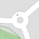
| junction | roundabout | This automatically implies oneway=yes, the oneway direction is defined by the sequential ordering of nodes within the Way. This applies on a way, tagged with highway=* already. | ||||
| lanes | <number> | The number of traffic lanes for general purpose traffic, also for buses and other specific classes of vehicle. | ||||
| lane_markings | yes | no | Specifies if a highway has painted markings to indicate the position of the lanes. | ||||
| lit | yes | no | Street lighting | ||||
| maxspeed | <number> | Specifies the maximum legal speed limit on a road, railway or waterway. | ||||
| motorroad | yes | no | The motorroad tag is used to describe highways that have motorway-like access restrictions but that are not a motorway. | ||||
| mountain_pass | yes | The highest point of a mountain pass. | ||||
| mtb:scale | 0-6 | Applies to highway=path and highway=track. A classification scheme for mtb trails (few inclination and downhill). | ||||
| mtb:scale:uphill | 0-5 | A classification scheme for mtb trails for going uphill if there is significant inclination. | ||||
| mtb:scale:imba | 0-4 | The IMBA Trail Difficulty Rating System shall be used for bikeparks. It is adapted to mtb trails with artificial obstacles. | ||||
| mtb:description | Text | Applies to highway=path and highway=track. A key to input variable infos related to mtbiking on a way with human words | ||||
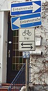
| oneway | yes | no | reversible | Oneway streets are streets where you are only allowed to drive in one direction. | ||||
| oneway:bicycle | yes | no | | Used on ways with oneway=yes where it is legally permitted to cycle in both directions. | ||||
| overtaking | yes | no | caution | both | forward | backward | Specifying sections of roads where overtaking is legally forbidden. Use overtaking:forward=yes/no/caution and overtaking:backward=yes/no/caution when it depends on driving direction. | ||||
| parallel | diagonal | perpendicular | marked | no_parking | no_stopping | fire_lane. | Deprecated variant to map parking along streets. See section on street parking above or the street parking page for more details. | |||||
| free | ticket | disc | residents | customers | private | Deprecated variant to map parking conditions along streets. See section on street parking above or the street parking page for more details. | |||||
| passing_places | yes | A way which has frequent passing places (See also: highway=passing_place) | ||||
| priority | forward | backward | Traffic priority for narrow parts of roads, e.g. narrow bridges. | ||||
| priority_road | designated | yes_unposted | end | Specifying roads signposted as priority roads. | ||||
| sac_scale | strolling | hiking | mountain_hiking | demanding_mountain_hiking | alpine_hiking | demanding_alpine_hiking | difficult_alpine_hiking | Applies to highway=path and highway=footway. A classification scheme for hiking trails. | ||||
| service | alley | driveway | parking_aisle etc. | See Key:service for more details. | ||||
| shoulder | no | yes | right | both | left | Presence of shoulder in highway | ||||
| side_road | yes | A side road. | ||||
| smoothness | excellent | good | intermediate | bad | very_bad | horrible | very_horrible | impassable | Specifies the physical usability of a way for wheeled vehicles due to surface regularity/flatness. See Key:smoothness for more details. | ||||
| surface | paved | unpaved | asphalt | concrete | paving_stones | sett | cobblestone | metal | wood | compacted | fine_gravel | gravel | pebblestone | plastic | grass_paver | grass | dirt | earth | mud | sand | ground | See Key:surface for more details. | ||||
| tactile_paving | yes | no | A paving in the ground to be followed with a blindman's stick. | ||||
| tracktype | grade1 | grade2 | grade3 | grade4 | grade5 | To describe the quality of the surface. See Key:tracktype for more information. | ||||
| traffic_calming | bump | hump | table | island | cushion | yes | etc. | Features used to slow down traffic. See Key:traffic calming for more details. | ||||
| trail_visibility | excellent | good | intermediate | bad | horrible | no | Applies to highway=path, highway=footway, highway=cycleway and highway=bridleway. A classification for hiking trails visibility | ||||
| trailblazed | yes | no | poles | cairns | symbols | Applies to highway=*. Describing trail blazing and marking. See Key:trailblazed for more information. | ||||
| trailblazed:visibility | excellent | good | intermediate | bad | horrible | no | Applies to trailblazed=*. A classification for visibility of trailblazing. See Key:trailblazed:visibility for more information. | ||||
| turn | left | slight_left | through | right | slight_right | merge_to_left | merge_to_right | reverse | The key turn can be used to specify the direction in which a way or a lane will lead. | ||||
| width | <number> | The width of a feature. | ||||
| winter_road | yes | A highway functions during winter, probably can't be driven in summer. | ||||
Other highway features | ||||||
| highway | bus_stop | A small bus stop. Optionally one may also use public_transport=stop_position for the position where the vehicle stops and public_transport=platform for the place where passengers wait. | ||||
| highway | crossing | A.k.a. crosswalk. Pedestrians can cross a street here; e.g., zebra crossing | ||||
| highway | cyclist_waiting_aid | Street furniture for cyclists that are intended to make waiting at esp. traffic lights more comfortable. | ||||
| highway | elevator | An elevator or lift, used to travel vertically, providing passenger and freight access between pathways at different floor levels. | ||||
| highway | emergency_bay | An area beside a highway where you can safely stop your car in case of breakdown or emergency. | ||||
| highway | emergency_access_point | Sign number which can be used to define your current position in case of an emergency. Use with ref=NUMBER_ON_THE_SIGN. See also emergency=access_point | ||||
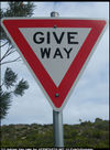
| highway | give_way | A "give way," or "Yield" sign | ||||
| emergency | phone | A calling device can be used to tell on your current position in case of an emergency. Use with ref=NUMBER_ON_THE_SIGN | ||||
| highway | ladder | A vertical or inclined set of steps or rungs intended for climbing or descending of a person with the help of hands. | ||||
| highway | milestone | Highway location marker | ||||
| highway | mini_roundabout | Similar to roundabouts, but at the center there is either a painted circle or a fully traversable island. In case of an untraversable center island, junction=roundabout should be used.
Rendered as anti-clockwise by default direction=anticlockwise. To render clockwise add the tag direction=clockwise. |
||||
| highway | motorway_junction | Indicates a junction (UK) or exit (US). ref=* should be set to the exit number or junction identifier. (Some roads – e.g., the A14 – also carry junction numbers, so the tag may be encountered elsewhere despite its name) | ||||
| highway | passing_place | The location of a passing space | ||||
| highway | platform | A platform at a bus stop or station. | ||||
| highway | rest_area | Place where drivers can leave the road to rest, but not refuel. | ||||
| highway | services | A service station to get food and eat something, often found at motorways | ||||
| highway | speed_camera | A fixed road-side or overhead speed camera. | ||||
| highway | speed_display | A dynamic electronic sign that displays the speed of the passer-by motorist. | ||||
| highway | stop | A stop sign | ||||
| highway | street_lamp | A street light, lamppost, street lamp, light standard, or lamp standard is a raised source of light on the edge of a road, which is turned on or lit at a certain time every night | ||||
| highway | toll_gantry | A toll gantry is a gantry suspended over a way, usually a motorway, as part of a system of electronic toll collection. For a toll booth with any kind of barrier or booth see: barrier=toll_booth | ||||
| highway | traffic_mirror | Mirror that reflects the traffic on one road when direct view is blocked. | ||||
| highway | traffic_signals | Lights that control the traffic | ||||
| highway | trailhead | Designated place to start on a trail or route | ||||
| highway | turning_circle | A turning circle is a rounded, widened area usually, but not necessarily, at the end of a road to facilitate easier turning of a vehicle. Also known as a cul de sac. | ||||
| highway | turning_loop | A widened area of a highway with a non-traversable island for turning around, often circular and at the end of a road. | ||||
| highway | User Defined | All commonly used values according to Taginfo | ||||
Waterway
This is used to described different types of waterways. When mapping the way of a river, stream, drain, canal, etc. these need to be aligned in the direction of the water flow. See the page titled Waterways for an introduction on its usage.
Natural watercourses
This table is a wiki template with a default description in English. Editable here.
Man-made waterways
This table is a wiki template with a default description in English. Editable here.
Facilities
This table is a wiki template with a default description in English. Editable here.
Barriers on waterways
This table is a wiki template with a default description in English. Editable here.
Other features on waterways
This table is a wiki template with a default description in English. Editable here.
Geological
This is used to describe the geological makeup of an area. See the page Geological for an introduction on its usage.
This table is a wiki template with a default description in English. Editable here.


