Vi:Map Features
OpenStreetMap không giới hạn nội dung của thẻ được gán vào các đối tượng trên đối tượng OSM: ![]() nốt (node) hay địa điểm (POI),
nốt (node) hay địa điểm (POI), ![]() lối (way), và
lối (way), và ![]() quan hệ (relation). Bạn có thể sử dụng bất cứ thẻ nào bạn muốn miễn là các giá trị có thể xác thực được. Tuy nhiên, sẽ tốt hơn nếu chúng ta có một chuẩn chung cho các thẻ để sau này chúng ta tạo, sửa đối tượng trên OSM cho thống nhất. Trang này bao gồm các tập đối tượng chính và các thẻ tương ứng.
quan hệ (relation). Bạn có thể sử dụng bất cứ thẻ nào bạn muốn miễn là các giá trị có thể xác thực được. Tuy nhiên, sẽ tốt hơn nếu chúng ta có một chuẩn chung cho các thẻ để sau này chúng ta tạo, sửa đối tượng trên OSM cho thống nhất. Trang này bao gồm các tập đối tượng chính và các thẻ tương ứng.
Nếu bạn không nhìn thấy thẻ cần dùng cho bản đồ hoặc để nhóm các lối và các nốt lại với nhau thành một thành phần cấp cao hơn, xin xem thêm tại đây.
- Có một số đối tượng bản đồ được mô tả chi tiết, xem tại đây.
- Nếu bạn muốn đề xuất dùng biểu tượng mới, xem tại đây.
- Để xem danh sách các đối tượng không còn sử dụng nữa, xin xem tại đây
- Các đối tượng bản đồ thay đổi gần đây
- Đồng thời xin xem thêm Quy ước và các chuẩn biên tập bản đồ.
Một số chú ý về trình bày:
- Using the tags here will mean that your editing efforts are more likely to show up in the various renderers. However, there is no guarantee that a tag listed here will be rendered by any particular renderer or by the renderers used by the main map page. For specific information on how to ensure that your symbols are rendered in Mapnik and Osmarender tiles, look at Symbol Rendering.
- Có thể có nhiều thẻ được hiển thị trên trang bản đồ chính nhưng không được liệt kê tại đây. Danh sách này không được cập nhật bởi tất cả các thẻ được triển khai bởi trình hiển thị
- The 'Rendering' column in these tables is only an example of how an imaginary map might choose to render the feature. It does not dictate how our renderers may render it, nor indeed any other map.
Các bảng được nhóm theo từng chủ đề, sắp xếp theo mức độ phổ biến của chủ đề.
Thẻ highway (đường bộ)
Thẻ highway được dùng để biểu diễn tất cả mọi loại đường trên mặt đất. Bảng này (dưới đây) chỉ tóm lược các cách dùng thẻ highway trên bản đồ với thông tin tối thiểu để có thể đọc hiểu được bản đồ OSM trên lãnh thổ Việt Nam. Nếu bạn muốn chỉnh sửa bản đồ Việt Nam thì bạn nên xem chi tiết ở trang Vi:Highways. Ngoài ra, các nước khác nhau có cách dùng thẻ highway tương đối khác nhau. Thế nên nếu muốn đọc hiểu bản đồ OSM trên lãnh thổ các nước khác, bạn hãy tham khảo bảng so sánh quốc tế.
| Khoá | Giá trị | Đối tượng | Mô tả | Biểu diễn OSM | Hình minh hoạ | |
|---|---|---|---|---|---|---|
Các loại đường lộ | ||||||
|
Đây là những loại đường chính nằm trong hệ thống phân loại đường lộ, được xếp theo tầm quan trọng giảm dần. | ||||||
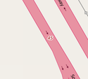
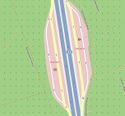
| highway | motorway | Đường cao tốc, tức đường dành riêng cho xe cơ giới, có dải phân cách chia đường cho xe chạy hai chiều riêng biệt; không giao nhau cùng mức với một hoặc các đường khác; giới hạn cả tốc độ lớn nhất lẫn tốc độ nhỏ nhất. | ||||
| highway | trunk | Quốc lộ trọng yếu hoặc xa lộ. Quốc lộ trọng yếu là những đường quốc lộ nối thủ đô, các đô thị trực thuộc Trung ương và nhiều tỉnh thành khác. Xa lộ là những đường phố có quy mô lớn giữ vị trí quan trọng trong hệ thống giao thông đô thị. Những loại đường này thường khá hiện đại và được thiết kế để tải lưu lượng giao thông cao (dù vậy, chúng không được phân loại là đường cao tốc). | ||||
| highway | primary | Đường quốc lộ thô sơ và đường đô thị chính (bao gồm làn xe máy của các đại lộ). | ||||
| highway | secondary | Đường tỉnh và đường đô thị phụ (cấp quận). Ở mức đô thị, loại đường này góp phần làm giảm lưu lượng giao thông ở các tuyến chính lớn hơn. | ||||
| highway | tertiary | Đường xã và phố (cấp phường). | ||||
| highway | unclassified | Đường không phân loại, thường là các con đường nằm trơ. Lưu ý rằng mặc dù nằm đơn lẻ nhưng những con đường này vẫn có chất lượng tốt. | ||||
| highway | residential | Đường đô thị nhỏ, cục bộ hoặc các con ngõ rộng (trong khu phố). | ||||
Các loại đường dẫn, đường nối | ||||||
| highway | motorway_link | Đường dẫn vào/ra đường cao tốc. | ||||
| highway | trunk_link | Đường dẫn vào/ra quốc lộ trọng yếu, xa lộ. | ||||
| highway | primary_link | Đường dẫn vào/ra đường quốc lộ thô sơ hoặc đường đô thị chính. | ||||
| highway | secondary_link | Đường dẫn vào/ra đường tỉnh hoặc đường đô thị phụ. | ||||
| highway | tertiary_link | Đường dẫn vào/ra đường xã hoặc phố. | ||||
Các loại đường đặc biệt | ||||||
| highway | living_street | Phố sinh hoạt, đường nội bộ trong khu dân cư, các loại xe bị hạn chế tốc độ tối đa (thường dưới 20 km/h). Thẻ này chỉ cho mục đích tham khảo vì nó không phù hợp trong hệ thống đường sá Việt Nam | ||||
| highway | service | Đường chuyên dụng và những ngõ ngách (kiệt, hẻm) trong đô thị. Đường chuyên dụng là những đường dùng riêng cho một tổ chức hay cá nhân, hoặc là đường trong các khuôn viên, được chỉ định bằng service=driveway. Các ngõ hẻm được chỉ định bằng service=alley | ||||
| highway | pedestrian | Phố đi bộ, thường dùng để mua sắm và ăn uống. | ||||
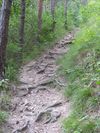
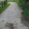
| highway | track | Đường đất hoặc đường mòn, đường rừng. Đây thường là loại đường phổ biến trên các cánh đồng hoặc các cánh rừng, rất gập ghềnh và không phù hợp cho xe cơ giới. | ||||
| highway | bus_guideway | Đường chuyên dụng cho xe buýt, xe điện chạy trên đường | ||||
| highway | escape | Đường lánh nạn ở các khúc ngoặt nguy hiểm trên đường đèo. Dùng trong trường hợp xe lao xuống dốc bị mất phanh (đứt thắng). | ||||
| highway | raceway | Đường đua xe | ||||
| highway | road | Đường chưa xác định rõ ràng (ví dụ chỉ mới vẽ theo ảnh vệ tinh). | ||||
| highway | busway | A dedicated roadway for bus rapid transit systems | ||||
Các loại lối đi | ||||||
| highway | footway | Đường đi bộ, dành riêng cho người đi bộ. | ||||
| highway | bridleway | Đường mòn đi ngựa | ||||
| highway | steps | Đường bậc thang | ||||
| highway | corridor | For a hallway inside of a building. | ||||
| highway | path | A non-specific path. Use highway=footway for paths mainly for walkers, highway=cycleway for one also usable by cyclists, highway=bridleway for ones available to horse riders as well as walkers and highway=track for ones which is passable by agriculture or similar vehicles. | ||||
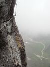
| highway | via_ferrata | A via ferrata is a route equipped with fixed cables, stemples, ladders, and bridges in order to increase ease and security for climbers. These via ferrata require equipment : climbing harness, shock absorber and two short lengths of rope, but do not require a long rope as for climbing. | ||||
When sidewalk/crosswalk is tagged as a separate way | ||||||
| footway | sidewalk | Sidewalk that runs typically along residential road. Use in combination with highway=footway or highway=path | ||||
| footway | crossing | Vạch đi bộ qua đường | ||||
| footway | traffic_island | The way between two crossings, safespot for pedestrians, has micromapping characteristics as a detailed alternative to =*. Use in combination with highway=footway or highway=path. | ||||
Khi một đường lộ có lối đi bộ bên lề, ta dùng thẻ sidewalk để đánh dấu thêm lên đường lộ chính. | ||||||
| sidewalk | both | left | right | no | Specifies that the highways has sidewalks on both sides, on one side or no sidewalk at all | ||||
Với một đường dành riêng cho xe đạp, ta đánh dấu nó bằng highway=cycleway. | ||||||
| highway | cycleway | Đường dành riêng cho xe đạp. | ||||
Khi một đường lộ có lối dành riêng cho xe đạp bên lề, ta dùng thẻ cycleway để đánh dấu thêm lên đường lộ chính. | ||||||
| cycleway | lane | A lane is a route that lies within the roadway | ||||
| cycleway | Deprecated variant for ways with oneway=yes where it is legally permitted to cycle in both directions. Replaced by oneway:bicycle=no. | |||||
| cycleway | Deprecated variant for ways with oneway=yes that have a cycling lane going the opposite direction of normal traffic flow (a "contraflow" lane). Replaced by oneway:bicycle=no + cycleway:left=lane/cycleway:right=lane + cycleway:left:oneway=-1/cycleway:right:oneway=-1. | |||||
| cycleway | track | A track provides a route that is separated from traffic. In the United States, this term is often used to refer to bike lanes that are separated from lanes for cars by pavement buffers, bollards, parking lanes, and curbs. Note that a cycle track may alternatively be drawn as a separate way next to the road which is tagged as highway=cycleway. | ||||
| cycleway | Deprecated variant for ways with oneway=yes that have a cycling track going the opposite direction of normal traffic flow. Replaced by oneway:bicycle=no + cycleway:left=track/cycleway:right=track + cycleway:left:oneway=-1/cycleway:right:oneway=-1. | |||||
| cycleway | share_busway | There is a bus lane that cyclists are permitted to use. | ||||
| cycleway | Deprecated variant for ways with oneway=yes that have a bus lane that cyclists are also permitted to use, and which go in the opposite direction to normal traffic flow (a "contraflow" bus lane). Replaced by oneway:bicycle=no + cycleway:left=share_busway/cycleway:right=share_busway + cycleway:left:oneway=-1/cycleway:right:oneway=-1. | |||||
| cycleway | shared_lane | Cyclists share a lane with motor vehicles, there are markings reminding about this. In some places these markings are known as "sharrows" ('sharing arrows') and this is the tag to use for those. | ||||
Busways tagged on the main roadway or lane (see Bus lanes) | ||||||
| lane | Deprecated variant to tag bus lanes. Replaced by bus/psv lane tagging lanes:bus=* / lanes:psv=*) / bus:lanes=* / psv:lanes=* | |||||
| opposite | Deprecated variant for ways with oneway=yes where buses are legally permitted to travel in both directions. Replaced by oneway:bus=no | |||||
| opposite_lane | Deprecated variant for ways with oneway=yes that have a bus lane which go in the opposite direction to normal traffic flow (a "contraflow" bus lane). Replaced by oneway:bus=no and lanes:bus=* / lanes:psv=*) / bus:lanes=* / psv:lanes=* | |||||
Street parking tagged on the main roadway (see Street parking) | ||||||
| parking:left / :right / :both (hereafter: parking:side) |
lane | street_side | on_kerb | half_on_kerb | shoulder | no | separate | yes | Primary key to record parking along the street. Describes the parking position of parked vehicles in the street. | ||||
| parking:sideorientation=* | parallel | diagonal | perpendicular | To specify the orientation of parked vehicles if there is street parking. | ||||
Các loại đường chưa hoàn thành (see also lifecycle prefixes) | ||||||
| highway | proposed | Đường dự kiến. Dùng thêm thẻ proposed=* để gán giá trị dự kiến của đường đó (giá trị giống như giá trị của thẻ highway). | ||||
| highway | construction | Đường đang thi công. Dùng thêm thẻ construction=* để gán giá trị sau khi thi công của đường đó (giá trị giống như giá trị của thẻ highway). | different colours | |||
Các thuộc tính của đường bộ, dùng kèm với thẻ highway để bổ sung thông tin cho một con đường (hoặc một nốt). | ||||||
| abutters | commercial | industrial | mixed | residential | retail etc. | See Key:abutters for more details. | ||||
| bicycle_road | yes | Cho phép xe đạp chạy trên đường. | ||||
| bus_bay | both | left | right | A bus bay outside the main carriageway for boarding/alighting | ||||
| change | yes | no | not_right | not_left | only_right | only_left | Specify the allowed/forbidden lane changes | ||||
| destination | <place name of destination> | Destination when following a linear feature | ||||
| embankment | yes | dyke | A dyke or a raised bank to carry a road, railway, or canal across a low-lying or wet area. | ||||
| embedded_rails | yes | <type of railway> | A highway on which non-railway traffic is also allowed has railway tracks embedded in it but the rails are mapped as separate ways. | ||||
| ford | yes | Đường có đoạn ngập nước (do mưa lũ, triều cường, hoặc đi qua suối, qua đập tràn,...) | ||||
| frontage_road | yes | A frontage road. | ||||
| ice_road | yes | A highway is laid upon frozen water basin, definitely doesn't exist in summer. | ||||
| incline | Number % | ° | up | down | Độ dốc của đường tính theo phần trăm (%). Giá trị dương là dốc lên, âm là dốc xuống. | ||||
| junction | roundabout | This automatically implies oneway=yes, the oneway direction is defined by the sequential ordering of nodes within the Way. This applies on a way, tagged with highway=* already. | ||||
| lanes | <number> | Số làn đường. | ||||
| lane_markings | yes | no | Specifies if a highway has painted markings to indicate the position of the lanes. | ||||
| lit | yes | no | Được thắp sáng (có đèn đường) hay không. | ||||
| maxspeed | <number> | Specifies the maximum legal speed limit on a road, railway or waterway. | ||||
| motorroad | yes | no | The motorroad tag is used to describe highways that have motorway-like access restrictions but that are not a motorway. | ||||
| mountain_pass | yes | Điểm đỉnh đèo, cao nhất trên đoạn đường đèo (qua núi) đó. | ||||
| mtb:scale | 0-6 | Applies to highway=path and highway=track. A classification scheme for mtb trails (few inclination and downhill). | ||||
| mtb:scale:uphill | 0-5 | A classification scheme for mtb trails for going uphill if there is significant inclination. | ||||
| mtb:scale:imba | 0-4 | The IMBA Trail Difficulty Rating System shall be used for bikeparks. It is adapted to mtb trails with artificial obstacles. | ||||
| mtb:description | Text | Applies to highway=path and highway=track. A key to input variable infos related to mtbiking on a way with human words | ||||
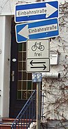
| oneway | yes | no | reversible | Oneway streets are streets where you are only allowed to drive in one direction. | ||||
| oneway:bicycle | yes | no | | Used on ways with oneway=yes where it is legally permitted to cycle in both directions. | ||||
| overtaking | yes | no | caution | both | forward | backward | Specifying sections of roads where overtaking is legally forbidden. Use overtaking:forward=yes/no/caution and overtaking:backward=yes/no/caution when it depends on driving direction. | ||||
| parallel | diagonal | perpendicular | marked | no_parking | no_stopping | fire_lane. | Deprecated variant to map parking along streets. See section on street parking above or the street parking page for more details. | |||||
| free | ticket | disc | residents | customers | private | Deprecated variant to map parking conditions along streets. See section on street parking above or the street parking page for more details. | |||||
| passing_places | yes | A way which has frequent passing places (See also: highway=passing_place) | ||||
| priority | forward | backward | Traffic priority for narrow parts of roads, e.g. narrow bridges. | ||||
| priority_road | designated | yes_unposted | end | Specifying roads signposted as priority roads. | ||||
| sac_scale | strolling | hiking | mountain_hiking | demanding_mountain_hiking | alpine_hiking | demanding_alpine_hiking | difficult_alpine_hiking | Cấp độ khó của môn đi bộ đường dài. Áp dụng cho các loại đường mòn (highway=path), đường đất (highway=track), và đường đi bộ (highway=footway). Xem thêm ở trang Vi:Hiking | ||||
| service | alley | driveway | parking_aisle etc. | Loại đường cho đường cấp 6 (highway=service): service=driveway cho đường đường chuyên dụng (đường đi riêng của một tổ chức hay cá nhân); service=alley cho các ngõ ngách (kiệt, hẻm). | ||||
| shoulder | no | yes | right | both | left | Presence of shoulder in highway | ||||
| side_road | yes | A side road. | ||||
| smoothness | excellent | good | intermediate | bad | very_bad | horrible | very_horrible | impassable | Specifies the physical usability of a way for wheeled vehicles due to surface regularity/flatness. See Key:smoothness for more details. | ||||
| surface | paved | unpaved | asphalt | concrete | paving_stones | sett | cobblestone | metal | wood | compacted | fine_gravel | gravel | pebblestone | plastic | grass_paver | grass | dirt | earth | mud | sand | ground | Bề mặt đường. Xem thêm ở trang Key:surface. | ||||
| tactile_paving | yes | no | A paving in the ground to be followed with a blindman's stick. | ||||
| tracktype | grade1 | grade2 | grade3 | grade4 | grade5 | To describe the quality of the surface. See Key:tracktype for more information. | ||||
| traffic_calming | bump | hump | table | island | cushion | yes | etc. | Features used to slow down traffic. See Key:traffic calming for more details. | ||||
| trail_visibility | excellent | good | intermediate | bad | horrible | no | Độ rõ của đường mòn (highway=path). | ||||
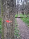
| trailblazed | yes | no | poles | cairns | symbols | Applies to highway=*. Describing trail blazing and marking. See Key:trailblazed for more information. | ||||
| trailblazed:visibility | excellent | good | intermediate | bad | horrible | no | Applies to trailblazed=*. A classification for visibility of trailblazing. See Key:trailblazed:visibility for more information. | ||||
| turn | left | slight_left | through | right | slight_right | merge_to_left | merge_to_right | reverse | The key turn can be used to specify the direction in which a way or a lane will lead. | ||||
| width | <number> | The width of a feature. | ||||
| winter_road | yes | A highway functions during winter, probably can't be driven in summer. | ||||
Những đối tượng bản đồ khác trên đường bộ | ||||||
| highway | bus_stop | Trạm dừng xe buýt | ||||
| highway | crossing | A.k.a. crosswalk. Pedestrians can cross a street here; e.g., zebra crossing | ||||
| highway | cyclist_waiting_aid | Street furniture for cyclists that are intended to make waiting at esp. traffic lights more comfortable. | ||||
| highway | elevator | An elevator or lift, used to travel vertically, providing passenger and freight access between pathways at different floor levels. | ||||
| highway | emergency_bay | An area beside a highway where you can safely stop your car in case of breakdown or emergency. | ||||
| highway | emergency_access_point | Sign number which can be used to define your current position in case of an emergency. Use with ref=NUMBER_ON_THE_SIGN. See also emergency=access_point | ||||
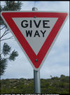
| highway | give_way | Giao với đường ưu tiên. Xe chạy tới đây phải giảm tốc độ để nhường đường. | ||||
| emergency | phone | A calling device can be used to tell on your current position in case of an emergency. Use with ref=NUMBER_ON_THE_SIGN | ||||
| highway | ladder | A vertical or inclined set of steps or rungs intended for climbing or descending of a person with the help of hands. | ||||
| highway | milestone | Highway location marker | ||||
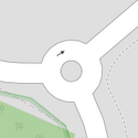
| highway | mini_roundabout | Similar to roundabouts, but at the center there is either a painted circle or a fully traversable island. In case of an untraversable center island, junction=roundabout should be used.
Rendered as anti-clockwise by default direction=anticlockwise. To render clockwise add the tag direction=clockwise. |
||||
| highway | motorway_junction | Indicates a junction (UK) or exit (US). ref=* should be set to the exit number or junction identifier. (Some roads – e.g., the A14 – also carry junction numbers, so the tag may be encountered elsewhere despite its name) | ||||
| highway | passing_place | The location of a passing space | ||||
| highway | platform | A platform at a bus stop or station. | ||||
| highway | rest_area | Place where drivers can leave the road to rest, but not refuel. | ||||
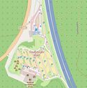
| highway | services | Điểm dịch vụ trên đường cao tốc (đổ xăng, ăn uống, nghỉ ngơi,...) | ||||
| highway | speed_camera | Camera kiểm tra tốc độ ("bắn tốc độ"). | ||||
| highway | speed_display | A dynamic electronic sign that displays the speed of the passer-by motorist. | ||||
| highway | stop | A stop sign | ||||
| highway | street_lamp | A street light, lamppost, street lamp, light standard, or lamp standard is a raised source of light on the edge of a road, which is turned on or lit at a certain time every night | ||||
| highway | toll_gantry | A toll gantry is a gantry suspended over a way, usually a motorway, as part of a system of electronic toll collection. For a toll booth with any kind of barrier or booth see: barrier=toll_booth | ||||
| highway | traffic_mirror | Mirror that reflects the traffic on one road when direct view is blocked. | ||||
| highway | traffic_signals | Đèn hiệu giao thông ("đèn xanh đèn đỏ"). | ||||
| highway | trailhead | Designated place to start on a trail or route | ||||
| highway | turning_circle | A turning circle is a rounded, widened area usually, but not necessarily, at the end of a road to facilitate easier turning of a vehicle. Also known as a cul de sac. | ||||
| highway | turning_loop | A widened area of a highway with a non-traversable island for turning around, often circular and at the end of a road. | ||||
| highway | User Defined | All commonly used values according to Taginfo | ||||
Địa danh
Địa danh (Places) là tên các địa danh. Nơi chốn chỉ thể hiện bằng 1 nốt (node). Tất cả các loại địa điểm đều có thể được trình bày trên OSM. Từ tên Quốc gia đến tỉnh, thành phố, thị xã, thị trấn, quận, huyện, xã, phường, khu phố, làng bản, thôn, xóm, ấp ....
Thực trạng
- Hiện tại trên thế giới có rất nhiều loại địa danh khác nhau, một số loại địa danh không trùng với mã key của OSM (vì OSM dựa trên 1 số loại địa danh hành chính phổ biến tại Anh Quốc và Mỹ). Một số địa danh còn thiếu, chẳng hạn province (tỉnh), township (thị trấn), commune (tạm gọi là xã).
Bên cạnh đó, hệ thống phân loại địa danh cũng rất khác nhau.
Vì thế có 2 xu hướng :
1. Dùng sẵn value đang có trên OSM. Ví dụ : Dùng value state đặt tên cho Tỉnh, như tỉnh Kalimantan Barat (Indonesia), đơn vị hành chính cấp 1.
2. Tạo value mới phù hợp với địa danh mình.
Ngoài ra, còn có một nhu cầu kết hợp chặt Hệ thống phân loại Ranh giới (Boundaries) với Địa danh (Places), sao cho hợp lý.
- Tại Việt Nam, chúng ta chưa có một quy chuẩn phân loại cụ thể cho Địa danh.
Mặc dù vậy, hệ thống phân loại Ranh giới cơ bản đã có, do anh Ninomax đề xuất tại đây. Có thể nói hệ thống này phù hợp và sử dụng được. Nhu cầu đặt ra bây giờ là cần tạo hệ thống Địa danh cho Việt Nam.
- Hiện tại Bản đồ OSM Việt Nam sử dụng tên địa danh hơi tùy tiện, còn thiếu nhiều chỗ.
- - Tỉnh : chưa có
- - Thành phố, thị xã : đã có. Hiện hầu hết dùng key place=City.
- - Thị trấn : hầu hết đã có sẵn và đang dùng key place=Town
- - Xã : Đã có, dùng place=Town
- - Phường : chưa đầy đủ, và chưa thống nhất. Có nơi dùng place=Town, có nơi lại place=neighbourhood hoặc place=suburb.
- - Khu phố, ấp, thôn bản, làng không có, và hầu như chưa phân loại.
- Thiếu phân cấp, phân loại :
- Về phân cấp hành chính : Không có quy chuẩn rõ ràng giữa thị trấn và thị xã (vốn là 2 cấp hành chính khác nhau). - Về xác định quy mô : Giữa Quận so với Phường, và giữa phường so với khu phố, và giữa khu phố so với thôn xóm. - Các địa danh không chính thức : gồm các địa danh không phải hành chính, nhưng được nhiều người biết đến, ví dụ : các xóm đạo, giáo xứ, thôn ấp, bản làng, mà ranh giới có thể chồng lấn lên nhau hoặc không có ranh giới cụ thể.
Đề xuất
Dựa trên thực trạng chưa rõ ràng trên bản đồ Việt Nam, có thể đề xuất phân loại địa danh tạm thời như sau :
Nguyên tắc chung
Vừa hành chính vừa phi hành chính. Tức là một số địa danh dựa trên cấp hành chính (từ Tỉnh --> thành phố --> xã phường), và một số địa danh là tên dân gian (không chính thức).
Danh sách
Cấp 1 =
Cấp 2
Cấp 3 =
Cấp 4 =
Cấp 5
Đặt tên
Hãy đặt tên cho địa danh, bằng tiếng Việt và tiếng Anh. Khuyến khích thêm càng nhiều ngoại ngữ càng tốt.
- Các tên bằng chữ (thành phố, thị xã, thị trấn) chỉ ghi tên. Ví dụ : name=Bắc Ninh (TP. Bắc Ninh). name=Hà Tiên (thị xã Hà Tiên).
- Các tên bằng số (Quận ở TP.HCM, và Phường, ấp, thôn), phải ghi đầy đủ. Ví dụ : name=Quận 3 (Quận 3, TP.HCM)
- Các tên cần ghi đầy đủ : Thành phố Hồ Chí Minh.
- Khuyến khích ghi các loại tên khác nhau.
Ví dụ : thị xã Mường Lay, tỉnh Lai Châu
- place=town
- name=Mường Lay
- official_name=Thị xã Mường Lay
- old_name=Lai Châu --> vì tên cũ của thị xã này là TX Lai Châu, sau khi lập tỉnh Lai Châu (mới) năm 2004, TX này đổi tên thành TX Mường Lay.
- Nhớ ghi thêm tên tiếng nước ngoài bạn bè nước ngoài dễ tìm. Tên tiếng nước ngoài không được gõ dấu Tiếng Việt và phải ghi danh hiệu. Ngoài key name chính, kèm theo key name:vi.
Dịch tên các địa danh :
- - Tỉnh : Province
- - Thành phố : City
- - Thị xã : Town
- - Quận/huyện : District. Ví dụ : Hai Ba Trung District (Hanoi) và District 12 (TP.HCM)
- - Thị trấn : Township
- - Phường : Ward
- - Xã : Commune
- - Khu phố : Neighbourhood
- - Thôn, làng : Village
Ví dụ : Quận 3, TP.HCM
Liên kết
Hãy liên kết các địa danh hành chính để khi tìm kiếm trên OSM, địa danh sẽ hiện ra đầy đủ.
Địa danh lớn hơn
- Dùng Key : is_in=địa danh lớn để ghi địa danh lớn hơn theo thứ tự tăng dần.
- Tên Địa danh lớn là tên đầy đủ, bằng tiếng Việt (có trong thẻ name)
Ví dụ : Phường 2 thuộc Quận 3 có key sau :
Thôn 1, xã Điện Dương, huyện Điện Bàn, tỉnh Quảng Nam' có key sau :
Ranh giới
Khi lập nốt địa danh, bạn đặt nó vào giữa vùng bạn muốn (có ranh giới), rồi thêm nó vào vùng Multipolygon tương ứng với Ranh giới của địa danh nó. Trong tùy chọn của Multipolygon ấy, đặt giá trị là admin_centre.
Amenity
Used to map facilities used by visitors and residents. For example: toilets, telephones, banks, pharmacies, cafes, parking and schools. See the page Amenities for an introduction on its usage.
| Key | Value | Element | Comment | Carto rendering | Photo | |
|---|---|---|---|---|---|---|
Sustenance | ||||||
| amenity | bar | Bar is a purpose-built commercial establishment that sells alcoholic drinks to be consumed on the premises. They are characterised by a noisy and vibrant atmosphere, similar to a party and usually don't sell food. See also the description of the tags amenity=pub;bar;restaurant for a distinction between these. | ||||
| amenity | biergarten | Biergarten or beer garden is an open-air area where alcoholic beverages along with food is prepared and served. See also the description of the tags amenity=pub;bar;restaurant. A biergarten can commonly be found attached to a beer hall, pub, bar, or restaurant. In this case, you can use biergarten=yes additional to amenity=pub;bar;restaurant. | ||||
| amenity | cafe | Cafe is generally an informal place that offers casual meals and beverages; typically, the focus is on coffee or tea. Also known as a coffeehouse/shop, bistro or sidewalk cafe. The kind of food served may be mapped with the tags cuisine=* and diet:*=*. See also the tags amenity=restaurant;bar;fast_food. | ||||
| amenity | fast_food | Fast food restaurant (see also amenity=restaurant). The kind of food served can be tagged with cuisine=* and diet:*=*. | ||||
| amenity | food_court | An area with several different restaurant food counters and a shared eating area. Commonly found in malls, airports, etc. | ||||
| amenity | ice_cream | Ice cream shop or ice cream parlour. A place that sells ice cream and frozen yoghurt over the counter | ||||
| amenity | pub | A place selling beer and other alcoholic drinks; may also provide food or accommodation (UK). See description of amenity=bar and amenity=pub for distinction between bar and pub | ||||
| amenity | restaurant | Restaurant (not fast food, see amenity=fast_food). The kind of food served can be tagged with cuisine=* and diet:*=*. | ||||
Education | ||||||
| amenity | college | Campus or buildings of an institute of Further Education (aka continuing education) | ||||
| amenity | dancing_school | A dancing school or dance studio | ||||
| amenity | driving_school | Driving School which offers motor vehicle driving lessons | ||||
| amenity | first_aid_school | A place where people can go for first aid courses. | ||||
| amenity | kindergarten | For children too young for a regular school (also known as preschool, playschool or nursery school), in some countries including afternoon supervision of primary school children. | ||||
| amenity | language_school | Language School: an educational institution where one studies a foreign language. | ||||
| amenity | library | A public library (municipal, university, …) to borrow books from. | ||||
| amenity | surf_school | A surf school is an establishment that teaches surfing. | ||||
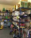
| amenity | toy_library | A place to borrow games and toys, or play with them on site. | ||||
| amenity | research_institute | An establishment endowed for doing research. | ||||
| amenity | training | Public place where you can get training. | ||||
| amenity | music_school | A music school, an educational institution specialized in the study, training, and research of music. | ||||
| amenity | school | School and grounds - primary, middle and secondary schools | ||||
| amenity | traffic_park | Juvenile traffic schools | ||||
| amenity | university | A university campus: an institute of higher education | ||||
Transportation | ||||||
| amenity | bicycle_parking | Parking for bicycles | ||||
| amenity | bicycle_repair_station | General tools for self-service bicycle repairs, usually on the roadside; no service | ||||
| amenity | bicycle_rental | Rent a bicycle | ||||
| amenity | bicycle_wash | Clean a bicycle | ||||
| amenity | boat_rental | Rent a Boat | ||||
| amenity | boat_sharing | Share a Boat | ||||
| amenity | bus_station | May also be tagged as public_transport=station. | ||||
| amenity | car_rental | Rent a car | ||||
| amenity | car_sharing | Share a car | ||||
| amenity | car_wash | Wash a car | ||||
| amenity | compressed_air | A device to inflate tires/tyres (e.g. motorcar, bicycle) | ||||
| amenity | vehicle_inspection | Government vehicle inspection | ||||
| amenity | charging_station | Charging facility for electric vehicles | ||||
| amenity | driver_training | A place for driving training on a closed course | ||||
| amenity | ferry_terminal | Ferry terminal/stop. A place where people/cars/etc. can board and leave a ferry. | ||||
| amenity | fuel | Petrol station; gas station; marine fuel; … Streets to petrol stations are often tagged highway=service. | ||||
| amenity | grit_bin | A container that holds grit or a mixture of salt and grit. | ||||
| amenity | motorcycle_parking | Parking for motorcycles | ||||
| amenity | parking | Parking area for vehicles. Streets on car parking are often tagged highway=service and service=parking_aisle. | ||||
| amenity | parking_entrance | An entrance or exit to an underground or multi-storey parking facility. Group multiple parking entrances together with a relation using the tags type=site and site=parking | Underground Multi-storey | |||
| amenity | parking_space | A single parking space within a car park. Parking spaces should be mapped within an amenity=parking area. Group multiple parking spaces together with a relation using the tags type=site and site=parking | ||||
| amenity | taxi | A place where taxis wait for passengers. | ||||
| amenity | weighbridge | A large weight scale to weigh vehicles and goods | ||||
Financial | ||||||
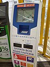
| amenity | atm | Automated teller machine (ATM) or cashpoint: a device that provides the clients of a financial institution with access to financial transactions. | ||||
| amenity | payment_terminal | Self-service payment kiosk/terminal | ||||
| amenity | bank | Bank or credit union: a financial establishment where customers can deposit and withdraw money, take loans, make investments and transfer funds. | ||||
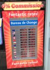
| amenity | bureau_de_change | Bureau de change, money changer, currency exchange, Wechsel, cambio – a place to change foreign bank notes and travellers cheques. | ||||
| amenity | money_transfer | A place that offers money transfers, especially cash to cash | ||||
| amenity | payment_centre | A non-bank place, where people can pay bills of public and private services and taxes. | ||||
Healthcare | ||||||
| amenity | baby_hatch | A place where a baby can be, out of necessity, anonymously left to be safely cared for and perhaps adopted. | ||||
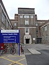
| amenity | clinic | A medium-sized medical facility or health centre. | ||||
| amenity | dentist | A dentist practice / surgery. | ||||
| amenity | doctors | A doctor's practice / surgery. | ||||
| amenity | hospital | A hospital providing in-patient medical treatment. Often used in conjunction with emergency=* to note whether the medical centre has emergency facilities (A&E (brit.) or ER (am.)) | ||||
| amenity | nursing_home | Discouraged tag for a home for disabled or elderly persons who need permanent care. Use amenity=social_facility + social_facility=nursing_home now. | ||||
| amenity | pharmacy | Pharmacy: a shop where a pharmacist sells medications dispensing=yes/no - availability of prescription-only medications |
||||
| amenity | social_facility | A facility that provides social services: group & nursing homes, workshops for the disabled, homeless shelters, etc. | ||||
| amenity | veterinary | A place where a veterinary surgeon, also known as a veterinarian or vet, practices. | ||||
Entertainment, Arts & Culture | ||||||
| amenity | arts_centre | A venue where a variety of arts are performed or conducted | ||||
| amenity | brothel | An establishment specifically dedicated to prostitution | ||||
| amenity | casino | A gambling venue with at least one table game(e.g. roulette, blackjack) that takes bets on sporting and other events at agreed upon odds. | ||||
| amenity | cinema | A place where films are shown (US: movie theater) | ||||
| amenity | community_centre | A place mostly used for local events, festivities and group activities; including special interest and special age groups. . | ||||
| amenity | conference_centre | A large building that is used to hold a convention | ||||
| amenity | events_venue | A building specifically used for organising events | ||||
| amenity | exhibition_centre | An exhibition centre | ||||
| amenity | fountain | A fountain for cultural / decorational / recreational purposes. | ||||
| amenity | gambling | A place for gambling, not being a shop=bookmaker, shop=lottery, amenity=casino, or leisure=adult_gaming_centre.
Games that are covered by this definition include bingo and pachinko. |
||||
| amenity | love_hotel | A love hotel is a type of short-stay hotel operated primarily for the purpose of allowing guests privacy for sexual activities. | ||||
| amenity | music_venue | An indoor place to hear contemporary live music. | ||||
| amenity | nightclub | A place to drink and dance (nightclub). The German word is "Disco" or "Discothek". Please don't confuse this with the German "Nachtclub" which is most likely amenity=stripclub. | ||||
| amenity | planetarium | A planetarium. | ||||
| amenity | public_bookcase | A street furniture containing books. Take one or leave one. | ||||
| amenity | social_centre | A place for free and not-for-profit activities. | ||||
| amenity | stage | A raised platform for performers. | ||||
| amenity | stripclub | A place that offers striptease or lapdancing (for sexual services use amenity=brothel). | ||||
| amenity | studio | TV radio or recording studio | ||||
| amenity | swingerclub | A club where people meet to have a party and group sex. | ||||
| amenity | theatre | A theatre or opera house where live performances occur, such as plays, musicals and formal concerts. Use amenity=cinema for movie theaters. | ||||
Public Service | ||||||
| amenity | courthouse | A building home to a court of law, where justice is dispensed | ||||
| amenity | fire_station | A station of a fire brigade | ||||
| amenity | police | A police station where police officers patrol from and that is a first point of contact for civilians | ||||
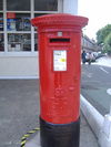
| amenity | post_box | A box for the reception of mail. Alternative mail-carriers can be tagged via operator=* | ||||
| amenity | post_depot | Post depot or delivery office, where letters and parcels are collected and sorted prior to delivery. | ||||
| amenity | post_office | Post office building with postal services | ||||
| amenity | prison | A prison or jail where people are incarcerated before trial or after conviction | ||||
| amenity | ranger_station | National Park visitor headquarters: official park visitor facility with police, visitor information, permit services, etc | ||||
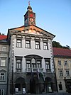
| amenity | townhall | Building where the administration of a village, town or city may be located, or just a community meeting place | ||||
Facilities | ||||||
| amenity | bbq | BBQ or Barbecue is a permanently built grill for cooking food, which is most typically used outdoors by the public. For example these may be found in city parks or at beaches. Use the tag fuel=* to specify the source of heating, such as fuel=wood;electric;charcoal. For mapping nearby table and chairs, see also the tag tourism=picnic_site. For mapping campfires and firepits, instead use the tag leisure=firepit. | ||||
| amenity | bench | A bench to sit down and relax a bit | ||||
| amenity | dog_toilet | Area designated for dogs to urinate and excrete. | ||||
| amenity | dressing_room | Area designated for changing clothes. | ||||
| amenity | drinking_water | Drinking water is a place where humans can obtain potable water for consumption. Typically, the water is used for only drinking. Also known as a drinking fountain or bubbler. | ||||
| amenity | give_box | A small facility where people drop off and pick up various types of items in the sense of free sharing and reuse. | ||||
| amenity | lounge | A comfortable waiting area for customers, usually found in airports and other transportation hubs. Typically has extra amenities or sustenance. | ||||
| amenity | mailroom | A mailroom for receiving packages or letters. | ||||
| amenity | parcel_locker | Machine for picking up and sending parcels | ||||
| amenity | shelter | A small shelter against bad weather conditions. To additionally describe the kind of shelter use shelter_type=*. | ||||
| amenity | shower | Public shower. | ||||
| amenity | telephone | Public telephone | ||||
| amenity | toilets | Public toilets (might require a fee) | ||||
| amenity | water_point | Place where you can get large amounts of drinking water | ||||
| amenity | watering_place | Place where water is contained and animals can drink | ||||
Waste Management | ||||||
| amenity | sanitary_dump_station | A place for depositing human waste from a toilet holding tank. | ||||
| amenity | recycling | Recycling facilities (bottle banks, etc.). Combine with recycling_type=container for containers or recycling_type=centre for recycling centres. | ||||
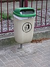
| amenity | waste_basket | A single small container for depositing garbage that is easily accessible for pedestrians. | ||||
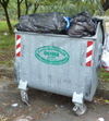
| amenity | waste_disposal | A medium or large disposal bin, typically for bagged up household or industrial waste. | ||||
| amenity | waste_transfer_station | A waste transfer station is a location that accepts, consolidates and transfers waste in bulk. | ||||
Others | ||||||
| amenity | animal_boarding | A facility where you, paying a fee, can bring your animal for a limited period of time (e.g. for holidays) | ||||
| amenity | animal_breeding | A facility where animals are bred, usually to sell them | ||||
| amenity | animal_shelter | A shelter that recovers animals in trouble | ||||
| amenity | animal_training | A facility used for non-competitive animal training | ||||
| amenity | baking_oven | An oven used for baking bread and similar, for example inside a building=bakehouse. | ||||
| amenity | clock | A public visible clock | ||||
| amenity | crematorium | A place where dead human bodies are burnt | ||||
| amenity | dive_centre | A dive center is the base location where sports divers usually start scuba diving or make dive guided trips at new locations. | ||||
| amenity | funeral_hall | A place for holding a funeral ceremony, other than a place of worship. | ||||
| amenity | grave_yard | A (smaller) place of burial, often you'll find a church nearby. Large places should be landuse=cemetery instead. | ||||
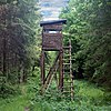
| amenity | hunting_stand | A hunting stand: an open or enclosed platform used by hunters to place themselves at an elevated height above the terrain | ||||
| amenity | internet_cafe | A place whose principal role is providing internet services to the public. | ||||
| amenity | kitchen | A public kitchen in a facility to use by everyone or customers | ||||
| amenity | kneipp_water_cure | Outdoor foot bath facility. Usually this is a pool with cold water and handrail. Popular in German speaking countries. | ||||
| amenity | lounger | An object for people to lie down. | ||||
| amenity | marketplace | A marketplace where goods and services are traded daily or weekly. | ||||
| amenity | monastery | Monastery is the location of a monastery or a building in which monks and nuns live. | ||||
| amenity | mortuary | A morgue or funeral home, used for the storage of human corpses. | ||||
| amenity | photo_booth | A stand to create instant photos. | ||||
| amenity | place_of_mourning | A room or building where families and friends can come, before the funeral, and view the body of the person who has died. | ||||
| amenity | place_of_worship | A church, mosque, or temple, etc. Note that you also need religion=*, usually denomination=* and preferably name=* as well as amenity=place_of_worship. See the article for details. | ||||
| amenity | public_bath | A location where the public may bathe in common, etc. japanese onsen, turkish bath, hot spring | ||||
| A generic public building. Don't use! See office=government. | ||||||
| amenity | refugee_site | A human settlement sheltering refugees or internally displaced persons | ||||
| amenity | vending_machine | A machine selling goods – food, tickets, newspapers, etc. Add type of goods using vending=* | ||||
| amenity | user defined | All commonly used values according to Taginfo | ||||
This table is a wiki template with a default description in English. Editable here.
This table is a wiki template with a default description in English. Editable here.
Xin đừng sao chép thông tin như loại đường từ những nguồn dưới bản quyền! OpenStreetMap có mục đích xây dựng dịch vụ bản đồ đầu tiên không bị vướng vào những vấn đề quyền tác giả. Xem thêm chi tiết tại Copyright. Hãy cẩn thận: nhiều khi các công ty dữ liệu địa lý có cách để nhận ra vụ vi phạm bản quyền, thí dụ các Easter egg.
